| Revision as of 12:08, 14 February 2006 editCambridgeBayWeather (talk | contribs)Autopatrolled, Administrators253,542 edits AWB assisted clean up and links← Previous edit |
Latest revision as of 19:09, 22 June 2021 edit undoCambridgeBayWeather (talk | contribs)Autopatrolled, Administrators253,542 edits Adding local short description: "Airport in Nunavut, Canada", overriding Wikidata description "airport in Nunavut, Canada" (Shortdesc helper) |
| (51 intermediate revisions by 17 users not shown) |
| Line 1: |
Line 1: |
|
{{Airport frame}} |
|
{{Short description|Airport in Nunavut, Canada}} |
|
|
{{Infobox airport |
|
{{Airport title|name=Kimmiruit Airport|}} |
|
|
|
| name = Kimmirut Airport |
|
{{Airport infobox| |
|
|
|
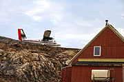
| image = Kimmirut-airstrip.jpg |
|
IATA=YLC| |
|
| IATA = YLC |
|
ICAO=CYLC| |
|
| ICAO = CYLC |
|
type=Public| |
|
| type = Public |
| ⚫ |
run by=Government of Nunavut| |
|
|
|
| owner = |
|
closest town=Kimmiruit, Nunavut| |
|
|
⚫ |
| operator = Government of Nunavut |
|
elevation_ft=175| |
|
|
|
| city-served = |
|
elevation_m=53| |
|
|
|
| location = ] |
|
coordinates=62° 51' N |
|
|
|
| timezone = ] |
|
69° 53' W |
|
|
|
| utc = ] |
|
|
| summer = EDT |
|
|
| utcs = ] |
|
|
| elevation-f = 169 |
|
|
| coordinates = {{coord|62|50|53|N|069|52|38|W|region:CA-NU|display=inline,title}} |
|
|
| pushpin_map = Canada Nunavut#Canada |
|
|
| pushpin_label = CYLC |
|
|
| pushpin_map_caption = Location in Nunavut |
|
|
| website = |
|
|
| r1-number = 15/33 |
|
|
| r1-length-f = 1,899 |
|
|
| r1-surface = Gravel |
|
|
| stat-year = 2010 |
|
|
| stat1-header = Aircraft movements |
|
|
| stat1-data = 634 |
|
|
| footnotes = Source: ]<ref name="CFS">{{CFS}}</ref><br>Movements from ].<ref name="move"></ref> |
|
}} |
|
}} |
|
|
|
|
{{Runway title}} |
|
|
⚫ |
'''Kimmirut Airport''' {{Airport codes|YLC|CYLC}} is located at ], ], Canada, and is operated by the Government of Nunavut. Unlike most ]s in Nunavut, it uses ] for the runway rather than ]. |
|
{{Runway| |
|
|
|
|
|
runway_angle=17/35| |
|
|
|
At {{convert|1899|ft|0|abbr=on}} the Kimmirut airstrip is the second shortest in Nunavut. Formerly ] at {{convert|1500|ft|0|abbr=on}} was the shortest, but in 2010 the runway was extended to {{convert|3935|ft|0|abbr=on}}.<ref name="CFS"/> |
|
runway_length_f=1,900| |
|
|
|
|
|
runway_length_m=579| |
|
|
|
The runway at ] is just slightly shorter than Kimmirut at {{convert|1675|ft|0|abbr=on}}.<ref name="CFS"/> The length of the runway and challenging terrain at both Kimmirut and Grise Fiord limit the type of aircraft that can service those communities. Currently, both are served by airlines operating ] aircraft. |
|
runway_surface=]| |
|
|
|
|
|
|
==Airlines and destinations== |
|
|
|
|
|
{{airport-dest-list |
|
|
| ] | ]<ref></ref> |
|
}} |
|
}} |
|
{{Airport end frame}} |
|
|
|
|
|
|
|
{{Gallery |
| ⚫ |
'''Kimmiruit Airport''' is located at ], ], ], and is operated by the government of Nunavut. It is one of the few airports in Nunavut that uses ] for the runways rather than magnetic headings. |
|
|
|
| title = Kimmirut Airport |
|
|
| File:Threshold of runway 16.JPG| Threshold of runway 16 (now 15) |
|
|
| File:Threshold of runway 34.JPG| Threshold of runway 34 (now 33) |
|
|
| File:Overhead Kimmirut airport.jpg| Overhead Kimmirut airport |
|
|
| File:Twin Otter landing runway 34.JPG| Twin Otter landing runway 34 (now 33) |
|
|
| File:Twin Otter just landing on runway 34.jpg| Twin Otter just landing on runway 34 (now 33) |
|
|
}} |
|
|
|
|
|
==References== |
|
|
{{reflist}} |
|
|
* ] publication TP 14371E |
|
|
* |
|
|
|
|
|
==External links== |
|
|
{{Can-arpt-wx|CYLC|Kimmirut Airport}} |
|
|
|
|
|
{{List of airports in Canada}} |
|
|
|
|
|
|
|
|
{{authority control}} |
|
|
|
|
|
] |
|
] |
|
|
] |
|
|
|
|
|
|
|
|
|
{{Canada-airport-stub}} |
|
{{Nunavut-airport-stub}} |
At 1,899 ft (579 m) the Kimmirut airstrip is the second shortest in Nunavut. Formerly Arctic Bay Airport at 1,500 ft (457 m) was the shortest, but in 2010 the runway was extended to 3,935 ft (1,199 m).


Threshold of runway 16 (now 15)
Threshold of runway 34 (now 33)
 Overhead Kimmirut airport
Twin Otter landing runway 34 (now 33)
 Twin Otter just landing on runway 34 (now 33)