| Revision as of 04:06, 16 May 2016 editAnomieBOT (talk | contribs)Bots6,589,343 editsm Dating maintenance tags: {{Cn}}← Previous edit | Latest revision as of 01:59, 7 October 2024 edit undoSoupersalads (talk | contribs)96 edits added district | ||
| (17 intermediate revisions by 12 users not shown) | |||
| Line 1: | Line 1: | ||
| {{Short description|Village in Hungary}} | |||
| {{More citations|date=October 2024}} | |||
| {{Use dmy dates|date=February 2020}} | |||
| {{Infobox settlement <!--more fields are available for this Infobox--See Template:Infobox settlement--> | {{Infobox settlement <!--more fields are available for this Infobox--See Template:Infobox settlement--> | ||
| |settlement_type = <!--For Town or Village (Leave blank for the default City)--> | |settlement_type = <!--For Town or Village (Leave blank for the default City)--> | ||
| |subdivision_type = ] | |subdivision_type = ] | ||
| |subdivision_name = {{HUN}} | |subdivision_name = {{HUN}} | ||
| |image_flag = File:Flag of Helvécia.svg | |||
| |latd= |latm= |lats= |latNS=N | |||
| |image_shield = File:Coa Hungary Town Helvécia.svg | |||
| |longd= |longm= |longs= |longEW=E | |||
| ⚫ | |coordinates = {{Coord|46|50|N|19|37|E|region:HU_type:city|display=inline,title}} | ||
| ⚫ | |pushpin_map = Hungary Bács-Kiskun#Hungary#Europe | ||
| <!--If coordinates are filled in above remove ed notes from "Hungary" in pushpin_map field to display map--> | |||
| |pushpin_relief = 1 | |||
| ⚫ | |pushpin_map = |
||
| |pushpin_label_position = <!-- the position of the pushpin label: left, right, top, bottom, none --> | |pushpin_label_position = <!-- the position of the pushpin label: left, right, top, bottom, none --> | ||
| |pushpin_map_caption = | |pushpin_map_caption = Location of Helvécia | ||
| |pushpin_mapsize = | |pushpin_mapsize = | ||
| |timezone=] | |timezone=] | ||
| Line 15: | Line 18: | ||
| |timezone_DST=] | |timezone_DST=] | ||
| |utc_offset_DST=+2 | |utc_offset_DST=+2 | ||
| ⚫ | |official_name=Helvécia | ||
| | | |||
| |subdivision_type1=] | |||
| ⚫ | official_name=Helvécia |
||
| ⚫ | |subdivision_name1=] | ||
| picture=Helvécia| | |||
| |subdivision_type2=] | |||
| |subdivision_name2=] | |||
| ⚫ | subdivision_name1=Bács-Kiskun |
||
| area_total_km2=56.47 |
|area_total_km2=56.47 | ||
| population_as_of=2015 |
|population_as_of=2015 | ||
| population_total=4522<ref name="HunStat2015">''''. Hungarian Central Statistical Office. |
|population_total=4522<ref name="HunStat2015">''''. Hungarian Central Statistical Office. 3 September 2015</ref> | ||
| population_density_km2=80.1 |
|population_density_km2=80.1 | ||
| postal_code_type=] |
|postal_code_type=] | ||
| postal_code=6034 |
|postal_code=6034 | ||
| area_code=76 |
|area_code=76 | ||
| }} | }} | ||
| ⚫ | '''Helvécia''' is a village in ] county, in the ] region of southern ]. | ||
| ] | |||
| county in ]]] | |||
| ==History== | |||
| ⚫ | '''Helvécia''' is a |
||
| Helvécia was founded in 1892 by Swiss-born teacher {{ill|Heinrich Eduard Weber|de}}.<ref name=a1>{{cite web|last=Béla|first=Barna|url=https://csamborgo.hu/2021/04/03/svajc-a-magyar-alfoldon-helvecia/|title= Svájc a magyar Alföldön: Helvécia|language=hu|access-date=6 October 2024|trans-title=Switzerland in the Hungarian Great Plain: Helvécia|website=Csámborgo}}</ref> | |||
| After the great ] epidemic that had destroyed much of the historical vineyard plantings in the 1870s, sandy soils of the Great Plains became much more valuable for grape cultivation than before.{{citation needed|date=October 2024}} | |||
| Helvécia was settled by 501 vineyard workers, most of them from the Balaton wine country.{{citation needed|date=October 2024}} It gained independence of nearby ] in 1952.<ref name=a1/> | |||
| ==Geography== | ==Geography== | ||
| It covers an |
It covers an area of {{Convert|73.66|km2|sqmi|0|abbr=on}} and has a population of 4,522 people (2015). Most of its inhabitants work in agriculture.{{citation needed|date=October 2024}} | ||
| Approximately half of the population lives in hamlets. The rest is distributed between two centres approximately 3 km apart from each other: the older Helvécia-Ótelep, and the Szabó-Sándor-telep or Újtelep, originally a housing area for the former ].{{citation needed|date=October 2024}} | |||
| == |
==Twin towns – sister cities== | ||
| {{ |
{{See also|List of twin towns and sister cities in Hungary}} | ||
| Helvécia is ] with:<ref>{{cite web |title=XXVI. Szüreti Mulatság pályázat|url=http://helvecia.hu/newpage/index.php/elnyert-palyazatok/55-xxvi-szureti-mulatsag-palyazat|website=helvecia.hu|publisher=Helvécia|language=hu|date=2020-04-30|access-date=2021-04-03}}</ref> | |||
| Helvécia is ] with ], Switzerland | |||
| *{{flagicon|ROU}} ], Romania | |||
| *{{flagicon|SUI}} ], Switzerland | |||
| *{{flagicon|SRB}} ], Serbia | |||
| *{{flagicon|SVK}} ], Slovakia | |||
| == Accident == | == Accident == | ||
| ⚫ | In 1973, a severe ] took place here with 37 people at least killed.{{Citation needed|date=May 2016}} | ||
| ⚫ | In 1973, a severe ] took place here with 37 people at least killed.{{ |
||
| == References == | == References == | ||
| {{reflist}} | {{reflist}} | ||
| ⚫ | {{Coord|46|50|N| |
||
| {{Bács-Kiskun}} | {{Bács-Kiskun}} | ||
| {{Authority control}} | |||
| {{DEFAULTSORT:Helvecia}} | {{DEFAULTSORT:Helvecia}} | ||
| ] | ] | ||
| {{Bacs-geo-stub}} | {{Bacs-geo-stub}} | ||
Latest revision as of 01:59, 7 October 2024
Village in Hungary| This article needs additional citations for verification. Please help improve this article by adding citations to reliable sources. Unsourced material may be challenged and removed. Find sources: "Helvécia" – news · newspapers · books · scholar · JSTOR (October 2024) (Learn how and when to remove this message) |
Place in Bács-Kiskun, Hungary
| Helvécia | |
|---|---|
 Flag Flag Coat of arms Coat of arms | |
   | |
| Coordinates: 46°50′N 19°37′E / 46.833°N 19.617°E / 46.833; 19.617 | |
| Country | |
| County | Bács-Kiskun |
| District | Kecskemét |
| Area | |
| • Total | 56.47 km (21.80 sq mi) |
| Population | |
| • Total | 4,522 |
| • Density | 80.1/km (207/sq mi) |
| Time zone | UTC+1 (CET) |
| • Summer (DST) | UTC+2 (CEST) |
| Postal code | 6034 |
| Area code | 76 |
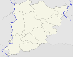
Helvécia is a village in Bács-Kiskun county, in the Southern Great Plain region of southern Hungary.
History
Helvécia was founded in 1892 by Swiss-born teacher Heinrich Eduard Weber [de]. After the great phylloxera epidemic that had destroyed much of the historical vineyard plantings in the 1870s, sandy soils of the Great Plains became much more valuable for grape cultivation than before. Helvécia was settled by 501 vineyard workers, most of them from the Balaton wine country. It gained independence of nearby Kecskemét in 1952.
Geography
It covers an area of 73.66 km (28 sq mi) and has a population of 4,522 people (2015). Most of its inhabitants work in agriculture. Approximately half of the population lives in hamlets. The rest is distributed between two centres approximately 3 km apart from each other: the older Helvécia-Ótelep, and the Szabó-Sándor-telep or Újtelep, originally a housing area for the former collective farm.
Twin towns – sister cities
See also: List of twin towns and sister cities in HungaryHelvécia is twinned with:
Accident
In 1973, a severe level crossing accident took place here with 37 people at least killed.
References
- Gazetteer of Hungary, 1st January 2015. Hungarian Central Statistical Office. 3 September 2015
- ^ Béla, Barna. "Svájc a magyar Alföldön: Helvécia" [Switzerland in the Hungarian Great Plain: Helvécia]. Csámborgo (in Hungarian). Retrieved 6 October 2024.
- "XXVI. Szüreti Mulatság pályázat". helvecia.hu (in Hungarian). Helvécia. 30 April 2020. Retrieved 3 April 2021.
Lua error in Module:Navbox at line 535: attempt to get length of local 'arg' (a number value).
This Bács-Kiskun location article is a stub. You can help Misplaced Pages by expanding it. |