| Revision as of 18:33, 28 October 2012 editXqbot (talk | contribs)Bots, Template editors2,336,340 editsm r2.7.3) (Robot: Adding bg:Заполярни← Previous edit | Latest revision as of 09:12, 29 October 2024 edit undoMonkbot (talk | contribs)Bots3,695,952 editsm Task 20: replace {lang-??} templates with {langx|??} ‹See Tfd› (Replaced 2);Tag: AWB | ||
| (16 intermediate revisions by 13 users not shown) | |||
| Line 1: | Line 1: | ||
| {{Short description|Town in Murmansk Oblast, Russia}} | |||
| {{Other |
{{Other places|Zapolyarny (inhabited locality)}} | ||
| {{Infobox Russian |
{{Infobox Russian inhabited locality | ||
| |en_name=Zapolyarny | |en_name=Zapolyarny | ||
| |ru_name=Заполярный | |ru_name=Заполярный | ||
| ⚫ | |no_name=Zapoljarnyj | ||
| |image_skyline=Вид на промплощадку.jpg | |image_skyline=Вид на промплощадку.jpg | ||
| |image_caption=View of Zapolyarny | |image_caption=View of Zapolyarny | ||
| |map_label_position=right | |map_label_position=right | ||
| |coordinates = {{coord|69|25|N|30|48|E|display=inline,title}} | |||
| |latd=69 | |||
| |latm=25 | |||
| |lats= | |||
| |longd=30 | |||
| |longm=48 | |||
| |longs= | |||
| |image_flag=Flag of Zapolyarny (Murmansk oblast).png | |image_flag=Flag of Zapolyarny (Murmansk oblast).png | ||
| |flag_caption= | |flag_caption= | ||
| Line 24: | Line 21: | ||
| |federal_subject=] | |federal_subject=] | ||
| |federal_subject_ref= | |federal_subject_ref= | ||
| |adm_data_as_of= | |||
| |adm_district_jur=] | |adm_district_jur=] | ||
| |adm_district_jur_ref= | |adm_district_jur_ref= | ||
| Line 31: | Line 27: | ||
| |adm_ctr_of2= | |adm_ctr_of2= | ||
| |adm_ctr_of2_ref= | |adm_ctr_of2_ref= | ||
| |adm_ctr_of3= | |||
| |adm_ctr_of3_ref= | |||
| |inhabloc_cat=Town | |inhabloc_cat=Town | ||
| |inhabloc_cat_ref= | |inhabloc_cat_ref= | ||
| Line 38: | Line 32: | ||
| |inhabloc_type_ref= | |inhabloc_type_ref= | ||
| <!----MUNICIPAL STATUS----> | <!----MUNICIPAL STATUS----> | ||
| |mun_data_as_of= | |||
| |mun_district_jur= | |mun_district_jur= | ||
| |mun_district_jur_ref= | |mun_district_jur_ref= | ||
| Line 54: | Line 47: | ||
| |representative_body_ref= | |representative_body_ref= | ||
| <!----STATISTICS----> | <!----STATISTICS----> | ||
| |area_of_what= | |||
| |area_as_of= | |||
| |area_km2= | |area_km2= | ||
| |area_km2_ref= | |area_km2_ref= | ||
| Line 73: | Line 64: | ||
| |current_cat_date_ref=<ref name="ATSBook56" /> | |current_cat_date_ref=<ref name="ATSBook56" /> | ||
| |prev_name1= | |prev_name1= | ||
| |prev_name1_date= | |||
| |prev_name1_ref= | |prev_name1_ref= | ||
| <!----MISCELLANEA----> | <!----MISCELLANEA----> | ||
| Line 80: | Line 70: | ||
| |dialing_codes= | |dialing_codes= | ||
| |dialing_codes_ref= | |dialing_codes_ref= | ||
| |website= |
|website=https://pechengamr.gov-murman.ru/ | ||
| |website_ref= | |||
| |commonscat= | |||
| |date=June 2012 | |||
| }} | }} | ||
| ] | ] | ||
| '''Zapolyarny''' ({{ |
'''Zapolyarny''' ({{langx|ru|Заполя́рный}}; {{langx|no|Zapoljarnyj}}) is a ] in ] of ], ], located on the ], {{convert|10|km|sp=us}} northeast of the ] project. Population: {{ru-census|p2010=15,825|p2002=18,640|p1989=23,564}} | ||
| The area where the town is located belonged to ] in 1920–1944. It was founded in 1956 as ''Zhdanovsk'' ({{lang|ru|Жда́новск}}) and was granted ] status and later given its present name.{{citation needed|date=November 2011}} | The area where the town is located belonged to ] in 1920–1944. It was founded in 1956 as ''Zhdanovsk'' ({{lang|ru|Жда́новск}}) and was granted ] status and later given its present name.{{citation needed|date=November 2011}} | ||
| On February 1, 1963, by the Decree by the ], Zapolyarny was elevated in status to that of a ].<ref name="ATSBook56">''Administrative-Territorial Division of Murmansk Oblast'', p. 56</ref> | On February 1, 1963, by the Decree by the ], Zapolyarny was elevated in status to that of a ].<ref name="ATSBook56">''Administrative-Territorial Division of Murmansk Oblast'', p. 56</ref> | ||
| It is the nearest town to the disused ] ]. | |||
| ==References== | ==References== | ||
| Line 105: | Line 94: | ||
| ] | ] | ||
| ] | ] | ||
| ⚫ | ] | ||
| ] | |||
| ] | |||
| ] | |||
| ] | |||
| ] | |||
| ⚫ | |||
| ] | |||
| ] | |||
| ] | |||
| ] | |||
| ] | |||
| ] | |||
| ] | |||
| ] | |||
| ] | |||
| ] | |||
| ] | |||
| ] | |||
| ⚫ | ] | ||
| ] | |||
| ] | |||
| ] | |||
| ] | |||
Latest revision as of 09:12, 29 October 2024
Town in Murmansk Oblast, Russia For other places with the same name, see Zapolyarny (inhabited locality). Town in Murmansk Oblast, Russia| Zapolyarny Заполярный | |
|---|---|
| Town | |
 View of Zapolyarny View of Zapolyarny | |
 Flag Flag Coat of arms Coat of arms | |
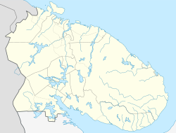
| Location of Zapolyarny | |
  | |
| Coordinates: 69°25′N 30°48′E / 69.417°N 30.800°E / 69.417; 30.800 | |
| Country | Russia |
| Federal subject | Murmansk Oblast |
| Administrative district | Pechengsky District |
| Founded | 1956 |
| Town status since | February 1, 1963 |
| Elevation | 150 m (490 ft) |
| Population | |
| • Total | 15,825 |
| Time zone | UTC+3 (MSK |
| Postal code(s) | 184430 |
| OKTMO ID | 47615103001 |
| Website | pechengamr |

Zapolyarny (Russian: Заполя́рный; Norwegian: Zapoljarnyj) is a town in Pechengsky District of Murmansk Oblast, Russia, located on the Kola Peninsula, 10 kilometers (6.2 mi) northeast of the Kola Superdeep Borehole project. Population: 15,825 (2010 Census); 18,640 (2002 Census); 23,564 (1989 Soviet census).
The area where the town is located belonged to Finland in 1920–1944. It was founded in 1956 as Zhdanovsk (Жда́новск) and was granted work settlement status and later given its present name.
On February 1, 1963, by the Decree by the Presidium of the Supreme Soviet of the RSFSR, Zapolyarny was elevated in status to that of a town of district significance.
It is the nearest town to the disused Koshka Yavr naval air station.
References
Notes
- ^ Administrative-Territorial Division of Murmansk Oblast, p. 56
- ^ Russian Federal State Statistics Service (2011). Всероссийская перепись населения 2010 года. Том 1 [2010 All-Russian Population Census, vol. 1]. Всероссийская перепись населения 2010 года (in Russian). Federal State Statistics Service.
- "Об исчислении времени". Официальный интернет-портал правовой информации (in Russian). June 3, 2011. Retrieved January 19, 2019.
- Почта России. Информационно-вычислительный центр ОАСУ РПО. (Russian Post). Поиск объектов почтовой связи (Postal Objects Search) (in Russian)
- Federal State Statistics Service (May 21, 2004). Численность населения России, субъектов Российской Федерации в составе федеральных округов, районов, городских поселений, сельских населённых пунктов – районных центров и сельских населённых пунктов с населением 3 тысячи и более человек [Population of Russia, Its Federal Districts, Federal Subjects, Districts, Urban Localities, Rural Localities—Administrative Centers, and Rural Localities with Population of Over 3,000] (XLS). Всероссийская перепись населения 2002 года (in Russian).
- Всесоюзная перепись населения 1989 г. Численность наличного населения союзных и автономных республик, автономных областей и округов, краёв, областей, районов, городских поселений и сёл-райцентров [All Union Population Census of 1989: Present Population of Union and Autonomous Republics, Autonomous Oblasts and Okrugs, Krais, Oblasts, Districts, Urban Settlements, and Villages Serving as District Administrative Centers]. Всесоюзная перепись населения 1989 года (in Russian). Институт демографии Национального исследовательского университета: Высшая школа экономики . 1989 – via Demoscope Weekly.
Sources
- Архивный отдел Администрации Мурманской области. Государственный Архив Мурманской области. (1995). Административно-территориальное деление Мурманской области (1920–1993 гг.). Справочник. Мурманск: Мурманское издательско-полиграфическое предприятие "Север".
| Administrative divisions of Murmansk Oblast | |
|---|---|
| Administrative center: Murmansk • Rural localities | |
| Administrative districts | |
| Closed administrative-territorial formations | |
| Cities and towns (all levels) | |
| Urban-type settlements | |
Categories: