| Revision as of 09:51, 24 February 2017 editDrchriswilliams (talk | contribs)Autopatrolled, Extended confirmed users33,599 edits Undid revision 767169754 by Springchickensoup (talk) reverted addition of excessive number of navigation templates← Previous edit | Revision as of 09:57, 24 February 2017 edit undoSpringchickensoup (talk | contribs)Extended confirmed users3,667 edits Undid revision 767171483 by Drchriswilliams (talk)Next edit → | ||
| Line 53: | Line 53: | ||
| {{oscoor gbx|NS 05856 82680}} | {{oscoor gbx|NS 05856 82680}} | ||
| ⚫ | {{Commons category|Ardtaraig}} | ||
| ⚫ | {{Portal|Scotland}} | ||
| {{Portal|United Kingdom}} | |||
| {{DEFAULTSORT:Ardtaraig}} | {{DEFAULTSORT:Ardtaraig}} | ||
| {{Navboxes | |||
| |list={{Scotland topics}} | |||
| {{Years in Scotland}} | |||
| {{British Isles}} | |||
| {{British peoples}} | |||
| {{Celtic nations}} | |||
| {{British-Irish Council}} | |||
| {{Scotland subdivisions}} | |||
| {{Scottish provinces|major}} | |||
| {{English official language clickable map}} | |||
| }} | |||
| ⚫ | {{Commons category|Ardtaraig}} | ||
| ⚫ | {{Portal|Scotland}} | ||
| ] | ] | ||
| ] | ] | ||
Revision as of 09:57, 24 February 2017
Template:New unreviewed article
| Ardtaraig | |
|---|---|
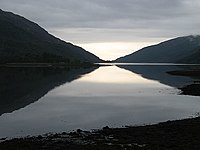
 Loch Striven - geograph.org.uk - 572652 Loch Striven - geograph.org.uk - 572652 | |
 | |
| OS grid reference | NS 05856 82680 |
| Council area |
|
| Lieutenancy area |
|
| Country | Scotland |
| Sovereign state | United Kingdom |
| Post town | DUNOON, ARGYLL |
| Postcode district | PA23 |
| Dialling code | 01369 |
| UK Parliament |
|
| Scottish Parliament |
|
| 55°59′52″N 5°06′53″W / 55.997656°N 5.1147546°W / 55.997656; -5.1147546 | |
Ardtaraig is a hamlet lying at the head of Loch Striven on the Cowal peninsula, Argyll and Bute, West of Scotland. The hamlet is on the single track B836 road.
Cowal Hydro Scheme

Part of the Sloy/Awe Hydro-Electric Scheme and produces 8MW from the stored waters of Loch Tarsan (artificial reservoir), located close by in Glen Lean. The generating house is located at Ardtaraig and is supplied by pipe. The scheme opened in 1951.
Ardtaraig Chapel
Ardtaraig Chapel no longer stands, but the foundations are still visible.
World War II
Ardtaraig was known as HMS Varbel II a secondary base to HMS Varbel, where navigation was taught to the men who manned the midget submarines or X-craft.
References
- "Striven". 56.00916202561257;-5.1195368969573565: Sse.com. Retrieved 2017-02-14.
{{cite web}}: CS1 maint: location (link) - "Ardtaraig Chapel". Faith in Cowal. Retrieved 2017-02-14.
- "Ardtaraig, Chapel". Canmore. Retrieved 2017-02-14.
- "Secret Scotland - HMS Varbel II".
- "Royal Navy at Rothesay".
- "Dorset Submariners - X CRAFT IN WW2 by Gordon Newman".
External Links
- Map sources for Ardtaraig
This Argyll and Bute location article is a stub. You can help Misplaced Pages by expanding it. |
