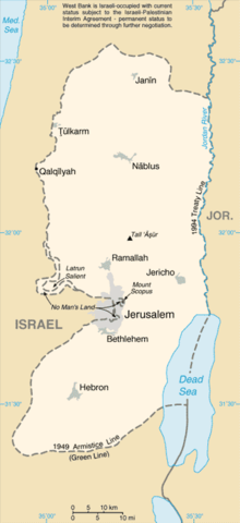
| Revision as of 17:11, 9 August 2007 editTimeshifter (talk | contribs)Extended confirmed users, Pending changes reviewers, Rollbackers50,599 edits The external link is to the best, most detailed map of East Jerusalem that I have found. This list article includes many locations that are disputed territory. West Bank map puts Jerusalem in context.← Previous edit | Revision as of 18:15, 9 August 2007 edit undoTewfik (talk | contribs)15,543 edits I'll grant the map until a better one can be found, but this is still a "list", and not a "territory" ( East Jerusalem, OTOH, is so categorised)Next edit → | ||
| Line 43: | Line 43: | ||
| ] | ] | ||
| ] | ] | ||
| ] | |||
Revision as of 18:15, 9 August 2007

List of locations in Jerusalem sometimes described by the term East Jerusalem:
Further information: List of places in JerusalemLocations in Jordanian municipality (1949-1967)
The following locations were included within the borders of the Jordanian municipality in the eastern part of the city between 1949 and 1967.
- American Colony
- Bab a-Zahara
- Old City of Jerusalem
- Sheikh Jarrah
- Silwan (added in Jordan's 1961 municipal expansion)
- Wadi al-Joz
Locations in expanded Israeli municipality (1967-present)

The following locations were included within the borders of the Israeli municipality after its expansion following the 1967 Six-Day War, formalised in the 1980 Israeli Jerusalem Law.
- A-Tur
- Beit Hanina
- Beit Safafa
- Issawiya
- Jabel Mukaber
- Jebel Batan al-Hawa
- Kafr 'Aqab
- Ras al-Amud
- Sawahra al-Arbiya
- Sharafat
- Shuafat
- Sur Baher
- Umm Tuba
External links
- B'Tselem - The Separation Barrier. Article with link to large PDF map of the West Bank that shows details of Jerusalem and surroundings.