| Revision as of 12:48, 1 August 2012 editArajdal (talk | contribs)17 editsm Tell the truth don't mislead the world with wrong information← Previous edit | Revision as of 01:55, 3 August 2012 edit undoTonyStarks (talk | contribs)Autopatrolled, Extended confirmed users, Pending changes reviewers23,065 edits Undid revision 505254245 by Arajdal (talk)Next edit → | ||
| Line 2: | Line 2: | ||
| <!-- See Template:Infobox settlement for additional fields and descriptions --> | <!-- See Template:Infobox settlement for additional fields and descriptions --> | ||
| | name = Bouïra Province | | name = Bouïra Province | ||
| | native_name = |
| native_name = ولاية البويرة | ||
| | native_name_lang = ar<!-- ISO 639-2 code e.g. "fr" for French.--> | | native_name_lang = ar<!-- ISO 639-2 code e.g. "fr" for French.--> | ||
| | type = ] | | type = ] | ||
| Line 56: | Line 56: | ||
| }} | }} | ||
| '''Bouïra''' ]: '' |
'''Bouïra''' ({{lang-ar|ولاية البويرة}}, ]: ''Tubiret'') is a ] ('']'') in ]. | ||
| ==Administrative divisions== | ==Administrative divisions== | ||
| Line 67: | Line 67: | ||
| # ] | # ] | ||
| # ] | # ] | ||
| # ''']''' | # ''']''' | ||
| # ] | # ] | ||
| # ] | # ] | ||
| # ] | # ] | ||
| # ] | # ] | ||
Revision as of 01:55, 3 August 2012
Province in Algeria| Bouïra Province ولاية البويرة | |
|---|---|
| Province | |
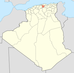
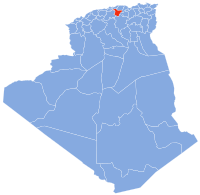
 Map of Algeria highlighting Bouïra Map of Algeria highlighting Bouïra | |
| Country | |
| Capital | Bouïra |
| Area | |
| • Total | 4,439 km (1,714 sq mi) |
| Population | |
| • Total | 694,750 |
| • Density | 160/km (410/sq mi) |
| Time zone | UTC+01 (CET) |
| Area Code | +213 (0) 26 |
| ISO 3166 code | DZ-10 |
| Districts | 12 |
| Municipalities | 45 |
Bouïra (Template:Lang-ar, Kabyle: Tubiret) is a province (wilaya) in Algeria.
Administrative divisions
It is made up of 12 districts and 45 communes or municipalities.
Districts
- Aïn Bessem
- Bechloul
- Bir Ghbalou
- Bordj Okhriss
- Bouïra
- El Hachimia
- Haïzer
- Kadiria
- Lakhdaria
- M'Chedellah
- Souk El Khemis
- Sour El Ghozlane
Communes
- Ain-Bessem
- Ahnif
- Aghbalou
- Ain El Hadjar
- Ahl El Ksar
- Ain Laloui
- Ath Mansour Taourirt
- Aomar
- Aïn Turk (Ain el Turc)
- Ait Laziz
- Bouderbala
- Bechloul
- Bir Ghbalou
- Bouiche
- Boukram
- Bordj Okhriss
- Bouira
- Dechmia
- Dirrah
- Djebahia
- El Asnam
- El Hakimia
- El Hachimia
- El Adjiba
- El Khabouzia
- El Mokrani
- Guerrouma
- Haizer
- Hadjera Zerga
- Kadiria
- Lakhdaria
- M'Chedallah
- Mezdour
- Maala
- Maamora
- Oued El Berdi
- Ouled Rached
- Raouraoua
- Ridane
- Saharidj
- Sour El Ghouzlane
- Souk El Khemis
- Taguedit
- Taghzout
- Zbarbar
References
- Office National des Statistiques, Recensement General de la Population et de l’Habitat 2008 Preliminary results of the 2008 population census. Accessed on 2008-07-02.
External links
| ||
This article about a location in Bouïra Province is a stub. You can help Misplaced Pages by expanding it. |

