This is an old revision of this page, as edited by Soumava2002 (talk | contribs) at 09:02, 21 January 2025. The present address (URL) is a permanent link to this revision, which may differ significantly from the current revision.
Revision as of 09:02, 21 January 2025 by Soumava2002 (talk | contribs)(diff) ← Previous revision | Latest revision (diff) | Newer revision → (diff)Neighbourhood in Presidency, West Bengal, India
| Gorabazar | |
|---|---|
| Neighbourhood | |
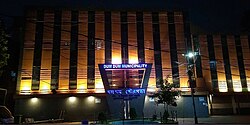
 Dum Dum Municipal Headquarters Dum Dum Municipal Headquarters | |
   | |
| Coordinates: 22°38′07″N 88°24′51″E / 22.6352°N 88.4143°E / 22.6352; 88.4143 | |
| Country | |
| State | West Bengal |
| Division | Presidency |
| District | North 24 Parganas |
| Metro Station | Dum Dum Cantonment (under construction) |
| Railway Station | Dum Dum Cantonment |
| Government | |
| • Type | Municipality |
| • Body | Dum Dum Municipality |
| Languages | |
| • Official | Bengali, English |
| Time zone | UTC+5:30 (IST) |
| PIN | 700028 |
| Telephone code | +91 33 |
| Vehicle registration | WB |
| Lok Sabha constituency | Dum Dum |
| Vidhan Sabha constituency | Dum Dum |
Gorabazar is a locality in Dum Dum of North 24 Parganas district in the Indian state of West Bengal. It is a part of the area covered by Kolkata Metropolitan Development Authority (KMDA).
References
- "Kolkata Metropolitan Development Authority". KMDA. Retrieved 21 January 2025.
- "Kolkata Metropolitan Area Map". KMDA. Retrieved 21 January 2025.