This is an old revision of this page, as edited by Timeshifter (talk | contribs) at 01:21, 15 August 2007 (→Locations in expanded Israeli municipality (1967-present): see link). The present address (URL) is a permanent link to this revision, which may differ significantly from the current revision.
Revision as of 01:21, 15 August 2007 by Timeshifter (talk | contribs) (→Locations in expanded Israeli municipality (1967-present): see link)(diff) ← Previous revision | Latest revision (diff) | Newer revision → (diff)
List of locations in Jerusalem sometimes described by the term East Jerusalem:
Further information: List of places in JerusalemLocations in Jordanian municipality (1949-1967)
Main article: Rule of the West Bank and East Jerusalem by JordanThe following locations were included within the borders of the Jordanian municipality in the eastern part of the city between 1949 and 1967.
- American Colony
- Bab a-Zahara
- Old City of Jerusalem
- Sheikh Jarrah
- Silwan (added in Jordan's 1961 municipal expansion)
- Wadi al-Joz
Locations in expanded Israeli municipality (1967-present)
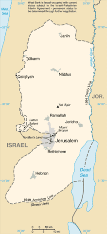
See also: West Bank, Green Line (Israel), East Jerusalem, and Positions on Jerusalem
The following locations were included within the borders of the Israeli municipality after its expansion following the 1967 Six-Day War, formalised in the 1980 Israeli Jerusalem Law.
- A-Tur
- Beit Hanina
- Beit Safafa
- Issawiya
- Jabel Mukaber
- Jebel Batan al-Hawa
- Kafr 'Aqab
- Ras al-Amud
- Sawahra al-Arbiya
- Sharafat
- Shuafat
- Sur Baher
- Umm Tuba
External links
- B'Tselem - The Separation Barrier. Article with link to large PDF map of the West Bank that shows details of Jerusalem and surroundings.