This is the current revision of this page, as edited by Monkbot (talk | contribs) at 12:15, 24 October 2024 (Task 20: replace {lang-??} templates with {langx|??} ‹See Tfd› (Replaced 2);). The present address (URL) is a permanent link to this version.
Revision as of 12:15, 24 October 2024 by Monkbot (talk | contribs) (Task 20: replace {lang-??} templates with {langx|??} ‹See Tfd› (Replaced 2);)(diff) ← Previous revision | Latest revision (diff) | Newer revision → (diff) Place in Famagusta District, Cyprus| Agios Symeon | |
|---|---|
 | |
| Coordinates: 35°29′29″N 34°13′04″E / 35.49139°N 34.21778°E / 35.49139; 34.21778 | |
| Country (de jure) | Cyprus |
| District | Famagusta District |
| Country (de facto) | Northern Cyprus |
| District | İskele District |
| Population | |
| • Total | 119 |
| Time zone | UTC+02:00 (EET) |
| • Summer (DST) | UTC+03:00 (EEST) |
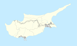
Agios Symeon (Greek: Άγιος Συμεών "Saint Simon", Turkish: Avtepe, previously also Aysinyo) is a village in Cyprus, located on the Karpas Peninsula. It is under the de facto control of Northern Cyprus. As of 2011, Avtepe had a population of 119. It has always been inhabited by Turkish Cypriots.
References
- In 1983, the Turkish Republic of Northern Cyprus unilaterally declared independence from the Republic of Cyprus. The de facto state is not recognised by any UN state except Turkey.
- "KKTC 2011 Nüfus ve Konut Sayımı" [TRNC 2011 Population and Housing Census] (PDF) (in Turkish). TRNC State Planning Organization. 6 August 2013. Archived from the original (PDF) on 6 November 2013.
- "AGIOS SYMEON". Internal Displacement in Cyprus. PRIO Cyprus Centre. Retrieved 17 January 2015.
This Cyprus location article is a stub. You can help Misplaced Pages by expanding it. |

