This is an old revision of this page, as edited by 85.196.3.205 (talk) at 19:29, 27 August 2014 (it is pov to include a single church and priest for his self-promotion; not encyclopedic; and I can find 8-9 other churches in the same village with greek priests; why mention just this particular???????). The present address (URL) is a permanent link to this revision, which may differ significantly from the current revision.
Revision as of 19:29, 27 August 2014 by 85.196.3.205 (talk) (it is pov to include a single church and priest for his self-promotion; not encyclopedic; and I can find 8-9 other churches in the same village with greek priests; why mention just this particular???????)(diff) ← Previous revision | Latest revision (diff) | Newer revision → (diff) Settlement in Greece| Aridaia Αριδαία | |
|---|---|
| Settlement | |
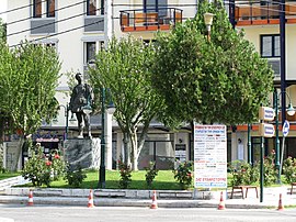
 View of the central square of Aridaia. View of the central square of Aridaia. | |
| Country | Greece |
| Administrative region | Central Macedonia |
| Regional unit | Pella |
| Districts | 17 |
| Government | |
| • Mayor | Dimitris Pasois (PASOK; since 2011) |
| Area | |
| • Municipal unit | 562.91 km (217.34 sq mi) |
| Elevation | 320 m (1,050 ft) |
| Highest elevation | 98 m (322 ft) |
| Lowest elevation | 70 m (230 ft) |
| Population | |
| • Municipal unit | 20,313 |
| • Municipal unit density | 36/km (93/sq mi) |
| • Community | 7,057 |
| Time zone | UTC+2 (EET) |
| • Summer (DST) | UTC+3 (EEST) |
| Postal code | 584 00 |
| Area code(s) | 23840-2 |
| Vehicle registration | ΕΕ |
| Website | dimosalmopias.gov.gr |
Aridaía (Template:Lang-el) is a town and a former municipality in the Pella regional unit, Greece. Since the 2011 local government reform it is part of the municipality Almopia, of which it is a municipal unit. It was the capital of the former Almopia eparchy. It is located in the northwest corner of the Pella regional unit, bordering the southern part of the Republic of Macedonia and the northeast corner of the Florina regional unit. Its land area is 562.910 km (217.341 sq mi). The population of Aridaia proper is 12,600, while that of the entire municipal unit is 20,213 (2001 census). Its largest other towns are Prómachoi (pop. 1,825), Sosándra (1,206), Ápsalos (1,178), Loutráki (1,163), Polykárpi (1,071), Tsákoi (1,020), Voreinó (871), and Χifianí (850). The municipal unit is divided into 17 communities.
References
- "Απογραφή Πληθυσμού - Κατοικιών 2011. ΜΟΝΙΜΟΣ Πληθυσμός" (in Greek). Hellenic Statistical Authority.
- Kallikratis law Greece Ministry of Interior Template:El icon
- "Προφίλ Επαρχίας Αλμωπίας" (in Greek). Δήμος Αριδαίας. Retrieved 2008-10-26.
External links
| Subdivisions of the municipality of Almopia | |
|---|---|
| Municipal unit of Aridaia | |
| Municipal unit of Exaplatanos |
|
This Central Macedonia location article is a stub. You can help Misplaced Pages by expanding it. |