| This article includes a list of general references, but it lacks sufficient corresponding inline citations. Please help to improve this article by introducing more precise citations. (August 2009) (Learn how and when to remove this message) |
| Astore Valley | |
|---|---|
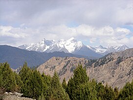
 Photograph of an unnamed, 5400-metre peak raising jagged, snow-clad ramparts above the Astore Valley Photograph of an unnamed, 5400-metre peak raising jagged, snow-clad ramparts above the Astore Valley | |
  | |
| Floor elevation | 2,600 m (8,500 ft) |
| Length | 120 km (75 mi) |
| Naming | |
| Native name | وادی استور (Urdu) |
| Geography | |
| Coordinates | 35°02′20.3″N 75°06′36.9″E / 35.038972°N 75.110250°E / 35.038972; 75.110250 |
The Astore Valley (Urdu: وادی استور; el. 2,600 m (8,500 ft)) is a valley located in the Astore District of Gilgit-Baltistan region in Pakistan.
History
According to The Imperial Gazetteer of India, around 1600:
Ghāzī Mukhpun, a Persian adventurer, is said to have married a princess of the Skārdu reigning family. The four sons born of this union became Rās of Skārdu, Astor, Roundu, and Kharmang respectively, and from them are descended the families of the present chiefs of those places. The independence of Astor ceased at the Dogra conquest. Afgan Kings SKW family are also here=(ARIFI Family)
See also
References
- Muhammad, Sher; Tian, Lide (15 December 2016). "Changes in the ablation zones of glaciers in the western Himalaya and the Karakoram between 1972 and 2015". Remote Sensing of Environment. 187: 505–512. Bibcode:2016RSEnv.187..505M. doi:10.1016/j.rse.2016.10.034. ISSN 0034-4257.
- Gilgit - Imperial Gazetteer of India, v. 12, p. 239 According to the Imperial Gazetteer, which was compiled in the first decade of the twentieth century, the marriage took place over three hundred years ago
This Gilgit-Baltistan location article is a stub. You can help Misplaced Pages by expanding it. |