| This article relies largely or entirely on a single source. Relevant discussion may be found on the talk page. Please help improve this article by introducing citations to additional sources. Find sources: "Badger, Manitoba" – news · newspapers · books · scholar · JSTOR (January 2022) |
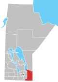
Badger, Manitoba is a hamlet in the Rural Municipality of Piney, Manitoba. The community, whose elevation is 377 m (1,236 ft), lies southwest of Whitemouth Lake, and is surrounded by the Sandilands Provincial Forest.
It known for its blueberry crop.
History
Badger began in 1900 as a railway station along the Manitoba and Southern Railway. In its early days, the community had three grocery stores, a post office (opened in 1904; closed in 1961), a dance hall, school house, section and station houses.
The community was known to the Canadian National Railway as Summit for their railway point on section 12-3-11E; the school district, called Evergreen, was located on 6-3-12E.
References
- ^ "Badger Manitoba". Rural Municipality of Piney. Archived from the original on July 17, 2012. Retrieved August 7, 2021.
- Geographical Names of Manitoba - Badger (pg. 16) : published by Conservation Manitoba 2008
| Division No. 1, Manitoba (Eastern Manitoba) | ||
|---|---|---|
| Towns |  | |
| Local government districts | ||
| Rural municipalities | ||
| First Nations | ||
| Indian reserves |
| |
| Unorganized areas | ||
| Unincorporated communities | ||
49°11′25″N 95°57′33″W / 49.19028°N 95.95917°W / 49.19028; -95.95917 (Badger)
This Manitoba location article is a stub. You can help Misplaced Pages by expanding it. |