| Bakhuizen Bakhuzen | |
|---|---|
| Village | |
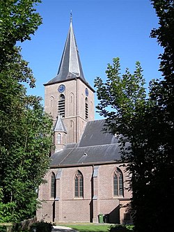
 Bakhuizen Church Bakhuizen Church | |
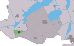
 Location in De Friese Meren municipality Location in De Friese Meren municipality | |
  | |
| Coordinates: 52°52′6″N 5°27′30″E / 52.86833°N 5.45833°E / 52.86833; 5.45833 | |
| Country | |
| Province | |
| Municipality | |
| Area | |
| • Total | 2.91 km (1.12 sq mi) |
| Elevation | 7 m (23 ft) |
| Population | |
| • Total | 1,045 |
| • Density | 360/km (930/sq mi) |
| Postal code | 8574 |
| Dialing code | 0514 |
| Website | Official |
Bakhuizen (West Frisian: Bakhuzen) is a village in the Dutch province of Friesland. It is in the municipality De Fryske Marren, about 6 km east of the city of Stavoren.
Bakhuizen has about 1,075 inhabitants.
History
The village was first mentioned in 1412 as Backhuysen. The etymology is unclear. Bakhuizen developed in the 12th or 13th century on a clay ridge. Even though it belonged to Mirns, it developed independently and became a Catholic enclave. The first church was built in 1412. After the Reformation, the villagers used a clandestine church in Elfbergen [nl] and the wind mill Mole Polle. The Catholic St.-Odulphus Church was built between 1913 and 1914. In 1840, it was home to 477 people.
References
- ^ "Kerncijfers wijken en buurten 2021". Central Bureau of Statistics. Retrieved 29 March 2022.
- "Postcodetool for 8574RA". Actueel Hoogtebestand Nederland (in Dutch). Het Waterschapshuis. Retrieved 29 March 2022.
- Kerncijfers wijken en buurten 2017 - CBS
- "Bakhuizen - (geografische naam)". Etymologiebank (in Dutch). Retrieved 29 March 2022.
- ^ Ronald Stenvert & Sabine Broekhoven (2000). "Bakhuizen" (in Dutch). Zwolle: Waanders. ISBN 90 400 9476 4. Retrieved 29 March 2022.
- ^ "Bakhuizen". Plaatsengids (in Dutch). Retrieved 29 March 2022.
External links
[REDACTED] Media related to Bakhuizen at Wikimedia Commons
This Friesland location article is a stub. You can help Misplaced Pages by expanding it. |