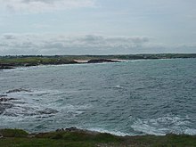

Booby's Bay is a sandy beach near Padstow, Cornwall, England, UK. During World War I, the three masted sailing ship Carl of the German navy was beached and abandoned in Constantine Bay while being towed to London during a storm.
References
- Ordnance Survey: Landranger map sheet 200 Newquay & Bodmin (Camelford & St Austell) (Map). Ordnance Survey. ISBN 978-0-319-22938-5.
- "Ordnance Survey: 1:50,000 Scale Gazetteer" (csv (download)). www.ordnancesurvey.co.uk. Ordnance Survey. 1 January 2016. Retrieved 30 January 2016.
- Lettens, Jan. "Carl [+1917]". wrecksite. Retrieved 15 April 2012.
50°32′21″N 5°01′36″W / 50.5392°N 5.0268°W / 50.5392; -5.0268
This Cornwall location article is a stub. You can help Misplaced Pages by expanding it. |