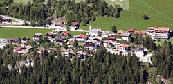
| Brandberg | |
|---|---|
| Municipality | |
 | |
 Coat of arms Coat of arms | |
 | |
| Coordinates: 47°10′00″N 11°54′00″E / 47.16667°N 11.90000°E / 47.16667; 11.90000 | |
| Country | Austria |
| State | Tyrol |
| District | Schwaz |
| Government | |
| • Mayor | Hermann Thanner |
| Area | |
| • Total | 156.47 km (60.41 sq mi) |
| Elevation | 1,082 m (3,550 ft) |
| Population | |
| • Total | 354 |
| • Density | 2.3/km (5.9/sq mi) |
| Time zone | UTC+1 (CET) |
| • Summer (DST) | UTC+2 (CEST) |
| Postal code | 6290 |
| Area code | 05285 |
| Vehicle registration | SZ |
| Website | www.brandberg.tirol.gv.at |
Brandberg is a municipality in the Schwaz district of in the Austrian state of Tyrol.
Geography
Brandberg lies in a side valley of the Ziller on the border with Italy.
References
- "Dauersiedlungsraum der Gemeinden Politischen Bezirke und Bundesländer - Gebietsstand 1.1.2018". Statistics Austria. Retrieved 10 March 2019.
- "Einwohnerzahl 1.1.2018 nach Gemeinden mit Status, Gebietsstand 1.1.2018". Statistics Austria. Retrieved 9 March 2019.
This Tyrol location article is a stub. You can help Misplaced Pages by expanding it. |