You can help expand this article with text translated from the corresponding article in German. (June 2010) Click for important translation instructions.
|
| This article does not cite any sources. Please help improve this article by adding citations to reliable sources. Unsourced material may be challenged and removed. Find sources: "Breitenstein" mountain – news · newspapers · books · scholar · JSTOR (February 2016) (Learn how and when to remove this message) |
| Breitenstein | |
|---|---|
 | |
| Highest point | |
| Elevation | 1,622 m (5,322 ft) |
| Isolation | 2.5 km (1.6 mi)Wendelstein |
| Coordinates | 47°43′20″N 11°59′21″E / 47.72222°N 11.98917°E / 47.72222; 11.98917 |
| Geography | |
 | |
| Parent range | Bavarian Prealps |
| Climbing | |
| Easiest route | Fischbachau - Kesselalm - Hubertushütte - Breitenstein |
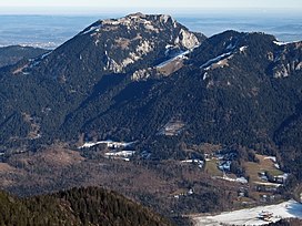
Breitenstein is a 1,622 m high mountain of the Bavarian Prealps.
Minimum altitude 627 m
Altitude difference 1023 m
Normal routes
The most common route is from Fischbachau to the Kesselalm continuing via the Hubertushütte to the summit.
The route to the mountain is popular and can get quite crowded on weekends
This Bavaria location article is a stub. You can help Misplaced Pages by expanding it. |