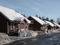
| Carlslid | |
|---|---|
| Residential area | |
 | |
 Map of Carlslid, from OpenStreetMap Map of Carlslid, from OpenStreetMap | |
| Coordinates: 63°48′31″N 20°19′44″E / 63.80861°N 20.32889°E / 63.80861; 20.32889 | |
| Country | Sweden |
| Province | Västerbotten |
| County | Västerbotten County |
| Municipality | Umeå Municipality |
| Time zone | UTC+1 (CET) |
| • Summer (DST) | UTC+2 (CEST) |
Carlslid is a residential area in Umeå, Sweden.
History
The names Carlslid, Carlshem and Carlshöjd originate from the inn Carlslund, which at the end of the 18th century was located where Älvans väg in Tomtebo exists in the present day.
External links
- Carlslid at Umeå Municipality
This article is a stub. You can help Misplaced Pages by expanding it. |