| Cause | |
|---|---|
 The Cause in Le Tholonet The Cause in Le Tholonet | |
  | |
| Location | |
| Country | France |
| Physical characteristics | |
| Mouth | Arc |
| • coordinates | 43°30′26″N 5°29′27″E / 43.5072°N 5.4909°E / 43.5072; 5.4909 |
| Length | 20.8 km (12.9 mi) |
| Basin features | |
| Progression | Arc→ Étang de Berre→ Mediterranean Sea |
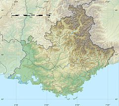
The Cause is a river in the Bouches-du-Rhône, France. It flows from its source in Vauvenargues to the river Arc near Palette. Recreational fishing is forbidden on Fridays except for bank holidays. It is 20.8 km (12.9 mi) long.
References
- "Rapport fait par M. le vicomte Héricart de Thury, au nom du comité des arts mécaniques, sur les marbes brèches et poudingues provenant des carrières du Tholonet, près d'Aix, département des Bouches-du-Rhône, et présentés à la Société par M. le marquis de Gallifet". Bulletin de la Société d'encouragement pour l'industrie nationale. 28: 381. 1829.
- "Où Pêcher? Aix-en-Provence". Fédération des Bouches-du-Rhône de Pêche et de Orotection du Milieu Aquatique. Retrieved March 29, 2016.
- Sandre. "Fiche cours d'eau - La Cause (Y4100500)".
This article related to a river in France is a stub. You can help Misplaced Pages by expanding it. |