| Chernomorsky Raion Aqmeçit rayonı | |
|---|---|
| Raion | |
 Tarhunkut Cape, Chernomorsky District Tarhunkut Cape, Chernomorsky District | |
 Flag Flag Seal Seal | |
| Location within Crimea | |
| Country | |
| Republic | Crimea |
| Capital | Chornomorske |
| Subdivisions |
List
|
| Area | |
| • Total | 1,509 km (583 sq mi) |
| Population | |
| • Total | 30,500 |
| • Density | 20/km (52/sq mi) |
| Time zone | UTC+3 (MSK) |
| Dialing code | +380-6558 |
| Website | chero |
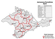
Chornomorske Raion (Ukrainian: Чорноморський район, Russian: Черноморский район, Crimean Tatar: Aqmeçit rayonı) is a raion (district) within boundaries of the Autonomous Republic of Crimea, which is the southernmost subdivision of Ukraine, but since 2014 occupied and administered by the Russian Federation. Population: 30,500 (2014 Census).
It is located in the far west of the republic on the Tarkhankut Peninsula. The raion's administrative centre is the town of Chornomorske.
Settlements and Population
The raion contains the urban-type settlement of Chornomorske, 31 villages:
- Daleke
- Dozorne
- Hromove
- Kalynivka
- Khmelove
- Kop-Aran
- Krasna Poliana
- Krasnosilske
- Krasnoyarske
- Kuznetske
- Lenske
- Maiak
- Mariine
- Medvedeve
- Mizhvodne
- Novoivanivka
- Novosilske
- Okunivka
- Olenivka
- Severne
- Snizhne
- Tarkhankut
- Toka
- Vnukove
- Vodopiine
- Volodymyrivka
- Zadorne
- Zaitseve
- Zhuravlivka
- Znamianka
- Zoriane
And two rural-type settlements: Ozerivka and Nyzivka.
Demographics
As of the 2001 Ukrainian census, the district counted a population of 34,112 people. Ethnic Russians make up a narrow majority, while Ukrainians are the biggest minority, accounting for a little less than one third of the population. Other significant minorities are Crimean Tatars, Tatars, Belarusians and Black Sea Germans.
| |||||||||||||||||||||||||||||||||||||||||||||||||||||||
2020 Ukrainian Administrative Reform

In July 2020, Ukraine conducted an administrative reform throughout its de jure territory. This included Crimea, which was at the time occupied by Russia, and is still ongoing as of October 2023. Crimea was reorganized from 14 raions and 11 municipalities into 10 raions, with municipalities abolished altogether. Chornomorsk Raion was abolished, and its territories to become a part of Yevpatoria Raion, but this has not yet been implemented due to the ongoing Russian occupation.
References
- Russian Federal State Statistics Service (2014). "Таблица 1.3. Численность населения Крымского федерального округа, городских округов, муниципальных районов, городских и сельских поселений" [Table 1.3. Population of Crimean Federal District, Its Urban Okrugs, Municipal Districts, Urban and Rural Settlements]. Федеральное статистическое наблюдение «Перепись населения в Крымском федеральном округе». ("Population Census in Crimean Federal District" Federal Statistical Examination) (in Russian). Federal State Statistics Service. Retrieved January 4, 2016.
- "Перепись населения 2001 года". www.sf.ukrstat.gov.ua (in Russian). Retrieved 2024-07-16.
- "Про утворення та ліквідацію районів". Офіційний вебпортал парламенту України (in Ukrainian). Retrieved 2023-10-16.
External links
| Capital: Simferopol | |||||
| Raions | |||||
| Municipalities | |||||
| Cities |
| ||||
45°30′07″N 32°42′09″E / 45.50194°N 32.70250°E / 45.50194; 32.70250
This article about a location in Crimea is a stub. You can help Misplaced Pages by expanding it. |
