| Chitral Gol National Park چترال گول نیشنل پارک | |
|---|---|
| IUCN category II (national park) | |
 The park features several alpine meadows The park features several alpine meadows | |
 | |
| Location | Lower Chitral District, Khyber-Pakhtunkhwa |
| Coordinates | 35°56′N 71°40′E / 35.933°N 71.667°E / 35.933; 71.667 |
| Area | 7750 hectares |
| Established | 1984 |
| Governing body | Wildlife and Parks Department of Government of Pakistan |

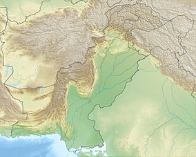
Chitral Gol National Park (Urdu: چترال گول نیشنل پارک) is one of the National Parks of Pakistan. It is located in Lower Chitral District in Khyber-Pakhtunkhwa province of Pakistan beside the Chitral River, at a distance of two hours drive from Chitral town. The park is also known as Chitral National Park.
Legal status
Up until 1983, Chitral Gol was considered to be the private property of the former Mehtar of Chitral. The status of the park has been in dispute since and has become the issue of ongoing litigation between heirs of the former Mehtar and the Government of Pakistan.
Parameters
The way leading to the park is quite narrow and dangerous, yet more risky during the rainy days. It is located between 1450 metre and about 5000 metre above sea level. It has an area of 7750 hectares.
Fauna
This park includes three valleys. Several glaciers also lie in the park through which several springs make their way and ultimately form a stream which runs 18 kilometres. The cold water of this stream flows towards the east, into the River Chitral. The park is rich in trees particularly cedar trees. The park also serves to provide shelter to a vast bio-diversity, especially markhor, an endangered wild goat species. Some of the larger mammals found in the park include:
- Kashmir Markhor
- Siberian ibex
- Snow leopard
- Ladakh Urial
- Himalayan black bear
- Himalayan Wolf
- Red fox
- Eurasian otter
- Yellow-throated marten
Weather
The annual rainfall in its region is estimated to be 462 ml (16.3 imp fl oz; 15.6 US fl oz). In September, it rains more on the spectacular peaks surrounding the park. However, in November, the rainfall is more in the valleys and on the lower peaks. There is also snowfall during the winter season. The snow-covered white peaks enhance the beauty till June. The general weather is cold and dry. The temperature ranges from −12.2 to 43.3 °C (10.0 to 109.9 °F).
Birmoghlasht
Further information: Birmoghlasht Summer FortThe Birmoghlasht part of the park is where the former Mehtar's Summer Fort is located. At the time of existence of the Chitral State, the Mehtar and his family use to move here in the summer and hold court. The fort was constructed in such a way that it overlooked the entire city. It stands at an elevation of over 2800 meters above sea level. Besides the fort Birmoghlasht also houses a wildlife hut and is a great tourist spot in a few kilometres drive from Chitral town.
Notes
- Camerapix (1998-01-01). Spectrum Guide to Pakistan. Interlink Books. p. 319. ISBN 9781566562409.
- Singh, Sarina (2008-01-01). Pakistan & the Karakoram Highway. Lonely Planet. ISBN 9781741045420.
- "Chitral National Park". National Parks in Pakistan. Archived from the original on 2018-11-09. Retrieved 2016-07-07.
- "Wildlife of Pakistan: National Parks of Pakistan".
- "Chitral Gol National Park – Documentary". Archived from the original on 2016-12-20.
- Michel, S. & Rosen Michel, T. (2016) . "Capra falconeri". IUCN Red List of Threatened Species. 2015: e.T3787A97218336. doi:10.2305/IUCN.UK.2015-4.RLTS.T3787A82028427.en. Retrieved 7 January 2024.
- "Chitral Gol National Park". Wildlife of Pakistan. Retrieved 12 March 2016.
- Hyder, Donald N. (1978-01-01). Proceedings of the First International Rangeland Congress, Denver, Colorado, USA, August 14–18, 1978. Society for Range Management.
- Green, Michael John Beverley (1990-01-01). IUCN Directory of South Asian Protected Areas. IUCN. ISBN 9782831700304.
- "Chitral Gol National Park". The Express Tribune. 2013-12-24.
- Pakistan Pictorial. Pakistan Publications. 2008-07-01.
- Pakistan Quarterly. 1954-01-01.