23°37′05″S 46°24′25″W / 23.6181°S 46.407°W / -23.6181; -46.407
This article is about the district of the city of São Paulo. For the subprefecture with the same name, see Subprefecture of Cidade Tiradentes. Place in São Paulo, Brazil| Cidade Tiradentes | |
|---|---|
 District of the city of São Paulo District of the city of São Paulo | |
| Country | |
| State | |
| Municipality | |
| Subprefecture | Cidade Tiradentes |
| Area | |
| • Total | 15.00 km (5.79 sq mi) |
| Population | |
| • Total | 211,501 |
| • Density | 14,100/km (37,000/sq mi) |
| Website | Subprefecture of Cidade Tiradentes |
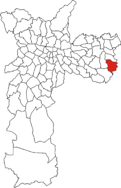
Cidade Tiradentes is one of 96 districts in the city of São Paulo, Brazil.

References
- "Dados Demográficos dos Distritos pertencentes as Subprefeituras". prefeitura.sp.gov.br (in Portuguese). City of São Paulo. Archived from the original on 4 February 2015. Retrieved 28 December 2014.
- "Mobilidade: paulistano leva uma hora e meia para ir e voltar do trabalho". Cidade de São Paulo (in Portuguese). Retrieved 4 December 2021.
This geographical article relating to the state of São Paulo is a stub. You can help Misplaced Pages by expanding it. |
