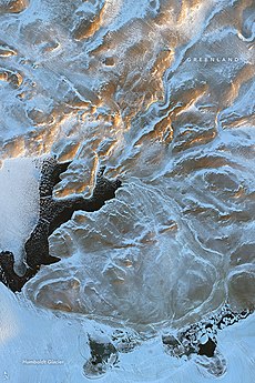
 View of the cliffs flanking Petermann Fjord marking the eastern limits of Daugaard-Jensen Land. View of the cliffs flanking Petermann Fjord marking the eastern limits of Daugaard-Jensen Land. | |
 | |
| Geography | |
|---|---|
| Location | NW Greenland |
| Coordinates | 80°19′N 61°30′W / 80.317°N 61.500°W / 80.317; -61.500 |
| Adjacent to | Cass Fjord Kennedy Channel Bessel Fjord Aleqatsiaq Fjord |
| Length | 120 km (75 mi) |
| Width | 90 km (56 mi) |
| Highest elevation | 1,066 m (3497 ft) |
| Administration | |
| Greenland (Denmark) | |
| Demographics | |
| Population | Uninhabited |
Daugaard-Jensen Land, (Danish: Daugård-Jensen Land), is a peninsula in northwestern Greenland. It is a part of the Avannaata municipality.
Daugaard-Jensen Land was named in honor of Jens Daugaard-Jensen (1871–1938), who served as the Inspector of Greenland from 1912 to 1938.
Geography
Daugaard-Jensen Land is located between Washington Land and the Petermann Glacier. The Cass Fjord is at the southern end, beyond which lies the Humboldt Glacier. The Pentamerus Range is located in the middle/northern region.
The northern coast runs between Aleqatsiaq Fjord and Bessel Fjord, east of which the Petermann Peninsula extends northwards.
 |
 |
Bibliography
- H.P. Trettin (ed.), Geology of the Innuitian Orogen and Arctic Platform of Canada and Greenland. Geological Survey of Canada (1991) ISBN 978-0660131313
See also
References
- ^ "Daugård-Jensen Land". Mapcarta. Retrieved 6 March 2019.
- GoogleEarth
- Prostar Sailing Directions 2005 Greenland and Iceland Enroute, p. 93
External links
This Greenland location article is a stub. You can help Misplaced Pages by expanding it. |