| Eidselva Lundeelva | |
|---|---|
 View of the river Eidselva View of the river Eidselva | |
  | |
| Location | |
| Country | Norway |
| County | Telemark |
| Municipalities | Nome Municipality |
| Physical characteristics | |
| Source | Nomevatnet lake |
| • location | Bjervamoen, Nome |
| • coordinates | 59°18′01″N 9°09′59″E / 59.30027°N 9.1663742°E / 59.30027; 9.1663742 |
| • elevation | 60 metres (200 ft) |
| Mouth | Norsjø lake |
| • location | Ulefoss, Nome |
| • coordinates | 59°17′11″N 9°15′47″E / 59.286446°N 9.2631053°E / 59.286446; 9.2631053 |
| • elevation | 16 metres (52 ft) |
| Length | 7.5 km (4.7 mi) |
| Basin features | |
| River system | Skiensvassdraget |
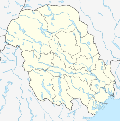
Eidselva or Lundeelva is a river in Nome Municipality in Telemark county, Norway. The 7.5-kilometre (4.7 mi) long river is part of Skiensvassdraget watershed and it is an important part of the Telemark Canal system. The river begins at the lake Nomevatnet, just east of the village of Bjervamoen and flows to the east and south into the large lake Norsjø at the village of Ulefoss.
Throughout its course, there are six sluices (14 sluicegates), with a total rise of around 57 metres (187 ft). In the river, there are four hydroelectric power stations: Eidsfoss, Vrangfoss, Ulefoss, and Aall-Ulefoss.
See also
References
- ^ Rosvold, Knut A., ed. (24 July 2023). "Eidselva (elv i Nome)". Store norske leksikon (in Norwegian). Kunnskapsforlaget. Retrieved 2 September 2023.
External links
This Telemark location article is a stub. You can help Misplaced Pages by expanding it. |
This article related to a river in Norway is a stub. You can help Misplaced Pages by expanding it. |