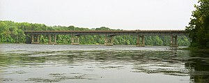
Bridge in Connecticut and Suffield, Connecticut
The Enfield–Suffield Veterans Bridge , commonly known in either town as the Enfield Bridge or Suffield Bridge , is the main traffic crossing that connects the towns of Enfield and Suffield, Connecticut over the Connecticut River . It carries Route 190 as well as the Windsor Locks Canal State Park Trail across the river.
See also
External links and references
Enfield-Suffield Veterans Bridge at Structurae Protection, Department of Environmental. "DEEP: Windsor Locks Canal State Park Trail" . www.ct.gov . Retrieved 2016-09-28.
This Connecticut road–related article is a stub . You can help Misplaced Pages by expanding it .
This article about a bridge in Connecticut is a stub . You can help Misplaced Pages by expanding it .
Categories :
Enfield–Suffield Veterans Bridge
Add topic
Text is available under the Creative Commons Attribution-ShareAlike License. Additional terms may apply.
**DISCLAIMER** We are not affiliated with Wikipedia, and Cloudflare.
The information presented on this site is for general informational purposes only and does not constitute medical advice.
You should always have a personal consultation with a healthcare professional before making changes to your diet, medication, or exercise routine.
AI helps with the correspondence in our chat.
We participate in an affiliate program. If you buy something through a link, we may earn a commission 💕
↑
