| Fortescue Marshes | |
|---|---|
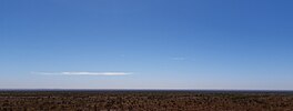
 The Fortescue Marshes seen from the south with the Munjina-Roy Hill Road in the foreground The Fortescue Marshes seen from the south with the Munjina-Roy Hill Road in the foreground | |
 | |
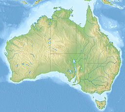
| Location | Pilbara, Western Australia |
| Coordinates | 22°26′44″S 119°26′38″E / 22.44556°S 119.44389°E / -22.44556; 119.44389 |
| Type | Marsh |
| Basin countries | Australia |
Fortescue Marsh (or marshes) is a part of the upper reaches of the Fortescue River in the Pilbara region of Western Australia.
The catchment area at the headwaters of the river is particularly flat and marshy where the Western Creek, Warrawanda Creek and Fortescue River converge, the river then flows through a poorly defined channel as far as Gregory Gorge when the river starts to form a well defined channel and flows through a number of pools before reaching the estuarine area.
Important Bird Area
The 960 km (370 sq mi) Fortescue Marshes have been identified by BirdLife International as an Important Bird Area (IBA) because, when the area is flooded it supports up to 270,000 waterbirds, including over 1% of the world populations of 14 species. The site is also the location for one of the only two records made since 1990 of the critically endangered night parrot.
Iron ore mining
The area is also within the range of iron ore mine operations, consisting of the Christmas Creek, Cloudbreak and Gudai-Darri mine.
The area is also regularly visited and issues assessed due to the sensitivity of the area and its geomorphology.
The operations include the Roy Hill mine and the Christmas Creek mine.
Notes
- "IBA: Fortescue Marshes". Birdata. Birds Australia. Archived from the original on 6 July 2011. Retrieved 22 June 2011.
- "NationalMap". nationalmap.gov.au. Geoscience Australia. Retrieved 2 November 2024.
- Western Australia. Environmental Protection Authority (2013), Environmental and water assessments relating to mining and mining-related activities in the Fortescue Marsh management area : advice of the Environmental Protection Authority to the Minister for Environment under Section 16(e) of the Environmental Protection Act 1986, Environmental Protection Authority, retrieved 20 June 2015
- "Archived copy" (PDF). Archived from the original (PDF) on 23 March 2015. Retrieved 19 June 2015.
{{cite web}}: CS1 maint: archived copy as title (link) - Humphreys, W; Waldock, J (2000), Subterranean aquatic fauna downstream of the Fortescue Marsh : preliminary report, Western Australian Museum, retrieved 20 June 2015
- Van Leeuwen, Stephen (2004), Background documentation : Fortescue Marsh visit : Conservation Commission, Western Australia, Friday 1 July 2005, Dept. of Conservation & Land Management, retrieved 20 June 2015
- Jackson, Jennifer; Kern, Stephen; Pinder, Adrian; Nowicki, Anna; Daniel, Glen (2009), Resource condition report for significant Western Australian wetland : wetlands of the Fortescue River system, Dept. of Environment & Conservation, retrieved 20 June 2015
- SMEC Australia Pty Ltd (2009), Roy Hill 1 iron ore mining project : draft public environmental review : appendices : appendix 6 : Fortescue Marsh management plan, SMEC Australia Pty Ltd, retrieved 20 June 2015