CDP in Montana, United States
| Frazer, Montana | |
|---|---|
| CDP | |
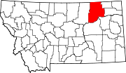
 Location of Frazer, Montana Location of Frazer, Montana | |
| Coordinates: 48°03′12″N 106°02′53″W / 48.05333°N 106.04806°W / 48.05333; -106.04806 | |
| Country | United States |
| State | Montana |
| County | Valley |
| Area | |
| • Total | 1.65 sq mi (4.27 km) |
| • Land | 1.62 sq mi (4.20 km) |
| • Water | 0.03 sq mi (0.07 km) |
| Elevation | 2,060 ft (630 m) |
| Population | |
| • Total | 354 |
| • Density | 218.11/sq mi (84.23/km) |
| Time zone | UTC-7 (Mountain (MST)) |
| • Summer (DST) | UTC-6 (MDT) |
| ZIP code | 59225 |
| Area code | 406 |
| FIPS code | 30-29275 |
| GNIS feature ID | 2408256 |
Frazer is a census-designated place (CDP) in Valley County, Montana, United States, located within the Fort Peck Indian Reservation, about 80 miles from the Canadian border. The population was 420 at the 2020 census.
The St. Paul, Minneapolis & Manitoba Railway established Frazer as a station in 1888. A post office opened in 1907.
Geography
According to the United States Census Bureau, the CDP has a total area of 1.7 square miles (4.4 km), of which 1.7 square miles (4.4 km) is land and 0.04 square miles (0.10 km) (1.75%) is water.
Demographics
| Census | Pop. | Note | %± |
|---|---|---|---|
| 2020 | 354 | — | |
| U.S. Decennial Census | |||
Transportation
Amtrak’s Empire Builder, which operates between Seattle/Portland and Chicago, passes through the town on BNSF tracks, but makes no stop. The nearest station is located in Wolf Point, 19 miles (31 km) to the east.
Education
Frazer School educates students from kindergarten through 12th grade. Frazer High School's team name is the Bearcubs.
References
- "ArcGIS REST Services Directory". United States Census Bureau. Retrieved September 5, 2022.
- ^ U.S. Geological Survey Geographic Names Information System: Frazer, Montana
- Doughtery, Jesse (January 3, 2018). "Reservation basketball stars rarely make it to Division I. But Mya Fourstar has a dream". Washington Post. Archived from the original on January 4, 2018. Retrieved January 5, 2018.
- "US Gazetteer files: 2010, 2000, and 1990". United States Census Bureau. February 12, 2011. Retrieved April 23, 2011.
- ^ "Frazer". Montana Place Names Companion. Montana Historical Society. Retrieved April 2, 2021.
- "Census of Population and Housing". Census.gov. Retrieved June 4, 2016.
- "Frazer School". Frazer School. Retrieved April 20, 2021.
- "Member Schools". Montana High School Association. Retrieved April 19, 2021.
| Municipalities and communities of Valley County, Montana, United States | ||
|---|---|---|
| County seat: Glasgow | ||
| City |  | |
| Towns | ||
| CDPs | ||
| Other communities | ||
| Indian reservations | ||
| Ghost towns | ||
| Footnotes | ‡This populated place also has portions in an adjacent county or counties | |