| Ghiring Rural Municipality घिरिङ्ग गाउँपालिका | |
|---|---|
| Gaunpalika | |
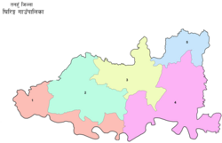
 Ghiring Gaunpalika (rural municipality), Nepal map Ghiring Gaunpalika (rural municipality), Nepal map | |
 | |
| Coordinates: 28°03′54″N 83°56′21″E / 28.065029°N 83.939057°E / 28.065029; 83.939057 | |
| Country | |
| Province | Gandaki |
| District | Tanahun District |
| Population | |
| • Total | 19,318 |
| Time zone | UTC+5:45 (Nepal Time) |
| Website | http://ghiringmun.gov.np |
Ghiring Rural Municipality (Ghiring Gaupalika) (Nepali: घिरिङ्ग गाउँपालिका) is a Gaunpalika in Tanahaun District in Gandaki Province of Nepal. On 12 March 2017, the government of Nepal implemented a new local administrative structure, in which VDCs have been replaced with municipal and Village Councils. Ghiring is one of these 753 local units.
Demographics
At the time of the 2011 Nepal census, Ghiring Rural Municipality had a population of 19,318. Of these, 48.0% spoke Magar, 42.6% Nepali, 7.5% Newar, 1.3% Gurung, 0.2% Bhojpuri, 0.1% Doteli, 0.1% Kumhali, 0.1% Maithili and 0.2% other languages as their first language.
In terms of ethnicity/caste, 50.7% were Magar, 10.1% Kami, 9.7% Kumal, 8.2% Newar, 4.9% Hill Brahmin, 4.8% Sarki, 3.5% Chhetri, 3.5% Damai/Dholi, 1.4% Gurung, 0.8% Darai, 0.5% Badi, 0.5% Gharti/Bhujel, 0.3% Sanyasi/Dasnami, 0.3% Thakuri, 0.3% Yadav, 0.1% Sunuwar, 0.1% Tharu and 0.2% others.
In terms of religion, 92.7% were Hindu, 6.3% Buddhist, 0.6% Christian, 0.1% Muslim and 0.4% others.
In terms of literacy, 67.5% could read and write, 1.7% could only read and 30.6% could neither read nor write.
See also
References
- "Ghiring" (PDF). Ghiring Gaupalika.
- Collegenp. "Ghiring Rural Municipality, Tanahun". www.collegenp.com. Retrieved 2020-07-06.
- "घिरिङ गाउँपालिका, गाउँकार्यपालिकाको कार्यालय | गण्डकी प्रदेश, तनहुँ, नेपाल". ghiringmun.gov.np. Retrieved 2020-07-06.
- NepalMap Language
- NepalMap Caste
- NepalMap Religion
- NepalMap Literacy
| Tanahun District | ||
|---|---|---|
| Headquarters: Damauli (part of Vyas Municipality) | ||
| Municipalities |  | |
| Rural municipalities | ||
| Former VDCs |
| |
This article about a location in the Tanahun District of Nepal is a stub. You can help Misplaced Pages by expanding it. |