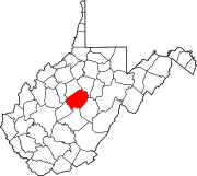
Unincorporated community in West Virginia, United States
| Gip | |
|---|---|
| Unincorporated community | |
  | |
| Coordinates: 38°40′40″N 80°59′38″W / 38.67778°N 80.99389°W / 38.67778; -80.99389 | |
| Country | United States |
| State | West Virginia |
| County | Braxton |
| Time zone | UTC-5 (Eastern (EST)) |
| • Summer (DST) | UTC-4 (EDT) |
Gip is an unincorporated community in Braxton County, West Virginia, United States. Gip's elevation is 932 feet and the community is located in the Eastern time zone.
The community's name is derived from shortening and alteration of the name of Frank Gibson, an early postmaster.
References
- ^ "Gip (in Braxton County, WV) Populated Place Profile." Westvirginia.hometownlocator.com. Accessed August 2011.
- Kenny, Hamill (1945). West Virginia Place Names: Their Origin and Meaning, Including the Nomenclature of the Streams and Mountains. Piedmont, WV: The Place Name Press. p. 268.
External links
| Municipalities and communities of Braxton County, West Virginia, United States | ||
|---|---|---|
| County seat: Sutton | ||
| Towns |  | |
| Unincorporated communities |
| |
| Ghost towns | ||
| Footnotes | ‡This populated place also has portions in an adjacent county or counties | |
This article about a location in Braxton County, West Virginia is a stub. You can help Misplaced Pages by expanding it. |