| Gongala | |
|---|---|
 | |
| Highest point | |
| Elevation | 1,358 m (4,455 ft) |
| Coordinates | 6°23′9″N 80°39′14″E / 6.38583°N 80.65389°E / 6.38583; 80.65389 |
| Geography | |
 | |
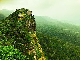
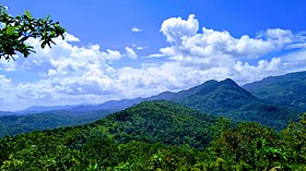
Gongala is a mountain in the Ratnapura District of Sri Lanka. At a summit elevation of 1,358 m (4,455 ft). It is the 15th tallest mountain in Sri Lanka.

Folklore
The name of Gongala means Cow Rock. According to folklores, the shape of this mountain top is the shape of a cow head. Another folklore is that a long time ago many cows lived around the Gongala mountain range.
See also
References
- Survey Department of Sri Lanka (2007). The National Atlas of Sri Lanka (Second Edition) (2nd ed.). p. 36. ISBN 955-9059-04-1. OL 23136585M. Wikidata Q87733463.
- "Gongala, Sri Lanka". GeoNames. Retrieved 19 March 2020.
- "Gongala, Province of Sabaragamuwa, Sri Lanka". Mindat.org. Retrieved 19 March 2020.
- "Gongala". lovidhu.com. Retrieved 4 March 2021.
This Sabaragamuwa Province, Sri Lanka location article is a stub. You can help Misplaced Pages by expanding it. |