Name
Location
Type
Completed Date designated
Grid ref. Entry number Image
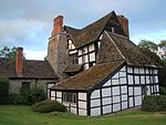
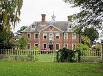
Abbey House
Ledbury House
1600
18 September 1953
SO7102937872 52°02′19″N 2°25′26″W / 52.038486°N 2.42377°W / 52.038486; -2.42377 (Abbey House)
1349379 Abbey House
Abbots Lodge
Ledbury
House
15th century
5 November 1976
SO7121137706 52°02′13″N 2°25′16″W / 52.037003°N 2.421102°W / 52.037003; -2.421102 (Abbots Lodge)
1301823 Upload Photo
Almeley Manor
Almeley House
16th century
20 February 1953
SO3314051604 52°09′31″N 2°58′44″W / 52.158644°N 2.978776°W / 52.158644; -2.978776 (Almeley Manor)
1349938 Almeley Manor
Amberley Chapel
Amberley , MardenChapel
12th century
20 October 1952
SO5465747883 52°07′39″N 2°39′50″W / 52.127384°N 2.663771°W / 52.127384; -2.663771 (Amberley Chapel)
1099404 Amberley Chapel More images
Apostles Farmhouse
Kington Rural Farmhouse
15th century
19 August 1953
SO2850752414 52°09′55″N 3°02′48″W / 52.165344°N 3.04666°W / 52.165344; -3.04666 (Apostles Farmhouse)
1081746 Apostles Farmhouse
Arrow Mill
Arrow Green, Kingsland
Watermill
Late 16th century
11 June 1959
SO4364658721 52°13′26″N 2°49′35″W / 52.223797°N 2.826404°W / 52.223797; -2.826404 (Arrow Mill)
1081828 Arrow Mill More images
Aubrey's Almshouses
Hereford Timber Framed House
c. 1630
10 June 1952
SO5078139916 52°03′20″N 2°43′09″W / 52.05543°N 2.719233°W / 52.05543; -2.719233 (Aubrey's Almshouses)
1205405 Aubrey's Almshouses More images
Aylton Parish Church
Aylton Parish Church
12th century
6 March 1967
SO6584037666 52°02′11″N 2°29′58″W / 52.036338°N 2.499395°W / 52.036338; -2.499395 (Aylton Parish Church)
1099070 Aylton Parish Church More images
Barn about 25m east of Brook House
Colwall Barn
Early 19th century
19 September 1984
SO7524642172 52°04′38″N 2°21′45″W / 52.07735°N 2.362606°W / 52.07735; -2.362606 (Barn about 25m east of Brook House)
1302263 Upload Photo
Barn about 5m north-west of Eardisley Wooton Farmhouse
Eardisley Barn
13th century
19 August 1953
SO3085550586 52°08′57″N 3°00′43″W / 52.149211°N 3.011965°W / 52.149211; -3.011965 (Barn about 5m north-west of Eardisley Wooton Farmhouse)
1157336 Upload Photo
Barn and attached Cow House built onto Glibes Farmhouse
Michaelchurch Escley Barn
Later alterations
12 November 1984
SO3006137376 52°01′49″N 3°01′15″W / 52.030365°N 3.020853°W / 52.030365; -3.020853 (Barn and attached Cow House built onto Glibes Farmhouse)
1223446 Upload Photo
Barn and Cow House about 60m north-west of Court Farmhouse
Aylton
Cruck House
C14-C15
4 December 1985
SO6579337675 52°02′11″N 2°30′00″W / 52.036416°N 2.500081°W / 52.036416; -2.500081 (Barn and Cow House about 60m north-west of Court Farmhouse)
1099072 Upload Photo
Barn approx. 20m west of Old Hall Farmhouse
Orcop Barn
15th century
20 May 1987
SO4629025653 51°55′36″N 2°46′57″W / 51.926789°N 2.782485°W / 51.926789; -2.782485 (Barn approx. 20m west of Old Hall Farmhouse)
1301403 Upload Photo
Barn approx. 20m east of Precentor's House
Cathedral Close, Hereford
Aisled Barn
Late 13th century
22 October 1973
SO5107039852 52°03′18″N 2°42′54″W / 52.05488°N 2.715009°W / 52.05488; -2.715009 (Barn approx. 20m east of Precentor's House)
1196812 Barn approx. 20m east of Precentor's House
Barn at Treago Farm
St Weonards House
19th century
30 April 1986
SO4896824179 51°54′50″N 2°44′36″W / 51.91379°N 2.743325°W / 51.91379; -2.743325 (Barn at Treago Farm)
1348800 Barn at Treago Farm More images
Barn to South of Wall Hills Farmhouse
Ledbury
Barn
Later alterations
10 January 1986
SO6948938325 52°02′33″N 2°26′47″W / 52.042476°N 2.446261°W / 52.042476; -2.446261 (Barn to South of Wall Hills Farmhouse)
1224771 Upload Photo
Barrow Mill
Bearswood Common, Cradley
Timber Framed House
Early 17th century
9 April 1952
SO7320349882 52°08′48″N 2°23′35″W / 52.14657°N 2.393025°W / 52.14657; -2.393025 (Barrow Mill)
1082296 Barrow Mill
Belmont Abbey
Hereford Abbey
1854-1886
22 October 1986
SO4821638149 52°02′22″N 2°45′23″W / 52.03931°N 2.75637°W / 52.03931; -2.75637 (Belmont Abbey)
1099699 Belmont Abbey More images
Belmont House
Belmont Rural Country House
1788-90
8 September 1981
SO4768138741 52°02′40″N 2°45′51″W / 52.044582°N 2.764259°W / 52.044582; -2.764259 (Belmont House)
1167079 Upload Photo
Bernithan Court
Bernithan, Llangarron
House
Earlier
18 May 1953
SO5407721494 51°53′24″N 2°40′07″W / 51.890097°N 2.668696°W / 51.890097; -2.668696 (Bernithan Court)
1099439 Bernithan Court More images
Berrington House
Hereford
House
c. 1635
10 June 1952
SO5079139814 52°03′16″N 2°43′09″W / 52.054513°N 2.719072°W / 52.054513; -2.719072 (Berrington House)
1279761 Upload Photo
Bewell House
Hereford
House
Mid 18th century
22 November 1972
SO5073940088 52°03′25″N 2°43′12″W / 52.056972°N 2.71987°W / 52.056972; -2.71987 (Bewell House)
1205430 Bewell House More images
Black Hall
King's Pyon House
Early 17th century
20 February 1953
SO4373050505 52°09′00″N 2°49′26″W / 52.149948°N 2.823808°W / 52.149948; -2.823808 (Black Hall)
1301676 Upload Photo
Black Hall
Aston, Kingsland
Farmhouse
14th century
11 June 1959
SO4608062949 52°15′43″N 2°47′29″W / 52.262048°N 2.791452°W / 52.262048; -2.791452 (Black Hall)
1349878 Upload Photo
Black Lion Inn
Hereford
Box Frame House
Early 17th century
10 June 1952
SO5077039678 52°03′12″N 2°43′10″W / 52.053289°N 2.719359°W / 52.053289; -2.719359 (Black Lion Inn)
1205517 Black Lion Inn More images
Bleathwood Manor
Little Hereford Farmhouse
Early 17th century
11 June 1959
SO5607069676 52°19′24″N 2°38′45″W / 52.323413°N 2.64597°W / 52.323413; -2.64597 (Bleathwood Manor)
1301094 Upload Photo
Blue Leader
3 Widemarsh Street, Hereford
House
Late 18th century
10 June 1952
SO5095740061 52°03′24″N 2°43′00″W / 52.056749°N 2.716687°W / 52.056749; -2.716687 (Blue Leader)
1207947 Blue Leader
Bodcott Farmhouse
Dorstone Farmhouse
Mid 16th century
29 September 1952
SO3374743103 52°04′56″N 2°58′06″W / 52.0823°N 2.968246°W / 52.0823; -2.968246 (Bodcott Farmhouse)
1168073 Upload Photo
Bollingham Chapel
Eardisley Chapel
13th century
16 October 1967
SO3017352695 52°10′05″N 3°01′21″W / 52.168083°N 3.022365°W / 52.168083; -3.022365 (Bollingham Chapel)
1157325 Bollingham Chapel More images
Bollitree Castle Farmhouse
Weston under Penyard Farmhouse
c. 1700
18 May 1953
SO6364424023 51°54′49″N 2°31′48″W / 51.913542°N 2.529956°W / 51.913542; -2.529956 (Bollitree Castle Farmhouse)
1099638 Upload Photo
Booth Hall Hotel
Hereford
Timber Framed House
15th century
10 June 1952
SO5106639998 52°03′22″N 2°42′54″W / 52.056192°N 2.715088°W / 52.056192; -2.715088 (Booth Hall Hotel)
1196827 Booth Hall Hotel More images
Brand Lodge
Colwall
House
1910
18 November 1952
SO7658741232 52°04′08″N 2°20′35″W / 52.068958°N 2.342975°W / 52.068958; -2.342975 (Brand Lodge)
1349714 Upload Photo
Bridge Farmhouse
Wellington
House
16th century
20 October 1952
SO4985448230 52°07′48″N 2°44′02″W / 52.130088°N 2.733977°W / 52.130088; -2.733977 (Bridge Farmhouse)
1179775 Upload Photo
Broadfield Court
Bodenham House
14th century
11 June 1959
SO5450553077 52°10′27″N 2°40′00″W / 52.174065°N 2.666689°W / 52.174065; -2.666689 (Broadfield Court)
1082023 Broadfield Court More images
Brockhampton Chapel
Brockhampton-by-Bromyard, Brockhampton
Chapel
Built 1798
9 June 1967
SO6835554889 52°11′29″N 2°27′52″W / 52.191326°N 2.464339°W / 52.191326; -2.464339 (Brockhampton Chapel)
1349630 Brockhampton Chapel More images
Brockhampton Park
Brockhampton Park, Brockhampton
Country House
Mid 18th century
9 June 1967
SO6863955037 52°11′34″N 2°27′37″W / 52.192673°N 2.460199°W / 52.192673; -2.460199 (Brockhampton Park)
1176659 Brockhampton Park More images
Bronsil Castle Bridge and Moat
Eastnor Castle
Mid 15th century
6 March 1967
SO7496937179 52°01′57″N 2°21′59″W / 52.032448°N 2.36628°W / 52.032448; -2.36628 (Bronsil Castle Bridge and Moat)
1156646 Bronsil Castle Bridge and Moat More images
Brook House
Colwall
Farmhouse
17th century
18 November 1952
SO7520642172 52°04′38″N 2°21′47″W / 52.077348°N 2.36319°W / 52.077348; -2.36319 (Brook House)
1082126 Upload Photo
Broomy Hill Pumping Station
Hereford Pumping station
1856
15 March 2015
SO4966739316 52°03′00″N 2°44′07″W / 52.049935°N 2.7353896°W / 52.049935; -2.7353896 (Broomy Hill Pumping Station)
1422752 Broomy Hill Pumping Station More images
Building in Yard to rear of Nos 40 and 42, Broad St
Leominster Guest House
late C15/early 16th century
31 August 1989
SO4962459261 52°13′45″N 2°44′20″W / 52.229232°N 2.738979°W / 52.229232; -2.738979 (Building in Yard to rear of Nos 40 and 42, Broad St)
1255399 Upload Photo
Burton Court
Eardisland
Country House
c. 1808
20 February 1953
SO4228457190 52°12′36″N 2°50′46″W / 52.209893°N 2.846079°W / 52.209893; -2.846079 (Burton Court)
1081945 Burton Court More images
Bush Farmhouse and attached Barn to North East
Coddington
Farmhouse
C16-C17
18 November 1952
SO7341443105 52°05′08″N 2°23′22″W / 52.085653°N 2.38941°W / 52.085653; -2.38941 (Bush Farmhouse and attached Barn to North East)
1157254 Upload Photo
Byford Court
Byford House
16th century
20 February 1953
SO3963842939 52°04′53″N 2°52′56″W / 52.081501°N 2.882261°W / 52.081501; -2.882261 (Byford Court)
1157633 Byford Court More images
Caradoc Court
Sellack Country House
16th century
18 May 1953
SO5586627485 51°56′39″N 2°38′36″W / 51.944103°N 2.643472°W / 51.944103; -2.643472 (Caradoc Court)
1214935 Upload Photo
Castle End
Lea House
17th century
18 May 1953
SO6545321948 51°53′42″N 2°30′12″W / 51.895002°N 2.503449°W / 51.895002; -2.503449 (Castle End)
1348810 Upload Photo
Chandos
Much Marcle Farmhouse
Late 16th century
18 November 1952
SO6433834470 52°00′27″N 2°31′15″W / 52.00751°N 2.520956°W / 52.00751; -2.520956 (Chandos)
1099043 Upload Photo
Chapel approximately 30m north of Chapel Farmhouse
Yatton Parish Church
Mid 12th century
25 February 1966
SO6270130392 51°58′15″N 2°32′40″W / 51.970739°N 2.544358°W / 51.970739; -2.544358 (Chapel approximately 30m north of Chapel Farmhouse)
1099211 Chapel approximately 30m north of Chapel Farmhouse More images
Chapel of St John
Much Fawley, Brockhampton
Chapel
12th century
25 February 1966
SO5905229555 51°57′47″N 2°35′51″W / 51.962957°N 2.597372°W / 51.962957; -2.597372 (Chapel of St John)
1099265 Chapel of St John More images
Chapel of St John of Jerusalem
Dinmore Chapel
Late 12th century
15 July 1985
SO4860250276 52°08′54″N 2°45′09″W / 52.148365°N 2.752575°W / 52.148365; -2.752575 (Chapel of St John of Jerusalem)
1348966 Chapel of St John of Jerusalem
Church of All Saints
Coddington Church
C12-C13
6 March 1967
SO7183642680 52°04′54″N 2°24′45″W / 52.081753°N 2.412403°W / 52.081753; -2.412403 (Church of All Saints)
1082177 Church of All Saints More images
Church of All Saints
Eyton Parish Church
12th century
11 June 1959
SO4750961557 52°14′59″N 2°46′13″W / 52.249674°N 2.770299°W / 52.249674; -2.770299 (Church of All Saints)
1081863 Church of All Saints More images
Church of All Saints
Hereford Parish Church
13th century
10 June 1952
SO5089240043 52°03′24″N 2°43′03″W / 52.056581°N 2.717632°W / 52.056581; -2.717632 (Church of All Saints)
1025105 Church of All Saints More images
Church of All Saints
Kinsham Parish Church
Late 13th century or early 14th century
17 December 1986
SO3643464910 52°16′43″N 2°55′59″W / 52.278644°N 2.933136°W / 52.278644; -2.933136 (Church of All Saints)
1081486 Church of All Saints More images
Church of All Saints
Monkland Parish Church
12th century
11 June 1959
SO4603357671 52°12′53″N 2°47′29″W / 52.214597°N 2.791296°W / 52.214597; -2.791296 (Church of All Saints)
1349845 Church of All Saints More images
Church of St Andrew
Allensmore Parish Church
12th century
26 January 1967
SO4662935875 52°01′07″N 2°46′45″W / 52.018717°N 2.779149°W / 52.018717; -2.779149 (Church of St Andrew)
1099725 Church of St Andrew More images
Church of St Andrew
Leinthall Earls , Aymestrey Chapel
12th century
11 June 1959
SO4430267885 52°18′22″N 2°49′06″W / 52.306242°N 2.818318°W / 52.306242; -2.818318 (Church of St Andrew)
1082117 Church of St Andrew More images
Church of St Andrew
Bredwardine Parish Church
Early 12th century
26 January 1967
SO3347644500 52°05′41″N 2°58′21″W / 52.094826°N 2.972474°W / 52.094826; -2.972474 (Church of St Andrew)
1099515 Church of St Andrew More images
Church of St Andrew
Evesbatch Parish Church
Medieval origins
9 June 1967
SO6863348138 52°07′50″N 2°27′35″W / 52.130649°N 2.459647°W / 52.130649; -2.459647 (Church of St Andrew)
1349690 Church of St Andrew More images
Church of St Andrew
Pixley Parish Church
13th century
6 March 1967
SO6608638800 52°02′48″N 2°29′45″W / 52.046548°N 2.495921°W / 52.046548; -2.495921 (Church of St Andrew)
1098989 Church of St Andrew More images
Church of St Andrew
Wolferlow Church
Early 12th century
9 June 1967
SO6686561723 52°15′10″N 2°29′13″W / 52.252676°N 2.486807°W / 52.252676; -2.486807 (Church of St Andrew)
1217197 Church of St Andrew More images
Church of St Andrew and St Mary
How Caple Parish Church
14th century
25 February 1966
SO6115930542 51°58′19″N 2°34′01″W / 51.971982°N 2.566821°W / 51.971982; -2.566821 (Church of St Andrew and St Mary)
1166452 Church of St Andrew and St Mary More images
Church of St Anna
Thornbury Church
Early 12th century
9 June 1967
SO6221859674 52°14′02″N 2°33′17″W / 52.233955°N 2.554646°W / 52.233955; -2.554646 (Church of St Anna)
1234834 Church of St Anna More images
Church of St Bartholomew
Ashperton Chapel of Ease
Mid 13th century
6 March 1967
SO6425841493 52°04′14″N 2°31′22″W / 52.070643°N 2.522858°W / 52.070643; -2.522858 (Church of St Bartholomew)
1098909 Church of St Bartholomew More images
Church of St Bartholomew
Docklow, Docklow and Hampton Wafer
Parish Church
12th century
11 June 1959
SO5641657518 52°12′51″N 2°38′22″W / 52.214143°N 2.639319°W / 52.214143; -2.639319 (Church of St Bartholomew)
1349778 Church of St Bartholomew More images
Church of St Bartholomew
Munsley Parish Church
12th century
6 March 1967
SO6623940937 52°03′57″N 2°29′38″W / 52.065769°N 2.493903°W / 52.065769; -2.493903 (Church of St Bartholomew)
1098876 Church of St Bartholomew More images
Church of St Bridget
Bridstow Parish Church
12th century
26 March 1987
SO5846024836 51°55′14″N 2°36′19″W / 51.920488°N 2.605416°W / 51.920488; -2.605416 (Church of St Bridget)
1214131 Church of St Bridget More images
Church of St David
Little Dewchurch Parish Church
14th century
26 January 1967
SO5295031759 51°58′56″N 2°41′11″W / 51.982287°N 2.686478°W / 51.982287; -2.686478 (Church of St David)
1157474 Church of St David More images
Church of St Denys
Pencoyd Church
14th century
30 April 1986
SO5160826555 51°56′07″N 2°42′19″W / 51.935387°N 2.705282°W / 51.935387; -2.705282 (Church of St Denys)
1348774 Church of St Denys More images
Church of St Dubricius
Ballingham Parish Church
13th century to 15th century
26 March 1987
SO5760031650 51°58′54″N 2°37′08″W / 51.981682°N 2.618763°W / 51.981682; -2.618763 (Church of St Dubricius)
1214127 Church of St Dubricius More images
Church of St Dubricius
Hentland Parish church
c. 1300
26 March 1987
SO5430626391 51°56′03″N 2°39′58″W / 51.934141°N 2.66602°W / 51.934141; -2.66602 (Church of St Dubricius)
1288593 Church of St Dubricius More images
Church of St Dubricius
St Devereux Church
13th century
26 January 1967
SO4408931223 51°58′36″N 2°48′55″W / 51.976645°N 2.815398°W / 51.976645; -2.815398 (Church of St Dubricius)
1099585 Church of St Dubricius More images
Church of St Dubricius
Whitchurch Parish Church
13th century
3 July 1985
SO5561917496 51°51′15″N 2°38′45″W / 51.854279°N 2.645776°W / 51.854279; -2.645776 (Church of St Dubricius)
1224924 Church of St Dubricius More images
Church of St Faith
Bacton Parish Church
C13-C16
26 January 1967
SO3708332382 51°59′11″N 2°55′03″W / 51.986314°N 2.917595°W / 51.986314; -2.917595 (Church of St Faith)
1098657 Church of St Faith More images
Church of St Faith
Dorstone Parish Church
Medieval
16 January 1967
SO3146041797 52°04′13″N 3°00′05″W / 52.070281°N 3.001353°W / 52.070281; -3.001353 (Church of St Faith)
1348887 Church of St Faith More images
Church of St Francis Xavier
Hereford
Roman Catholic Church
c. 1839
10 June 1952
SO5093939880 52°03′18″N 2°43′01″W / 52.05512°N 2.716924°W / 52.05512; -2.716924 (Church of St Francis Xavier)
1297462 Church of St Francis Xavier More images
Church of St George
Woolhope Church
12th century
6 March 1967
SO6115535785 52°01′09″N 2°34′03″W / 52.019118°N 2.567475°W / 52.019118; -2.567475 (Church of St George)
1156792 Church of St George More images
Church of St Giles
Acton Beauchamp Church
late Norman
9 June 1967
SO6794850310 52°09′00″N 2°28′11″W / 52.150137°N 2.469859°W / 52.150137; -2.469859 (Church of St Giles)
1082414 Church of St Giles More images
Church of St Giles
Goodrich Parish Church
13th century
25 February 1966
SO5721819051 51°52′06″N 2°37′22″W / 51.868384°N 2.622755°W / 51.868384; -2.622755 (Church of St Giles)
1157263 Church of St Giles More images
Church of St James
Colwall Church
12th century
6 March 1967
SO7390242309 52°04′43″N 2°22′56″W / 52.07852°N 2.382227°W / 52.07852; -2.382227 (Church of St James)
1178404 Church of St James More images
Church of St James
Cradley
Parish Church
12th-century origins
9 June 1967
SO7360547135 52°07′19″N 2°23′13″W / 52.121893°N 2.386936°W / 52.121893; -2.386936 (Church of St James)
1082298 Church of St James More images
Church of St James
Kimbolton Parish Church
12th century
11 June 1959
SO5259561618 52°15′02″N 2°41′45″W / 52.250685°N 2.695815°W / 52.250685; -2.695815 (Church of St James)
1082568 Church of St James More images
Church of St James
Stanford Bishop Parish Church
c. 1200
9 June 1967
SO6820751561 52°09′41″N 2°27′58″W / 52.161398°N 2.466191°W / 52.161398; -2.466191 (Church of St James)
1276170 Church of St James More images
Church of St James
Tedstone Delamere Church
Preconquest
9 June 1967
SO6956058557 52°13′28″N 2°26′49″W / 52.22437°N 2.447043°W / 52.22437; -2.447043 (Church of St James)
1234705 Church of St James More images
Church of St James the Great
Ocle Pychard Parish Church
14th century
9 June 1967
SO5955046221 52°06′46″N 2°35′32″W / 52.112823°N 2.592102°W / 52.112823; -2.592102 (Church of St James the Great)
1276199 Church of St James the Great More images
Church of St John Baptist
Llanrothal Parish Church
12th century
25 February 1966
SO4706618589 51°51′48″N 2°46′12″W / 51.863358°N 2.770114°W / 51.863358; -2.770114 (Church of St John Baptist)
1348962 Church of St John Baptist More images
Church of St John Baptist
Weston Beggard Anglican Church
1881
11 October 1985
SO5839041236 52°04′05″N 2°36′30″W / 52.067922°N 2.60843°W / 52.067922; -2.60843 (Church of St John Baptist)
1348736 Church of St John Baptist More images
Church of St John the Baptist
Aston Ingham Church
13th century
17 March 1987
SO6836223567 51°54′35″N 2°27′41″W / 51.909731°N 2.461326°W / 51.909731; -2.461326 (Church of St John the Baptist)
1099646 Church of St John the Baptist More images
Church of St John the Baptist
Lea Church
Late 13th century
17 March 1987
SO6576221743 51°53′35″N 2°29′56″W / 51.893179°N 2.498939°W / 51.893179; -2.498939 (Church of St John the Baptist)
1099652 Church of St John the Baptist More images
Church of St John the Baptist
Llanwarne Church
13th century
30 April 1986
SO5060828218 51°57′01″N 2°43′12″W / 51.950249°N 2.720065°W / 51.950249; -2.720065 (Church of St John the Baptist)
1301841 Church of St John the Baptist More images
Church of St John the Baptist
Mathon Church
Norman
6 March 1967
SO7336745846 52°06′37″N 2°23′25″W / 52.110293°N 2.390311°W / 52.110293; -2.390311 (Church of St John the Baptist)
1302229 Church of St John the Baptist More images
Church of St John the Baptist
Orcop Parish Church
Early 13th century
26 January 1967
SO4738926270 51°55′57″N 2°46′00″W / 51.932441°N 2.766599°W / 51.932441; -2.766599 (Church of St John the Baptist)
1157843 Church of St John the Baptist More images
Church of St John the Baptist
Whitbourne Church
Late 12th century
9 June 1967
SO7251956939 52°12′36″N 2°24′13″W / 52.20998°N 2.403595°W / 52.20998; -2.403595 (Church of St John the Baptist)
1217070 Church of St John the Baptist More images
Church of St Junabius
Llandinabo Church
Medieval
30 April 1986
SO5184028439 51°57′08″N 2°42′08″W / 51.952344°N 2.702172°W / 51.952344; -2.702172 (Church of St Junabius)
1302116 Church of St Junabius More images
Church of St Laurence
Preston on Wye Parish Church
12th century
2 September 1966
SO3837942446 52°04′37″N 2°54′02″W / 52.07693°N 2.900542°W / 52.07693; -2.900542 (Church of St Laurence)
1081856 Church of St Laurence More images
Church of St Lawrence
Bishopstone Parish church
1854
2 September 1966
SO4159043897 52°05′25″N 2°51′14″W / 52.090323°N 2.853944°W / 52.090323; -2.853944 (Church of St Lawrence)
1081874 Church of St Lawrence More images
Church of St Lawrence
Weston under Penyard Church
Late 12th century
17 March 1987
SO6313323235 51°54′23″N 2°32′14″W / 51.906424°N 2.537301°W / 51.906424; -2.537301 (Church of St Lawrence)
1348828 Church of St Lawrence More images
Church of St Leonard
Yarpole , Croft and YarpoleParish Church
Early 14th century
11 June 1959
SO4698664868 52°16′46″N 2°46′43″W / 52.279387°N 2.778481°W / 52.279387; -2.778481 (Church of St Leonard)
1296754 Church of St Leonard More images
Church of St Leonard
Hatfield , Hatfield and Newhampton Parish Church
11th century
11 June 1959
SO5858659384 52°13′52″N 2°36′28″W / 52.231086°N 2.60779°W / 52.231086; -2.60779 (Church of St Leonard)
1082567 Church of St Leonard More images
Church of St Luke
Stoke Prior Parish Church
14th century
21 May 1987
SO5197656490 52°12′16″N 2°42′15″W / 52.204532°N 2.704152°W / 52.204532; -2.704152 (Church of St Luke)
1157842 Church of St Luke More images
Church of St Luke
Ullingswick Parish Church
12th century
9 June 1967
SO5966349937 52°08′46″N 2°35′27″W / 52.146239°N 2.590894°W / 52.146239; -2.590894 (Church of St Luke)
1234909 Church of St Luke More images
Church of St Margaret
Welsh Bicknor Parish Church
Earlier
3 July 1985
SO5922917674 51°51′22″N 2°35′36″W / 51.856156°N 2.593387°W / 51.856156; -2.593387 (Church of St Margaret)
1348965 Church of St Margaret More images
Church of St Margaret Churchyard cross
Wellington Cross
14th century or 15th century
15 July 1985
SO4973748196 52°07′47″N 2°44′08″W / 52.129771°N 2.735681°W / 52.129771; -2.735681 (Church of St Margaret Churchyard cross)
1348970 Church of St Margaret Churchyard cross More images
Church of St Mary
Bishop's Frome Church
12th century
9 June 1967
SO6634048313 52°07′56″N 2°29′35″W / 52.132087°N 2.49316°W / 52.132087; -2.49316 (Church of St Mary)
1349597 Church of St Mary More images
Church of St Mary
Brinsop and Wormsley Parish Church
12th century
2 September 1966
SO4274947794 52°07′32″N 2°50′16″W / 52.125476°N 2.837686°W / 52.125476; -2.837686 (Church of St Mary)
1301626 Church of St Mary More images
Church of St Mary
Burghill Parish Church
12th century
27 January 1967
SO4793444501 52°05′47″N 2°45′41″W / 52.096387°N 2.761451°W / 52.096387; -2.761451 (Church of St Mary)
1099280 Church of St Mary More images
Church of St Mary
Clifford Parish Church
12th century
26 January 1967
SO2514945025 52°05′55″N 3°05′39″W / 52.098479°N 3.094117°W / 52.098479; -3.094117 (Church of St Mary)
1348871 Church of St Mary More images
Church of St Mary
Craswall Schoolroom
19th century
26 January 1967
SO2815036282 52°01′13″N 3°02′55″W / 52.020286°N 3.048473°W / 52.020286; -3.048473 (Church of St Mary)
1078203 Church of St Mary More images
Church of St Mary
Cusop Parish Church
Early 12th century
26 January 1967
SO2400541540 52°04′01″N 3°06′36″W / 52.066997°N 3.110036°W / 52.066997; -3.110036 (Church of St Mary)
1168008 Church of St Mary More images
Church of St Mary
Eardisland Parish Church
Early 13th century
2 September 1966
SO4204858520 52°13′19″N 2°50′59″W / 52.221824°N 2.849761°W / 52.221824; -2.849761 (Church of St Mary)
1349843 Church of St Mary More images
Church of St Mary
Hope under Dinmore Parish Church
14th century or earlier
11 June 1959
SO5105852826 52°10′17″N 2°43′01″W / 52.171513°N 2.717054°W / 52.171513; -2.717054 (Church of St Mary)
1301623 Church of St Mary More images
Church of St Mary
Humber Parish Church
13th century or earlier
11 June 1959
SO5356656338 52°12′12″N 2°40′51″W / 52.203302°N 2.680866°W / 52.203302; -2.680866 (Church of St Mary)
1157768 Church of St Mary More images
Church of St Mary
Little Birch Parish Church
1869
21 May 1987
SO5114831187 51°58′37″N 2°42′45″W / 51.976989°N 2.712632°W / 51.976989; -2.712632 (Church of St Mary)
1348854 Church of St Mary More images
Church of St Mary
Turnastone Parish Church
12th century
26 January 1967
SO3574536477 52°01′23″N 2°56′16″W / 52.022972°N 2.937845°W / 52.022972; -2.937845 (Church of St Mary)
1224950 Church of St Mary More images
Church of St Mary
Tyberton Parish Church
1720
21 February 1986
SO3802339889 52°03′14″N 2°54′19″W / 52.053904°N 2.905271°W / 52.053904; -2.905271 (Church of St Mary)
1348758 Church of St Mary More images
Church of St Mary Magdalene
Elton, Leinthall Starkes
Parish Church
12th century
11 June 1959
SO4418770028 52°19′32″N 2°49′13″W / 52.325495°N 2.82036°W / 52.325495; -2.82036 (Church of St Mary Magdalene)
1081770 Church of St Mary Magdalene More images
Church of St Mary Magdalene
Little Hereford Parish Church
12th century
11 June 1959
SO5538968006 52°18′30″N 2°39′21″W / 52.308345°N 2.655739°W / 52.308345; -2.655739 (Church of St Mary Magdalene)
1082535 Church of St Mary Magdalene More images
Church of St Mary Magdalene
Stretton Sugwas Parish Church
1877-80
27 January 1967
SO4596442026 52°04′26″N 2°47′23″W / 52.073948°N 2.789813°W / 52.073948; -2.789813 (Church of St Mary Magdalene)
1296537 Church of St Mary Magdalene More images
Church of St Michael
Brampton Abbotts Parish Church
12th century
25 February 1966
SO6009626411 51°56′05″N 2°34′55″W / 51.934767°N 2.581813°W / 51.934767; -2.581813 (Church of St Michael)
1099258 Church of St Michael More images
Church of St Michael
Brimfield Parish Church
13th century
11 June 1959
SO5268467493 52°18′13″N 2°41′43″W / 52.303506°N 2.695338°W / 52.303506; -2.695338 (Church of St Michael)
1349854 Church of St Michael More images
Church of St Michael
Dewsall Parish Church
12th century
26 January 1967
SO4861733492 51°59′51″N 2°44′59″W / 51.997482°N 2.749823°W / 51.997482; -2.749823 (Church of St Michael)
1167194 Church of St Michael More images
Church of St Michael
Edwyn Ralph Church
12th century
9 June 1967
SO6452057498 52°12′52″N 2°31′15″W / 52.214547°N 2.520712°W / 52.214547; -2.520712 (Church of St Michael)
1177450 Church of St Michael More images
Church of St Michael
Hope Mansell Church
12th century
17 March 1987
SO6254219646 51°52′27″N 2°32′44″W / 51.874118°N 2.5455°W / 51.874118; -2.5455 (Church of St Michael)
1348808 Church of St Michael More images
Church of St Michael
Knill Parish Church
Late 12th century and early 13th century
16 October 1967
SO2911360467 52°14′16″N 3°02′22″W / 52.23781°N 3.03949°W / 52.23781; -3.03949 (Church of St Michael)
1081487 Church of St Michael More images
Church of St Michael
Mansel Lacy Parish Church
12th century
2 September 1966
SO4255745565 52°06′20″N 2°50′24″W / 52.105419°N 2.840114°W / 52.105419; -2.840114 (Church of St Michael)
1081951 Church of St Michael More images
Church of St Michael
Michaelchurch Escley Parish Church
12th century
26 January 1967
SO3167234186 52°00′07″N 2°59′48″W / 52.00189°N 2.996737°W / 52.00189; -2.996737 (Church of St Michael)
1223432 Church of St Michael More images
Church of St Michael
Sollers Hope Parish Church
14th century
25 February 1966
SO6124933118 51°59′43″N 2°33′57″W / 51.995147°N 2.565802°W / 51.995147; -2.565802 (Church of St Michael)
1349011 Church of St Michael More images
Church of St Michael
Sutton St Michael , SuttonChurch
12th century
26 January 1967
SO5264645824 52°06′31″N 2°41′34″W / 52.108705°N 2.692858°W / 52.108705; -2.692858 (Church of St Michael)
1348978 Church of St Michael More images
Church of St Michael
Upper Sapey Church
mid to late 12th century
9 June 1967
SO6827663617 52°16′11″N 2°27′59″W / 52.269786°N 2.466317°W / 52.269786; -2.466317 (Church of St Michael)
1275895 Church of St Michael More images
Church of St Michael and All Angels
Bodenham Parish Church
c. 1200
11 June 1959
SO5299050888 52°09′15″N 2°41′19″W / 52.154259°N 2.688537°W / 52.154259; -2.688537 (Church of St Michael and All Angels)
1349790 Church of St Michael and All Angels More images
Church of St Michael and All Angels
Kingstone Parish Church
12th century
21 February 1986
SO4244335700 52°01′00″N 2°50′24″W / 52.016724°N 2.840112°W / 52.016724; -2.840112 (Church of St Michael and All Angels)
1178447 Church of St Michael and All Angels More images
Church of St Michael and All Angels
Lyonshall Parish Church
Late 12th century
16 October 1967
SO3310256258 52°12′02″N 2°58′49″W / 52.200475°N 2.980251°W / 52.200475; -2.980251 (Church of St Michael and All Angels)
1349918 Church of St Michael and All Angels More images
Church of St Nicholas
Norton Canon Parish Church
13th century
2 September 1966
SO3820547756 52°07′29″N 2°54′15″W / 52.124644°N 2.904045°W / 52.124644; -2.904045 (Church of St Nicholas)
1157795 Church of St Nicholas More images
Church of St Nicholas
Sutton St Nicholas , SuttonParish Church
12th century
21 January 1967
SO5340545351 52°06′16″N 2°40′54″W / 52.104517°N 2.681711°W / 52.104517; -2.681711 (Church of St Nicholas)
1348981 Church of St Nicholas More images
Church of St Peter
Dormington Parish church
1877
26 January 1967
SO5832040196 52°03′31″N 2°36′34″W / 52.058567°N 2.609324°W / 52.058567; -2.609324 (Church of St Peter)
1099882 Church of St Peter More images
Church of St Peter
Hereford
Parish Church
Late C13/Early 14th century
10 June 1952
SO5115640014 52°03′23″N 2°42′50″W / 52.056344°N 2.713778°W / 52.056344; -2.713778 (Church of St Peter)
1196883 Church of St Peter More images
Church of St Peter
Llancillo Parish Church
11th century OR 12th century
26 January 1967
SO3662025567 51°55′30″N 2°55′23″W / 51.924997°N 2.923077°W / 51.924997; -2.923077 (Church of St Peter)
1078169 Church of St Peter More images
Church of St Peter
Lugwardine Anglican Church
1871-2
26 January 1967
SO5509041034 52°03′57″N 2°39′24″W / 52.065847°N 2.656542°W / 52.065847; -2.656542 (Church of St Peter)
1099844 Church of St Peter More images
Church of St Peter
Peterstow Parish Church
Anglo Saxon
26 March 1987
SO5639024902 51°55′15″N 2°38′08″W / 51.920922°N 2.635521°W / 51.920922; -2.635521 (Church of St Peter)
1214804 Church of St Peter More images
Church of St Peter
Pipe and Lyde Parish Church
late 12th century or 13th century
27 January 1967
SO5028244091 52°05′35″N 2°43′38″W / 52.092918°N 2.727119°W / 52.092918; -2.727119 (Church of St Peter)
1172739 Church of St Peter More images
Church of St Peter
Pudleston Parish Church
c. 1200
11 June 1959
SO5652959765 52°14′04″N 2°38′17″W / 52.234352°N 2.637955°W / 52.234352; -2.637955 (Church of St Peter)
1082544 Church of St Peter More images
Church of St Peter
Withington Parish Church
12th century
26 January 1967
SO5657443486 52°05′17″N 2°38′07″W / 52.088009°N 2.635208°W / 52.088009; -2.635208 (Church of St Peter)
1349003 Church of St Peter More images
Church of St Peter and St Paul
Whitney-on-Wye Parish Church
12th century
16 October 1967
SO2673347544 52°07′17″N 3°04′18″W / 52.121335°N 3.07154°W / 52.121335; -3.07154 (Church of St Peter and St Paul)
1349557 Church of St Peter and St Paul More images
Church of St Philip and St James
Tarrington Church
12th century
6 March 1967
SO6186140688 52°03′48″N 2°33′28″W / 52.063246°N 2.557736°W / 52.063246; -2.557736 (Church of St Philip and St James)
1302745 Church of St Philip and St James More images
Church of St Mary
Brilley Parish Church
12th century
16 October 1967
SO2604449215 52°08′11″N 3°04′55″W / 52.136263°N 3.081966°W / 52.136263; -3.081966 (Church of St Mary)
1082516 Church of St Mary More images
Church of St Michael
Winforton , Willersley and Winforton Parish Church
13th century or earlier
16 October 1967
SO2987046973 52°07′00″N 3°01′32″W / 52.11661°N 3.025612°W / 52.11661; -3.025612 (Church of St Michael)
1301508 Church of St Michael More images
Church of St Thomas of Canterbury
Huntington Parish Church
c. 1300
16 October 1967
SO2494653380 52°10′25″N 3°05′56″W / 52.173553°N 3.098927°W / 52.173553; -3.098927 (Church of St Thomas of Canterbury)
1349556 Church of St Thomas of Canterbury More images
Church of the Holy Rood
Mordiford Anglican Church
c. 1811
26 January 1967
SO5704737449 52°02′02″N 2°37′39″W / 52.033773°N 2.627544°W / 52.033773; -2.627544 (Church of the Holy Rood)
1179735 Church of the Holy Rood More images
Church of the Holy Trinity
Preston Wynne Parish Church
1727
26 January 1967
SO5587846580 52°06′57″N 2°38′45″W / 52.115769°N 2.645767°W / 52.115769; -2.645767 (Church of the Holy Trinity)
1302088 Church of the Holy Trinity More images
Churchyard Cross
Coddington Cross
C14-C15
6 March 1967
SO7184542670 52°04′54″N 2°24′44″W / 52.081664°N 2.412271°W / 52.081664; -2.412271 (Churchyard Cross)
1157237 Churchyard Cross More images
Churchyard Cross
Colwall
Cross
C14-C15
18 November 1952
SO7391942292 52°04′42″N 2°22′55″W / 52.078368°N 2.381977°W / 52.078368; -2.381977 (Churchyard Cross)
1349729 Churchyard Cross More images
Churchyard Cross
Hampton Bishop Cross
14th century
26 January 1967
SO5587838023 52°02′20″N 2°38′41″W / 52.038842°N 2.644657°W / 52.038842; -2.644657 (Churchyard Cross)
1099870 Churchyard Cross More images
Churchyard Cross
Mordiford
Cross
14th century or 15th century
26 January 1967
SO5705837437 52°02′01″N 2°37′39″W / 52.033666°N 2.627382°W / 52.033666; -2.627382 (Churchyard Cross)
1099815 Churchyard Cross More images
Churchyard Cross
Walterstone Cross
15th century or early 16th century
26 January 1967
SO3405924961 51°55′09″N 2°57′37″W / 51.919251°N 2.960197°W / 51.919251; -2.960197 (Churchyard Cross)
1342147 Upload Photo
Churchyard Cross about 20m south of the Tower of the Church of the Nativity of the Blessed Virgin Mary
Madley Cross
14th century
26 January 1962
SO4197438700 52°02′37″N 2°50′51″W / 52.043644°N 2.847455°W / 52.043644; -2.847455 (Churchyard Cross about 20m south of the Tower of the Church of the Nativity of the Blessed Virgin Mary)
1178625 Churchyard Cross about 20m south of the Tower of the Church of the Nativity of the Blessed Virgin Mary More images
Churchyard Cross and Base about 20m south of Chancel of Putley Parish Church
Putley Steps
14th century
6 March 1967
SO6461337593 52°02′08″N 2°31′02″W / 52.035604°N 2.517273°W / 52.035604; -2.517273 (Churchyard Cross and Base about 20m south of Chancel of Putley Parish Church)
1098968 Churchyard Cross and Base about 20m south of Chancel of Putley Parish Church More images
Churchyard Cross about 5m south of South Porch of Church of St Dubricius
Whitchurch Cross
1698
14 February 1966
SO5561717482 51°51′15″N 2°38′45″W / 51.854153°N 2.645803°W / 51.854153; -2.645803 (Churchyard Cross about 5m south of South Porch of Church of St Dubricius)
1225239 Churchyard Cross about 5m south of South Porch of Church of St Dubricius More images
67, Owen Street and City Wall to rear
Hereford
House and city wall
Early 19th century
22 October 1973
SO5138039794 52°03′16″N 2°42′38″W / 52.054386°N 2.71048°W / 52.054386; -2.71048 (67, Owen Street and City Wall to rear)
1196877 Upload Photo
Clear Brook
Pembridge
Farmhouse
Late 16th century
19 August 1953
SO3897558989 52°13′33″N 2°53′41″W / 52.225707°N 2.894824°W / 52.225707; -2.894824 (Clear Brook)
1081755 Clear Brook More images
Coningsby Hospital, including Chapel
Hereford
Courtyard
c. 1614
10 June 1952
SO5112640460 52°03′37″N 2°42′51″W / 52.060351°N 2.71428°W / 52.060351; -2.71428 (Coningsby Hospital, including Chapel)
1196898 Coningsby Hospital, including Chapel More images
Conservative Club
Hereford
House
18th century
10 June 1952
SO5103939946 52°03′21″N 2°42′56″W / 52.055722°N 2.715475°W / 52.055722; -2.715475 (Conservative Club)
1297440 Upload Photo
Court Farmhouse
Preston Wynne Farmhouse
14th century
20 October 1952
SO5574947005 52°07′10″N 2°38′52″W / 52.11958°N 2.647706°W / 52.11958; -2.647706 (Court Farmhouse)
1099380 Upload Photo
Court House Farmhouse
Richards Castle (Hereford)
Farmhouse
Early 17th century
11 June 1959
SO4914769834 52°19′27″N 2°44′51″W / 52.324234°N 2.74756°W / 52.324234; -2.74756 (Court House Farmhouse)
1349875 Upload Photo
Court of Noke
Pembridge
Country House
Early 18th century
19 August 1953
SO3719059608 52°13′52″N 2°55′16″W / 52.23107°N 2.921068°W / 52.23107; -2.921068 (Court of Noke)
1349923 Court of Noke More images
Cross in Churchyard of St Mary the Virgin
Ross-on-Wye
Cross
14th century
22 October 1952
SO5984124082 51°54′50″N 2°35′07″W / 51.913811°N 2.585249°W / 51.913811; -2.585249 (Cross in Churchyard of St Mary the Virgin)
1098721 Cross in Churchyard of St Mary the Virgin More images
Cwarelau and Barn adjoining to North
Newton
Farmhouse
16th century or earlier
29 September 1952
SO3417231618 51°58′45″N 2°57′35″W / 51.979108°N 2.959831°W / 51.979108; -2.959831 (Cwarelau and Barn adjoining to North)
1224503 Upload Photo
Cwmmau Farmhouse and adjoining Cowhouse
Brilley Farmhouse
Early 17th century
19 August 1953
SO2766651106 52°09′13″N 3°03′31″W / 52.153477°N 3.058675°W / 52.153477; -3.058675 (Cwmmau Farmhouse and adjoining Cowhouse)
1349554 Cwmmau Farmhouse and adjoining Cowhouse More images
Dingwood Park Farmhouse
Ledbury
Farmhouse
c1690's
18 November 1952
SO7208535212 52°00′53″N 2°24′29″W / 52.014626°N 2.408157°W / 52.014626; -2.408157 (Dingwood Park Farmhouse)
1082600 Upload Photo
Dovecot about 70m south East of Stockton Bury Farmhouse (not listed)
Stockton, Kimbolton
Dovecote
16th century OR 17th century
11 June 1959
SO5172960997 52°14′42″N 2°42′30″W / 52.245027°N 2.708411°W / 52.245027; -2.708411 (Dovecot about 70m south East of Stockton Bury Farmhouse (not listed))
1166938 Upload Photo
Dovecote about 20m north of Hellens
Much Marcle
Dovecote
1641
18 November 1952
SO6614433269 51°59′49″N 2°29′40″W / 51.996826°N 2.494527°W / 51.996826; -2.494527 (Dovecote about 20m north of Hellens)
1303025 Dovecote about 20m north of Hellens More images
Dovecote about 50m west of Barton Court
Colwall
Dovecote
late medieval-C16
18 November 1952
SO7413940893 52°03′57″N 2°22′43″W / 52.065801°N 2.378661°W / 52.065801; -2.378661 (Dovecote about 50m west of Barton Court)
1178618 Upload Photo
Dovecote South East of Netherwood
Thornbury
Dovecote
Medieval
9 April 1952
SO6331160704 52°14′36″N 2°32′20″W / 52.243289°N 2.538755°W / 52.243289; -2.538755 (Dovecote South East of Netherwood)
1234908 Upload Photo
Dovecote South of Cowarne Court
Much Cowarne Dovecote
probably medieval
9 April 1952
SO6143346372 52°06′52″N 2°33′53″W / 52.114316°N 2.564623°W / 52.114316; -2.564623 (Dovecote South of Cowarne Court)
1349680 Dovecote South of Cowarne Court
Dutch Barn or Silage Clamp at NGR 4080 4122, Lulham Court Farm
Madley
Hay Barn
1885
20 May 1987
SO4082941230 52°03′59″N 2°51′53″W / 52.066266°N 2.864587°W / 52.066266; -2.864587 (Dutch Barn or Silage Clamp at NGR 4080 4122, Lulham Court Farm)
1099793 Upload Photo
Elgar Court
Hereford
Apartment
Late C20
21 November 1990
SO5258639231 52°02′58″N 2°41′34″W / 52.049429°N 2.692815°W / 52.049429; -2.692815 (Elgar Court)
1187687 Upload Photo
Episcopal Palace, including Gatehouse and attached Ranges and Wall
Hereford
Bishops Palace
C12-C17
10 June 1952
SO5096339711 52°03′13″N 2°43′00″W / 52.053603°N 2.716549°W / 52.053603; -2.716549 (Episcopal Palace, including Gatehouse and attached Ranges and Wall)
1206091 Episcopal Palace, including Gatehouse and attached Ranges and Wall
Estate Building, Home Farmhouse
Moccas Park, Moccas
Farm building
1783-4
23 September 1987
SO3585243414 52°05′07″N 2°56′15″W / 52.085344°N 2.937591°W / 52.085344; -2.937591 (Estate Building, Home Farmhouse)
1081853 Upload Photo
Eyton Court
Eyton House
late 15th century to early 16th century
11 June 1959
SO4742661438 52°14′55″N 2°46′17″W / 52.248596°N 2.771497°W / 52.248596; -2.771497 (Eyton Court)
1349857 Eyton Court More images
Fawley Court
Fawley, Brockhampton
Country House
Early 16th century
18 May 1953
SO5774730136 51°58′05″N 2°36′59″W / 51.968082°N 2.616436°W / 51.968082; -2.616436 (Fawley Court)
1157774 Fawley Court More images
Forge Bridge (that part in Burrington Civil Parish)
Burrington Accommodation Bridge
c. 1772
11 June 1959
SO4539774970 52°22′12″N 2°48′12″W / 52.370042°N 2.803413°W / 52.370042; -2.803413 (Forge Bridge (that part in Burrington Civil Parish))
1081798 Forge Bridge (that part in Burrington Civil Parish) More images
Forge Bridge and Weir (those parts in Leintwardine)
Leintwardine Weir
c. 1772
11 June 1959
SO4539474993 52°22′13″N 2°48′12″W / 52.370248°N 2.803461°W / 52.370248; -2.803461 (Forge Bridge and Weir (those parts in Leintwardine))
1301691 Forge Bridge and Weir (those parts in Leintwardine) More images
Former Church of St John the Baptist
Aconbury Church
13th century
26 January 1967
SO5167833516 51°59′53″N 2°42′19″W / 51.997973°N 2.705246°W / 51.997973; -2.705246 (Former Church of St John the Baptist)
1348863 Former Church of St John the Baptist More images
Forsythia and West Leigh
Pembridge
House
15th century
16 June 1987
SO3894258139 52°13′05″N 2°53′43″W / 52.218063°N 2.895154°W / 52.218063; -2.895154 (Forsythia and West Leigh)
1349914 Upload Photo
Friends' Meeting House
Almeley Wootton, Almeley
Friends Meeting House
1672
2 September 1966
SO3327752423 52°09′58″N 2°58′37″W / 52.166023°N 2.976935°W / 52.166023; -2.976935 (Friends' Meeting House)
1157537 Friends' Meeting House More images
Garden Temple about 500m east of Church of St John the Evangelist
Shobdon Park, Shobdon
Garden Temple
c. 1750
9 December 1986
SO4057062818 52°15′37″N 2°52′20″W / 52.260302°N 2.872151°W / 52.260302; -2.872151 (Garden Temple about 500m east of Church of St John the Evangelist)
1349767 Upload Photo
Garden Wall, Gate Piers and Gates to Bernithan Court
Bernithan, Llangarron
Gate
Early 18th century
18 May 1963
SO5405021479 51°53′24″N 2°40′09″W / 51.88996°N 2.669086°W / 51.88996; -2.669086 (Garden Wall, Gate Piers and Gates to Bernithan Court)
1099440 Upload Photo
Gate House
Hereford
House
19th century
10 June 1952
SO5103440209 52°03′29″N 2°42′56″W / 52.058086°N 2.715585°W / 52.058086; -2.715585 (Gate House)
1293348 Gate House More images
Gate in South Wall of the Prospect
Ross-on-Wye
Gate
1700
22 October 1952
SO5969024018 51°54′48″N 2°35′15″W / 51.913224°N 2.587437°W / 51.913224; -2.587437 (Gate in South Wall of the Prospect)
1349264 Upload Photo
Gate Piers in East Wall of the Prospect
Ross-on-Wye
Gate Pier
1700
22 October 1952
SO5974824038 51°54′48″N 2°35′12″W / 51.913408°N 2.586596°W / 51.913408; -2.586596 (Gate Piers in East Wall of the Prospect)
1098722 Upload Photo
Gate, Gate Piers and adjacent Walls about 20m east of the South Aisle of the Church of St Cuthbert
Holme Lacy Gate
later 17th century
21 May 1987
SO5687234742 52°00′34″N 2°37′47″W / 52.009424°N 2.629752°W / 52.009424; -2.629752 (Gate, Gate Piers and adjacent Walls about 20m east of the South Aisle of the Church of St Cuthbert)
1157358 Gate, Gate Piers and adjacent Walls about 20m east of the South Aisle of the Church of St Cuthbert
Gatehouse about 25m north-north-west of Butthouse
King's Pyon Gatehouse
1632
20 February 1953
SO4417648829 52°08′06″N 2°49′01″W / 52.134927°N 2.817015°W / 52.134927; -2.817015 (Gatehouse about 25m north-north-west of Butthouse)
1301690 Gatehouse about 25m north-north-west of Butthouse
Gates, Gate Piers and Walls enclosing Garden East of Langstone Court
Llangarron
Gate
Early 18th century
18 May 1953
SO5345622016 51°53′41″N 2°40′40″W / 51.894738°N 2.67779°W / 51.894738; -2.67779 (Gates, Gate Piers and Walls enclosing Garden East of Langstone Court)
1302348 Upload Photo
Gatley Park
Leinthall Earls, Aymestrey
Country House
1630s
11 June 1959
SO4488068462 52°18′41″N 2°48′36″W / 52.311488°N 2.809936°W / 52.311488; -2.809936 (Gatley Park)
1082116 Gatley Park More images
Gazebo in Garden of 29, Castle Street
Hereford
Gazebo
17th century
22 October 1973
SO5116239690 52°03′12″N 2°42′49″W / 52.053432°N 2.713644°W / 52.053432; -2.713644 (Gazebo in Garden of 29, Castle Street)
1196806 Upload Photo
Gillow Manor
Hentland Moat
Late 14th century
18 May 1953
SO5308825352 51°55′29″N 2°41′01″W / 51.924699°N 2.683592°W / 51.924699; -2.683592 (Gillow Manor)
1214488 Upload Photo
Glibes Farmhouse
Michaelchurch Escley
Farmhouse
17th century
12 November 1984
SO3007837381 52°01′49″N 3°01′14″W / 52.030412°N 3.020606°W / 52.030412; -3.020606 (Glibes Farmhouse)
1223549 Upload Photo
Granary approx 10m south-west of Hergest Court
Hergest, Kington Rural
Granary
16th century
19 August 1953
SO2812155398 52°11′32″N 3°03′11″W / 52.192116°N 3.052936°W / 52.192116; -3.052936 (Granary approx 10m south-west of Hergest Court)
1166605 Upload Photo
Grange Court
Leominster
House
1954
24 July 1954
SO4993059091 52°13′40″N 2°44′04″W / 52.227731°N 2.734474°W / 52.227731; -2.734474 (Grange Court)
1077616 Grange Court More images
Grange Farmhouse
Abbey Dore Farmhouse
14th century or 15th century
29 September 1952
SO4034631166 51°58′33″N 2°52′12″W / 51.975743°N 2.869874°W / 51.975743; -2.869874 (Grange Farmhouse)
1099800 Upload Photo
Greyfriars Surgery
Hereford
House
13th century
22 October 1973
SO5072839732 52°03′14″N 2°43′12″W / 52.053771°N 2.719979°W / 52.053771; -2.719979 (Greyfriars Surgery)
1297419 Upload Photo
Hall Court
Much Marcle
House
Early 17th century
18 November 1952
SO6439935365 52°00′56″N 2°31′13″W / 52.01556°N 2.52016°W / 52.01556; -2.52016 (Hall Court)
1349114 Upload Photo
Haywood Lodge
Haywood
Farmhouse
Early 18th century
16 December 1975
SO4842436476 52°01′27″N 2°45′11″W / 52.02429°N 2.753085°W / 52.02429; -2.753085 (Haywood Lodge)
1296921 Upload Photo
Heath House
Leintwardine
Country House
c. 1660
11 June 1959
SO3830676524 52°23′00″N 2°54′28″W / 52.383256°N 2.907836°W / 52.383256; -2.907836 (Heath House)
1180036 Upload Photo
Hellens
Much Marcle
House
16th century
18 November 1952
SO6614633244 51°59′48″N 2°29′40″W / 51.996601°N 2.494495°W / 51.996601; -2.494495 (Hellens)
1099048 Hellens More images
Hereford Lodge, Gate Piers to West and Flanking Brick Wall to East
Stoke Edith Gate Pier
c. 1792
26 January 1967
SO5986440711 52°03′48″N 2°35′13″W / 52.063311°N 2.586866°W / 52.063311; -2.586866 (Hereford Lodge, Gate Piers to West and Flanking Brick Wall to East)
1179796 Upload Photo
Hergest Court
Hergest, Kington Rural
Farmhouse
Earlier
19 August 1953
SO2814155419 52°11′32″N 3°03′10″W / 52.192308°N 3.052648°W / 52.192308; -3.052648 (Hergest Court)
1081747 Hergest Court More images
Hill End Farmhouse with adjoining Hop Kilns
Weston Beggard Farmhouse
1601
20 October 1952
SO5787141469 52°04′12″N 2°36′58″W / 52.069977°N 2.61603°W / 52.069977; -2.61603 (Hill End Farmhouse with adjoining Hop Kilns)
1301761 Hill End Farmhouse with adjoining Hop Kilns More images
Homme House
Much Marcle House
16th century
18 November 1952
SO6538131827 51°59′02″N 2°30′20″W / 51.983814°N 2.505493°W / 51.983814; -2.505493 (Homme House)
1099009 Homme House More images
Hope Farmhouse
Edvin Loach and Saltmarshe Farmhouse
16th century
9 April 1952
SO6635259024 52°13′42″N 2°29′39″W / 52.228381°N 2.494051°W / 52.228381; -2.494051 (Hope Farmhouse)
1177437 Upload Photo
Huntley's Farmhouse
Much Marcle Farmhouse
16th century
18 November 1952
SO6563334518 52°00′29″N 2°30′08″W / 52.008023°N 2.502095°W / 52.008023; -2.502095 (Huntley's Farmhouse)
1099012 Upload Photo
Huntsham Court and adjoining Gate Piers
Huntsham, Goodrich
Farmhouse
Early 17th century
18 May 1953
SO5624417205 51°51′06″N 2°38′12″W / 51.851712°N 2.636665°W / 51.851712; -2.636665 (Huntsham Court and adjoining Gate Piers)
1099435 Huntsham Court and adjoining Gate Piers More images
Hyatt Sarnesfield
Norton Canon Farmhouse
18th century
16 July 1987
SO3801749995 52°08′41″N 2°54′26″W / 52.14475°N 2.9072°W / 52.14475; -2.9072 (Hyatt Sarnesfield)
1081695 Upload Photo
Junior House of Hereford Cathedral School
1 Castle Street, Hereford
House
18th century
10 June 1952
SO5114939799 52°03′16″N 2°42′50″W / 52.05441°N 2.713849°W / 52.05441; -2.713849 (Junior House of Hereford Cathedral School)
1196802 Junior House of Hereford Cathedral School More images
Kingsland House
Kingsland House
Early 18th century
11 June 1959
SO4441061199 52°14′46″N 2°48′56″W / 52.24615°N 2.815629°W / 52.24615; -2.815629 (Kingsland House)
1081822 Upload Photo
Kingstone Grange
Abbey Dore Farmhouse
Late 16th century to Early 17th century
19 September 1952
SO4222134446 52°00′20″N 2°50′35″W / 52.005428°N 2.843134°W / 52.005428; -2.843134 (Kingstone Grange)
1302393 Upload Photo
Kinnersley Castle
Kinnersley House
Late 16th century to early 17th century
20 February 1953
SO3461049616 52°08′27″N 2°57′25″W / 52.14095°N 2.956908°W / 52.14095; -2.956908 (Kinnersley Castle)
1081683 Kinnersley Castle More images
Knapp House
Eardisland House
17th century
20 February 1953
SO4185058553 52°13′20″N 2°51′10″W / 52.2221°N 2.852664°W / 52.2221; -2.852664 (Knapp House)
1081911 Upload Photo
Langstone Court
Llangarron House
17th century
18 May 1953
SO5342222037 51°53′42″N 2°40′42″W / 51.894924°N 2.678286°W / 51.894924; -2.678286 (Langstone Court)
1178604 Upload Photo
Leystone Bridge
Marden, County of Herefordshire
Road Bridge
17th century
20 October 1952
SO5180647676 52°07′31″N 2°42′19″W / 52.125281°N 2.705385°W / 52.125281; -2.705385 (Leystone Bridge)
1348952 Leystone Bridge More images
Lion Ballroom and Youth Enquiry Service
Leominster Assembly Rooms
c. 1830
24 July 1954
SO4957859168 52°13′42″N 2°44′23″W / 52.228391°N 2.739639°W / 52.228391; -2.739639 (Lion Ballroom and Youth Enquiry Service)
1119689 Upload Photo
Little Brampton Farmhouse
Little Brampton , Rodd, Nash and Little BramptonFarmhouse
Mid 16th century
19 August 1953
SO3037561368 52°14′46″N 3°01′16″W / 52.24607°N 3.021199°W / 52.24607; -3.021199 (Little Brampton Farmhouse)
1067771 Upload Photo
Little Marston
Marston Stannert , HumberHouse
17th century
9 April 1952
SO5695655174 52°11′35″N 2°37′52″W / 52.193114°N 2.631117°W / 52.193114; -2.631117 (Little Marston)
1276188 Upload Photo
Lower Court
Clifford, Herefordshire Farmhouse
14th century
16 November 1984
SO2453645584 52°06′12″N 3°06′11″W / 52.103421°N 3.103188°W / 52.103421; -3.103188 (Lower Court)
1348895 Upload Photo
Lower Hall
Ledbury House
17th century
18 September 1953
SO7125637784 52°02′16″N 2°25′14″W / 52.037707°N 2.420453°W / 52.037707; -2.420453 (Lower Hall)
1082872 Upload Photo
Lower House Farmhouse
Michaelchurch Escley
Farmhouse
16th century or 17th century
12 November 1984
SO3081936287 52°01′14″N 3°00′35″W / 52.020671°N 3.009586°W / 52.020671; -3.009586 (Lower House Farmhouse)
1267209 Upload Photo
Lower Welton Farmhouse
Bishop's Frome Farmhouse
C14/15
9 April 1952
SO6549747298 52°07′22″N 2°30′19″W / 52.12291°N 2.505372°W / 52.12291; -2.505372 (Lower Welton Farmhouse)
1176637 Upload Photo
Lucton School
Lucton School
1708
11 June 1959
SO4380764497 52°16′33″N 2°49′30″W / 52.275736°N 2.82501°W / 52.275736; -2.82501 (Lucton School)
1082082 Lucton School More images
Luntley Court
Luntley , DilwynHouse
Late 17th century
20 February 1953
SO3931755701 52°11′46″N 2°53′21″W / 52.196188°N 2.889227°W / 52.196188; -2.889227 (Luntley Court)
1301555 Luntley Court More images
Lych Gate
Monnington on Wye , Brobury with Monnington on WyeLych Gate
Late 17th century
2 September 1966
SO3734743356 52°05′06″N 2°54′57″W / 52.084994°N 2.915766°W / 52.084994; -2.915766 (Lych Gate)
1081855 Lych Gate More images
Lych Gate of St James's Church
Cradley Lych Gate
possibly earlier
9 June 1967
SO7358347101 52°07′18″N 2°23′14″W / 52.121586°N 2.387255°W / 52.121586; -2.387255 (Lych Gate of St James's Church)
1177095 Upload Photo
Lychgate, Churchyard of Church of St Mary
Kington Lych Gate
18th century
31 December 1993
SO2922456765 52°12′16″N 3°02′14″W / 52.204547°N 3.037089°W / 52.204547; -3.037089 (Lychgate, Churchyard of Church of St Mary)
1293359 Lychgate, Churchyard of Church of St Mary More images


