Name
Location
Type
Completed Date designated
Grid ref. Entry number Image
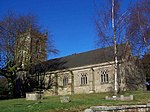
Church of St James
Audley Rural , Newcastle-under-Lyme Parish Church
c. 1300
17 November 1966
SJ7989450888 53°03′18″N 2°18′05″W / 53.054864°N 2.301419°W / 53.054864; -2.301419 (Church of St James)
1038613 Church of St James More images
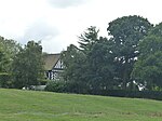
Hall O' the Wood
Balterley , Newcastle-under-LymeHouse
Late 16th century
2 December 1952
SJ7680050426 53°03′02″N 2°20′51″W / 53.050585°N 2.347545°W / 53.050585; -2.347545 (Hall O' the Wood)
1374892 Hall O' the Wood
Betley Court , Dovecote, and Forecourt Walls and Gates
Betley, Newcastle-under-Lyme
House
1716
13 September 1976
SJ7535048398 53°01′56″N 2°22′08″W / 53.03229°N 2.36902°W / 53.03229; -2.36902 (Betley Court, Dovecote, and Forecourt Walls and Gates)
1038584 Betley Court , Dovecote, and Forecourt Walls and GatesMore images
Betley Old Hall
Betley , Newcastle-under-LymeFarmhouse
Late C16/early 17th century
2 December 1952
SJ7520249066 53°02′18″N 2°22′17″W / 53.038288°N 2.371278°W / 53.038288; -2.371278 (Betley Old Hall)
1038588 Upload Photo
Model Farm Complex South West of Betley Old Hall
Betley, Newcastle-under-Lyme
Watermill
Early 19th century
22 April 1988
SJ7513849011 53°02′16″N 2°22′20″W / 53.037791°N 2.372228°W / 53.037791; -2.372228 (Model Farm Complex South West of Betley Old Hall)
1188395 Upload Photo
Church of St John the Baptist
Keele , Newcastle-under-LymeParish Church
Medieval
17 November 1966
SJ8098345218 53°00′14″N 2°17′05″W / 53.003936°N 2.284836°W / 53.003936; -2.284836 (Church of St John the Baptist)
1377612 Church of St John the Baptist More images
Keele Hall
Keele University Campus, Keele, Newcastle-under-LymeHouse
1856-61
2 December 1952
SJ8196944769 53°00′00″N 2°16′12″W / 52.999935°N 2.270118°W / 52.999935; -2.270118 (Keele Hall)
1377615 Keele Hall More images
Church of St John the Baptist
Ashley , Loggerheads , Newcastle-under-LymeTower
1350
17 November 1966
SJ7629036437 52°55′29″N 2°21′15″W / 52.924815°N 2.354122°W / 52.924815; -2.354122 (Church of St John the Baptist)
1377618 Church of St John the Baptist More images
Church of St Mary
Mucklestone , Loggerheads, Newcastle-under-LymeTower
Mid-14th century
17 November 1966
SJ7255237356 52°55′58″N 2°24′35″W / 52.932898°N 2.4098°W / 52.932898; -2.4098 (Church of St Mary)
1377621 Church of St Mary More images
Oakley Hall & Pair of Sphinxes Framing East Entrance
Oakley , Loggerheads, Newcastle-under-LymeHouse
Post 1710
2 December 1952
SJ7013436943 52°55′45″N 2°26′45″W / 52.929055°N 2.445734°W / 52.929055; -2.445734 (Oakley Hall & Pair of Sphinxes Framing East Entrance)
1205760 Oakley Hall & Pair of Sphinxes Framing East EntranceMore images
Willoughbridge Lodge
Mucklestone, Loggerheads, Newcastle-under-Lyme
Farmhouse
1985
17 November 1966
SJ7403538768 52°56′44″N 2°23′16″W / 52.945664°N 2.387851°W / 52.945664; -2.387851 (Willoughbridge Lodge)
1205676 Upload Photo
The Old Hall
Poolside, Madeley , Newcastle-under-Lyme
House
Post 1599
2 December 1952
SJ7734444628 52°59′55″N 2°20′20″W / 52.998491°N 2.339021°W / 52.998491; -2.339021 (The Old Hall)
1206169 The Old Hall More images
Church of St Peter
Maer , Newcastle-under-LymeParish Church
Late C12/early 13th century
17 November 1966
SJ7926838329 52°56′31″N 2°18′36″W / 52.941947°N 2.309948°W / 52.941947; -2.309948 (Church of St Peter)
1206359 Church of St Peter More images
Gatehouse, Flanking Walls and Bollards to Maer Hall
Maer, Newcastle-under-Lyme
Wall
Late 18th century
14 May 1985
SJ7924238292 52°56′30″N 2°18′37″W / 52.941613°N 2.310333°W / 52.941613; -2.310333 (Gatehouse, Flanking Walls and Bollards to Maer Hall)
1027834 Gatehouse, Flanking Walls and Bollards to Maer Hall
Lea Head Manor
Maer, Newcastle-under-Lyme
House
1671
2 December 1952
SJ7506442023 52°58′30″N 2°22′22″W / 52.974972°N 2.37279°W / 52.974972; -2.37279 (Lea Head Manor)
1027829 Upload Photo
Butterton Grange Farmhouse
Whitmore , Newcastle-under-LymeFarmhouse
1816
14 May 1985
SJ8430842111 52°58′34″N 2°14′06″W / 52.976116°N 2.235136°W / 52.976116; -2.235136 (Butterton Grange Farmhouse)
1027842 Butterton Grange Farmhouse
Church of St Mary and All Saints
Whitmore , Newcastle-under-LymeChurch
12th century
17 November 1966
SJ8103441032 52°57′59″N 2°17′02″W / 52.96631°N 2.283829°W / 52.96631; -2.283829 (Church of St Mary and All Saints)
1280181 Church of St Mary and All Saints More images
Church of St Thomas
Butterton , Whitmore, Newcastle-under-LymeParish Church
1844
14 May 1985
SJ8318942242 52°58′38″N 2°15′07″W / 52.977259°N 2.251807°W / 52.977259; -2.251807 (Church of St Thomas)
1353782 Church of St Thomas More images
Old Stable Block
Whitmore, Newcastle-under-Lyme
Stable
Late C16/early 17th century
17 November 1966
SJ8103541258 52°58′06″N 2°17′02″W / 52.968342°N 2.283827°W / 52.968342; -2.283827 (Old Stable Block)
1027845 Old Stable Block
Church of St George
Newcastle-under-Lyme Church
1828
21 October 1949
SJ8505946336 53°00′51″N 2°13′27″W / 53.014116°N 2.224149°W / 53.014116; -2.224149 (Church of St George)
1219946 Church of St George More images
Church of St Giles
Newcastle-under-Lyme Tower
13th century
21 October 1949
SJ8467846050 53°00′42″N 2°13′47″W / 53.011535°N 2.229814°W / 53.011535; -2.229814 (Church of St Giles)
1297603 Church of St Giles More images
Church of St Margaret
Wolstanton , Newcastle-under-LymeChurch
Medieval
21 October 1949
SJ8564048062 53°01′47″N 2°12′56″W / 53.029648°N 2.215566°W / 53.029648; -2.215566 (Church of St Margaret)
1196517 Church of St Margaret More images


