Name
Location
Type
Completed Date designated
Grid ref. Entry number Image
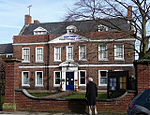
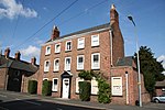
The Manor House
Crowland , South Holland House
c. 1775
7 February 1967
TF2398510260 52°40′33″N 0°10′03″W / 52.675867°N 0.167632°W / 52.675867; -0.167632 (The Manor House)
1359273 The Manor House More images
The Peacock Guest House
Donington , South HollandHouse
Late 17th century
13 January 1988
TF2089035683 52°54′18″N 0°12′14″W / 52.904993°N 0.204001°W / 52.904993; -0.204001 (The Peacock Guest House)
1064450 The Peacock Guest House More images
Wikes Farmhouse
Donington, South Holland
Farmhouse
1680
13 January 1988
TF2314835407 52°54′07″N 0°10′14″W / 52.902002°N 0.170551°W / 52.902002; -0.170551 (Wikes Farmhouse)
1359286 Upload Photo
36 Church Street
Donington, South Holland
House
Mid 18th century
7 February 1967
TF2085235905 52°54′25″N 0°12′16″W / 52.906997°N 0.204483°W / 52.906997; -0.204483 (36 Church Street)
1064448 Upload Photo
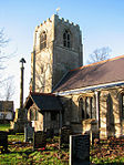
Church of Holy Trinity
Gedney Hill , South HollandParish Church
Late 14th century
30 June 1966
TF3386811273 52°40′57″N 0°01′16″W / 52.682619°N 0.021138°W / 52.682619; -0.021138 (Church of Holy Trinity)
1146771 Church of Holy Trinity More images
Cressy Hall
Gosberton , South HollandHouse
1695
7 February 1967
TF2240430479 52°51′28″N 0°11′00″W / 52.857894°N 0.183457°W / 52.857894; -0.183457 (Cressy Hall)
1064460 Upload Photo
Garnsgate Hall with Wall and Railings
Lutton , South HollandHouse
Early 18th century
30 June 1966
TF4191222624 52°46′57″N 0°06′10″E / 52.782546°N 0.102674°E / 52.782546; 0.102674 (Garnsgate Hall with Wall and Railings)
1359230 Garnsgate Hall with Wall and Railings More images
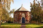
Chapel of St James
Moulton Chapel , Moulton , South HollandChapel of Ease
1722
7 February 1967
TF2934818231 52°44′46″N 0°05′07″W / 52.746231°N 0.085225°W / 52.746231; -0.085225 (Chapel of St James)
1359293 Chapel of St James More images
Crosskeys Bridge
River Nene, Sutton Bridge , South Holland
Swing Bridge
1897
11 January 1980
TF4821721030 52°46′00″N 0°11′43″E / 52.766535°N 0.195364°E / 52.766535; 0.195364 (Crosskeys Bridge)
1064536 Crosskeys Bridge More images
East Lighthouse on Bank of River Nene
Sutton Bridge, South Holland
Lighthouse/House
C20
1 April 1980
TF4931025717 52°48′30″N 0°12′49″E / 52.808336°N 0.213687°E / 52.808336; 0.213687 (East Lighthouse on Bank of River Nene)
1281069 East Lighthouse on Bank of River Nene More images
Hydraulic Engine House
Sutton Bridge, South Holland
Hydraulic Engine House
1897
11 January 1980
TF4800620902 52°45′56″N 0°11′32″E / 52.765443°N 0.192181°E / 52.765443; 0.192181 (Hydraulic Engine House)
1204796 Hydraulic Engine House
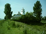
West Lighthouse on Bank of River Nene
River Nene, Sutton Bridge, South Holland
House
C20
30 June 1966
TF4911625750 52°48′31″N 0°12′39″E / 52.808686°N 0.210826°E / 52.808686; 0.210826 (West Lighthouse on Bank of River Nene)
1064537 West Lighthouse on Bank of River Nene More images
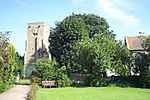
Tower to Church of St James
Sutton St James , South HollandTower
15th century
26 November 1987
TF3962518388 52°44′42″N 0°04′01″E / 52.745087°N 0.066986°E / 52.745087; 0.066986 (Tower to Church of St James)
1204853 Tower to Church of St James More images
Cley Hall
High St, Spalding , South Holland
Hotel
Mid 18th century
29 December 1950
TF2513922840 52°47′19″N 0°08′45″W / 52.788632°N 0.145784°W / 52.788632; -0.145784 (Cley Hall)
1169039 Cley Hall
Constitutional Club
Spalding, South Holland
House
Mid 18th century
29 December 1950
TF2486222776 52°47′17″N 0°09′00″W / 52.788121°N 0.149913°W / 52.788121; -0.149913 (Constitutional Club)
1063999 Constitutional Club
East Elloe
High St., Spalding, South Holland
House
Late 18th century
29 December 1950
TF2521422981 52°47′24″N 0°08′41″W / 52.789881°N 0.144618°W / 52.789881; -0.144618 (East Elloe)
1359525 East Elloe
Garden Wall to No 21, High St
Spalding, South Holland
Garden Wall
20 November 1975
TF2510622816 52°47′18″N 0°08′47″W / 52.788424°N 0.146282°W / 52.788424; -0.146282 (Garden Wall to No 21, High St)
1063983 Upload Photo
Garden Wall to the South of No 4, Church St
Spalding, South Holland
Gate
18th century
20 November 1975
TF2501122496 52°47′08″N 0°08′52″W / 52.785571°N 0.147812°W / 52.785571; -0.147812 (Garden Wall to the South of No 4, Church St)
1147578 Upload Photo
Monk's House, Bourne Rd
Spalding, South Holland
House
Early 16th century
29 December 1950
TF2310022164 52°46′59″N 0°10′35″W / 52.783026°N 0.176257°W / 52.783026; -0.176257 (Monk's House, Bourne Rd)
1063993 Upload Photo
Old Office Block of Land Settlement Association
Low Fulney , South HollandHouse
Medieval
19 December 1978
TF2712222352 52°47′02″N 0°07′00″W / 52.783784°N 0.116585°W / 52.783784; -0.116585 (Old Office Block of Land Settlement Association)
1359567 Upload Photo
Spalding High School for Girls
Spalding, South Holland
House
Mid 18th century
29 December 1950
TF2469822099 52°46′55″N 0°09′09″W / 52.782076°N 0.152601°W / 52.782076; -0.152601 (Spalding High School for Girls)
1306654 Upload Photo
The Grange, Pinchbeck Rd
Spalding, South Holland
House
Mid 18th century
29 December 1950
TF2481422913 52°47′22″N 0°09′02″W / 52.789363°N 0.150572°W / 52.789363; -0.150572 (The Grange, Pinchbeck Rd)
1063959 Upload Photo
The Limes
Spalding, South Holland
House
Early 18th century
29 December 1950
TF2493822710 52°47′15″N 0°08′56″W / 52.78751°N 0.148812°W / 52.78751; -0.148812 (The Limes)
1063971 The Limes More images
The Masters Lodge
Spalding, South Holland
House
1721
29 December 1950
TF2502522544 52°47′10″N 0°08′51″W / 52.785999°N 0.147586°W / 52.785999; -0.147586 (The Masters Lodge)
1359534 Upload Photo
The Sycamores
Spalding, South Holland
House
Early 19th century
29 December 1950
TF2494922728 52°47′16″N 0°08′55″W / 52.787669°N 0.148642°W / 52.787669; -0.148642 (The Sycamores)
1307194 The Sycamores More images
The Vicarage
Spalding, South Holland
House
Early 19th century
29 December 1950
TF2509022462 52°47′07″N 0°08′48″W / 52.785247°N 0.146654°W / 52.785247; -0.146654 (The Vicarage)
1064006 The Vicarage
Vicarage to Church of St Paul
Fulney, South Holland
Vicarage
1877-1879
21 August 2007
TF2610223817 52°47′50″N 0°07′52″W / 52.797186°N 0.131136°W / 52.797186; -0.131136 (Vicarage to Church of St Paul)
1392209 Upload Photo
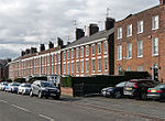
Welland Terrace
Spalding, South Holland
Terraced House
18th century
29 December 1950
TF2481622388 52°47′05″N 0°09′03″W / 52.784645°N 0.150743°W / 52.784645; -0.150743 (Welland Terrace)
1359539 Welland Terrace More images
Westbourne House
Spalding, South Holland
House
Mid 18th century
29 December 1950
TF2482622129 52°46′56″N 0°09′02″W / 52.782316°N 0.150693°W / 52.782316; -0.150693 (Westbourne House)
1359518 Westbourne House
Westbourne Lodge
Spalding, South Holland
House
Mid 18th century
29 December 1950
TF2477822044 52°46′54″N 0°09′05″W / 52.781563°N 0.151437°W / 52.781563; -0.151437 (Westbourne Lodge)
1359519 Upload Photo
White Hart Hotel
Spalding, South Holland
Hotel
Mid 18th century
29 December 1950
TF2478622670 52°47′14″N 0°09′04″W / 52.787186°N 0.15108°W / 52.787186; -0.15108 (White Hart Hotel)
1063953 White Hart Hotel
Willesby
Spalding , South HollandHouse
Early 17th century
29 December 1950
TF2522323195 52°47′30″N 0°08′40″W / 52.791802°N 0.144403°W / 52.791802; -0.144403 (Willesby)
1063991 Upload Photo
Wisteria Lodge
Spalding , South HollandHouse
1792
29 December 1950
TF2498022529 52°47′09″N 0°08′54″W / 52.785874°N 0.148259°W / 52.785874; -0.148259 (Wisteria Lodge)
1147529 Wisteria Lodge
Yew Lodge
Spalding , South HollandCountry House
Mid-Late 18th century
29 December 1950
TF2511222810 52°47′18″N 0°08′46″W / 52.788368°N 0.146195°W / 52.788368; -0.146195 (Yew Lodge)
1359524 Upload Photo
34 London Road
Spalding , South HollandHouse
Early 18th century
29 December 1950
TF2477722185 52°46′58″N 0°09′05″W / 52.78283°N 0.151398°W / 52.78283; -0.151398 (34 London Road)
1063947 Upload Photo
1 Sheep Market
Spalding , South HollandSmiths Cottage
c. 1230
29 December 1950
TF2464622707 52°47′15″N 0°09′11″W / 52.787551°N 0.153141°W / 52.787551; -0.153141 (1 Sheep Market)
1359545 Upload Photo


