Name
Location
Type
Completed Date designated
Grid ref. Entry number Image
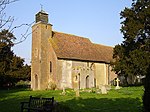
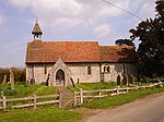
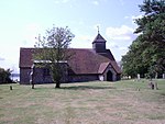
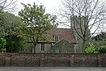
Church of St Leonard
Badlesmere , Swale Parish Church
13th century
24 January 1967
TR0138755096 51°15′34″N 0°53′06″E / 51.259444°N 0.884924°E / 51.259444; 0.884924 (Church of St Leonard)
1069922 Church of St Leonard More images
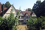
Borden Hall
Borden House
17th century
27 August 1952
TQ8820963019 51°20′06″N 0°42′02″E / 51.335106°N 0.700462°E / 51.335106; 0.700462 (Borden Hall)
1185884 Upload Photo
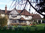
Hook's Hole
Borden
Hall House
15th century
27 August 1952
TQ8760863898 51°20′36″N 0°41′32″E / 51.3432°N 0.692308°E / 51.3432; 0.692308 (Hook's Hole)
1069424 Upload Photo
Olstede
Borden
House
17th century
27 August 1952
TQ8755863860 51°20′34″N 0°41′30″E / 51.342875°N 0.691571°E / 51.342875; 0.691571 (Olstede)
1069383 Upload Photo
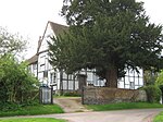
Yew Tree Cottage
Borden
House
16th century to 17th century
24 January 1967
TQ8686262154 51°19′40″N 0°40′51″E / 51.327781°N 0.680695°E / 51.327781; 0.680695 (Yew Tree Cottage)
1343887 Upload Photo
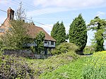
Colkins
Clockhouse, Boughton under Blean
House
1729
27 August 1952
TR0336059256 51°17′46″N 0°54′56″E / 51.296102°N 0.915528°E / 51.296102; 0.915528 (Colkins)
1069131 Colkins More images
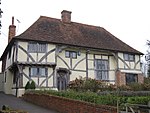
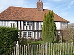
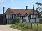
Hall Cottage
Boughton under Blean Wealden House
16th century
24 January 1967
TR0559257704 51°16′53″N 0°56′48″E / 51.281364°N 0.946605°E / 51.281364; 0.946605 (Hall Cottage)
1344002 Hall Cottage More images
Nash Court
Boughton under Blean
House
Restored before 1878
21 May 1986
TR0470459936 51°18′06″N 0°56′07″E / 51.301727°N 0.935169°E / 51.301727; 0.935169 (Nash Court)
1069133 Upload Photo
Style House
Boughton Street, Boughton under Blean
Continuous Jetty House
16th century
27 August 1952
TR0554359470 51°17′50″N 0°56′49″E / 51.29724°N 0.946919°E / 51.29724; 0.946919 (Style House)
1069156 Upload Photo
Walls about 20 to 60 Metres South East of Colkins
Clockhouse, Boughton under Blean
Wall
Early 18th century
21 May 1986
TR0340159215 51°17′45″N 0°54′58″E / 51.295719°N 0.916092°E / 51.295719; 0.916092 (Walls about 20 to 60 Metres South East of Colkins)
1069132 Walls about 20 to 60 Metres South East of Colkins
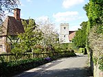
Walnut Tree House
Boughton under Blean
Wealden House
15th century
27 August 1952
TR0546857799 51°16′56″N 0°56′42″E / 51.282262°N 0.944884°E / 51.282262; 0.944884 (Walnut Tree House)
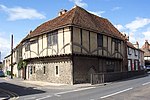
1325973 Walnut Tree House More images
Bexon Manor
Bexon , Bredgar Jettied House
15th century
27 August 1952
TQ8898459478 51°18′11″N 0°42′35″E / 51.303045°N 0.709699°E / 51.303045; 0.709699 (Bexon Manor)
1069395 Bexon Manor More images
Brickwall and Railings to Forecourt
Bredgar
Timber Framed House
17th century
24 January 1967
TQ8796360251 51°18′37″N 0°41′44″E / 51.310326°N 0.695477°E / 51.310326; 0.695477 (Brickwall and Railings to Forecourt)
1299305 Upload Photo
Chantry House
Bredgar
House
1984
24 January 1967
TQ8798260406 51°18′42″N 0°41′45″E / 51.311712°N 0.695831°E / 51.311712; 0.695831 (Chantry House)
1069369 Chantry House
Swanton Street Farmhouse
Swanton Street, Bredgar
Farmhouse
Earlier
27 August 1952
TQ8755059319 51°18′08″N 0°41′21″E / 51.302091°N 0.689068°E / 51.302091; 0.689068 (Swanton Street Farmhouse)
1069371 Upload Photo
Ruins of Shurland Hall or Castle
Eastchurch Castle
Earlier
14 May 1952
TQ9942171550 51°24′28″N 0°51′58″E / 51.4079°N 0.86599°E / 51.4079; 0.86599 (Ruins of Shurland Hall or Castle)
1258505 Ruins of Shurland Hall or Castle More images
Box Cottage
Eastling House
Early 19th century
24 January 1967
TQ9637856494 51°16′25″N 0°48′50″E / 51.273746°N 0.813996°E / 51.273746; 0.813996 (Box Cottage)
1054867 Upload Photo
Church of St Mary
Eastling
Parish Church
12th century
24 January 1967
TQ9652256555 51°16′27″N 0°48′58″E / 51.274244°N 0.816091°E / 51.274244; 0.816091 (Church of St Mary)
1343974 Church of St Mary More images
Eastling Manor
Eastling
House
1616
27 August 1952
TQ9626356518 51°16′26″N 0°48′45″E / 51.274001°N 0.812363°E / 51.274001; 0.812363 (Eastling Manor)
1069239 Eastling Manor More images
Abbey Farmhouse
Faversham Farmhouse
13th century or Early 14th century
3 August 1972
TR0209561831 51°19′11″N 0°53′56″E / 51.319676°N 0.898866°E / 51.319676; 0.898866 (Abbey Farmhouse)
1060995 Upload Photo
Arden's House
Faversham
Abbey
Presumably Medieval
29 July 1950
TR0182861729 51°19′08″N 0°53′42″E / 51.318855°N 0.894982°E / 51.318855; 0.894982 (Arden's House)
1186199 Arden's House More images
Church of St Catherine
Preston-by-Faversham , FavershamParish Church
Pre-conquest origins
29 July 1950
TR0168260768 51°18′37″N 0°53′32″E / 51.310276°N 0.892347°E / 51.310276; 0.892347 (Church of St Catherine)
1115766 Church of St Catherine More images
Cooksditch
Faversham
House
18th century
29 July 1950
TR0177261320 51°18′55″N 0°53′38″E / 51.315202°N 0.893948°E / 51.315202; 0.893948 (Cooksditch)
1069457 Upload Photo
Davington Priory
Davington , FavershamCloister
Founded 1153
29 July 1950
TR0109261743 51°19′09″N 0°53′04″E / 51.319241°N 0.884442°E / 51.319241; 0.884442 (Davington Priory)
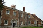
1069404 Davington Priory More images
Faversham Abbey Major Barn
Faversham
Abbey
c. 1500
3 August 1972
TR0211161762 51°19′09″N 0°53′57″E / 51.319051°N 0.899056°E / 51.319051; 0.899056 (Faversham Abbey Major Barn)
1344267 Faversham Abbey Major Barn More images
Fremlins Offices (including East Wing and Billiard Room)
Faversham
House
18th century
29 July 1950
TR0166361512 51°19′01″N 0°53′33″E / 51.316964°N 0.892495°E / 51.316964; 0.892495 (Fremlins Offices (including East Wing and Billiard Room))
1069489 Upload Photo
Gillett's Granaries
Faversham
Granary
29 July 1950
TR0196361940 51°19′15″N 0°53′49″E / 51.320702°N 0.897036°E / 51.320702; 0.897036 (Gillett's Granaries)
1115576 Upload Photo
Mediaeval Stables at Abbey Farm
Faversham
Stable
14th century or 15th century
17 January 1989
TR0216461803 51°19′10″N 0°53′59″E / 51.3194°N 0.899839°E / 51.3194; 0.899839 (Mediaeval Stables at Abbey Farm)
1268252 Upload Photo
Queen Court Farmhouse and Outbuildings
Ospringe , FavershamFarmhouse
15th century
29 July 1950
TR0015560464 51°18′29″N 0°52′13″E / 51.308085°N 0.870296°E / 51.308085; 0.870296 (Queen Court Farmhouse and Outbuildings)
1360992 Queen Court Farmhouse and Outbuildings More images
The Guildhall
Faversham
Local Government Office
1603
29 July 1950
TR0157161382 51°18′57″N 0°53′28″E / 51.31583°N 0.891103°E / 51.31583; 0.891103 (The Guildhall)
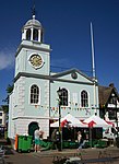
1343844 The Guildhall More images
The Maison Dieu Museum
Ospringe, Faversham
Public House
1950
29 July 1950
TR0036260855 51°18′41″N 0°52′25″E / 51.311524°N 0.873482°E / 51.311524; 0.873482 (The Maison Dieu Museum)
1069431 The Maison Dieu Museum More images
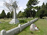
Faversham Munitions Explosion Memorial
Faversham
Grave
1917
27 September 1989
TR0250360871 51°18′41″N 0°54′16″E / 51.31134°N 0.90458°E / 51.31134; 0.90458 (Faversham Munitions Explosion Memorial)
1261010 Faversham Munitions Explosion Memorial More images
The Masonic Hall
Faversham
Grammar School
Founded 1527
29 July 1950
TR0185161636 51°19′05″N 0°53′43″E / 51.318011°N 0.895259°E / 51.318011; 0.895259 (The Masonic Hall)
1344229 Upload Photo
The Training Ship Hasarde
Faversham
Warehouse
15th century
29 July 1950
TR0158461615 51°19′05″N 0°53′29″E / 51.317917°N 0.891421°E / 51.317917; 0.891421 (The Training Ship Hasarde)
1116391 Upload Photo
87 To 92 Abbey Street
Faversham
House
18th century
29 July 1950
TR0177361664 51°19′06″N 0°53′39″E / 51.31829°N 0.894157°E / 51.31829; 0.894157 (87 To 92 Abbey Street)
1061013 Upload Photo
121 West Street
Faversham
House
Dated 1697
29 July 1950
TR0153261386 51°18′57″N 0°53′26″E / 51.315879°N 0.890546°E / 51.315879; 0.890546 (121 West Street)
1067608 Upload Photo
1 The Market Place
Faversham
House
18th century
29 July 1950
TR0154861377 51°18′57″N 0°53′27″E / 51.315793°N 0.890771°E / 51.315793; 0.890771 (1 The Market Place)
1069462 Upload Photo
5 and 6 The Market Place
Faversham
Jettied House
15th century possibly earlier
29 July 1950
TR0156261398 51°18′58″N 0°53′28″E / 51.315976°N 0.890983°E / 51.315976; 0.890983 (5 and 6 The Market Place)
1343845 Upload Photo
15 Ospringe Street
Ospringe, Faversham
Hospital
1230
29 July 1950
TR0038060850 51°18′41″N 0°52′25″E / 51.311472°N 0.873737°E / 51.311472; 0.873737 (15 Ospringe Street)
1069430 Upload Photo
81 Abbey Street
Faversham
Abbey
15th century
29 July 1950
TR0181761715 51°19′07″N 0°53′41″E / 51.318733°N 0.894817°E / 51.318733; 0.894817 (81 Abbey Street)
1344235 Upload Photo
84 Abbey Street
Faversham
House
c. 1589
29 July 1950
TR0179261682 51°19′06″N 0°53′40″E / 51.318445°N 0.89444°E / 51.318445; 0.89444 (84 Abbey Street)
1240604 Upload Photo
Ewell Farmhouse
Graveney with Goodnestone Hall House
14th century or 15th century
24 January 1967
TR0353760848 51°18′37″N 0°55′08″E / 51.310335°N 0.918971°E / 51.310335; 0.918971 (Ewell Farmhouse)
1325225 Upload Photo
Goodnestone Court
Graveney with Goodnestone
Continuous Jetty House
15th century
27 August 1952
TR0447661657 51°19′02″N 0°55′58″E / 51.317263°N 0.932888°E / 51.317263; 0.932888 (Goodnestone Court)
1107863 Goodnestone Court More images
Barrows Cottages
Hartlip , SwaleHouse
18th century
24 January 1967
TQ8386164009 51°20′44″N 0°38′19″E / 51.34542°N 0.638627°E / 51.34542; 0.638627 (Barrows Cottages)
1319991 Upload Photo
Queendown Warren
Queendown Warren , Hartlip Continuous Jetty House
c. 1560
27 August 1952
TQ8264563016 51°20′13″N 0°37′14″E / 51.336893°N 0.620678°E / 51.336893; 0.620678 (Queendown Warren)
1069375 Upload Photo
Warren Cottage
Queendown Warren, Hartlip
House
19th century
27 November 1984
TQ8323262875 51°20′08″N 0°37′44″E / 51.335437°N 0.629023°E / 51.335437; 0.629023 (Warren Cottage)
1116349 Upload Photo
Dargate House
Dargate , Hernhill House
Early 19th century
24 January 1967
TR0751861941 51°19′07″N 0°58′36″E / 51.318713°N 0.976644°E / 51.318713; 0.976644 (Dargate House)
1344025 Upload Photo
Manor House
Hernhill Green, Hernhill
Continuous Jetty House
15th century
24 January 1967
TR0653860684 51°18′28″N 0°57′43″E / 51.307782°N 0.961873°E / 51.307782; 0.961873 (Manor House)
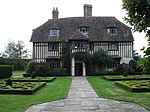
1323023 Manor House More images
Church of St Laurence
Leaveland Parish Church
13th century
24 January 1967
TR0048854850 51°15′27″N 0°52′19″E / 51.257551°N 0.871919°E / 51.257551; 0.871919 (Church of St Laurence)
1054051 Church of St Laurence More images
Leaveland Court
Leaveland
Continuous Jetty House
15th century
27 August 1952
TR0038954852 51°15′27″N 0°52′14″E / 51.257604°N 0.870504°E / 51.257604; 0.870504 (Leaveland Court)
1054067 Leaveland Court More images
Church of St Thomas the Apostle
Harty , Leysdown Church
11th century or early 12th century
27 June 1963
TR0231366279 51°21′34″N 0°54′16″E / 51.359542°N 0.904516°E / 51.359542; 0.904516 (Church of St Thomas the Apostle)
1258076 Church of St Thomas the Apostle More images
Bogle with Garden Wall
Lynsted with Kingsdown House
c. 1643
27 August 1952
TQ9474261452 51°19′08″N 0°47′36″E / 51.318835°N 0.793274°E / 51.318835; 0.793274 (Bogle with Garden Wall)
1106389 Bogle with Garden Wall More images
Bumpit
Lynsted with Kingsdown
House
16th century
24 January 1967
TQ9499161193 51°18′59″N 0°47′48″E / 51.316423°N 0.796701°E / 51.316423; 0.796701 (Bumpit)
1334371 Bumpit More images
Claxfield Farmhouse
Lynsted with Kingsdown
House
Later
21 March 1985
TQ9443562562 51°19′44″N 0°47′22″E / 51.328909°N 0.789479°E / 51.328909; 0.789479 (Claxfield Farmhouse)
1343922 Claxfield Farmhouse More images
Lynsted Park and adjacent Garden Walls
Lynsted Park, Lynsted with Kingsdown
House
1599
27 August 1952
TQ9471359655 51°18′10″N 0°47′31″E / 51.302706°N 0.791878°E / 51.302706; 0.791878 (Lynsted Park and adjacent Garden Walls)
1069310 Upload Photo
Sunderland Farmhouse
Lynsted with Kingsdown
Continuous Jetty House
16th century
27 August 1952
TQ9425961657 51°19′15″N 0°47′11″E / 51.320841°N 0.786463°E / 51.320841; 0.786463 (Sunderland Farmhouse)
1343923 Sunderland Farmhouse More images
The Malthouse
Lynsted with Kingsdown
Continuous Jetty House
Late 16th century
27 August 1952
TQ9490361904 51°19′22″N 0°47′45″E / 51.322839°N 0.795829°E / 51.322839; 0.795829 (The Malthouse)
1343929 Upload Photo
Church of St Mary and the Holy Cross
Milstead Parish Church
C12-C13
24 January 1967
TQ9035858760 51°17′46″N 0°43′44″E / 51.296139°N 0.729003°E / 51.296139; 0.729003 (Church of St Mary and the Holy Cross)
1069286 Church of St Mary and the Holy Cross More images
Milstead Manor
Milstead
Continuous Jetty House
16th century
27 August 1952
TQ9041458726 51°17′45″N 0°43′47″E / 51.295815°N 0.729787°E / 51.295815; 0.729787 (Milstead Manor)
1343916 Milstead Manor More images
Calico House
Newnham
House
18th century
27 August 1952
TQ9520857612 51°17′03″N 0°47′52″E / 51.284188°N 0.797854°E / 51.284188; 0.797854 (Calico House)
1069247 Calico House More images
Champion Court
Newnham
House
1952
27 August 1952
TQ9558657984 51°17′15″N 0°48′12″E / 51.287399°N 0.803471°E / 51.287399; 0.803471 (Champion Court)
1343938 Upload Photo
Church of St Peter and St Paul
Newnham Parish Church
c. 1200
24 January 1967
TQ9540157627 51°17′03″N 0°48′02″E / 51.284257°N 0.800626°E / 51.284257; 0.800626 (Church of St Peter and St Paul)
1055749 Church of St Peter and St Paul More images
Foxenden Manor
Foxenden, Newnham
Farmhouse
1604
27 August 1952
TQ9445156554 51°16′30″N 0°47′11″E / 51.274945°N 0.786437°E / 51.274945; 0.786437 (Foxenden Manor)
1366585 Foxenden Manor
Provender
Norton, Buckland and Stone Jettied House
16th century
27 August 1952
TQ9737960801 51°18′43″N 0°49′51″E / 51.31208°N 0.830707°E / 51.31208; 0.830707 (Provender)
1374517 Provender More images
Homeside with Railings to Forecourt
Oare House
Early 19th century
21 May 1986
TR0065362964 51°19′49″N 0°52′44″E / 51.330361°N 0.878838°E / 51.330361; 0.878838 (Homeside with Railings to Forecourt)
1344016 Upload Photo
Church of St Peter and St Paul
Ospringe Parish Church
c. 1200
29 July 1950
TR0002860311 51°18′24″N 0°52′06″E / 51.306756°N 0.868391°E / 51.306756; 0.868391 (Church of St Peter and St Paul)
1343988 Church of St Peter and St Paul More images
The Old Vicarage
Ospringe
House
17th century
3 August 1972
TR0008960190 51°18′20″N 0°52′09″E / 51.305648°N 0.869197°E / 51.305648; 0.869197 (The Old Vicarage)
1354736 Upload Photo
Parish Church of the Holy Trinity
Queenborough Tower
West tower dating from 11th century
19 October 1951
TQ9091772306 51°25′03″N 0°44′39″E / 51.417614°N 0.744276°E / 51.417614; 0.744276 (Parish Church of the Holy Trinity)
1258500 Parish Church of the Holy Trinity More images
Saffery Farmhouse
Owen's Court, Selling
Cross Wing House
15th century
27 August 1952
TR0297257796 51°16′59″N 0°54′33″E / 51.283129°N 0.909141°E / 51.283129; 0.909141 (Saffery Farmhouse)
1344044 Saffery Farmhouse
Church of St James
Sheldwich Parish Church
12th century
24 January 1967
TR0113356863 51°16′31″N 0°52′56″E / 51.275402°N 0.882282°E / 51.275402; 0.882282 (Church of St James)
1049130 Church of St James More images
Throwley House
Sheldwich
House
17th century or 18th century
2 November 1978
TR0105556839 51°16′31″N 0°52′52″E / 51.275214°N 0.881152°E / 51.275214; 0.881152 (Throwley House)
1344050 Upload Photo
Church of St Mary
Stalisfield Parish Church
13th century
24 January 1967
TQ9673852434 51°14′14″N 0°49′01″E / 51.237159°N 0.81692°E / 51.237159; 0.81692 (Church of St Mary)
1025295 Church of St Mary More images
Frognal Farmhouse and Garden Wall
Teynham House
1668
27 August 1952
TQ9484063391 51°20′10″N 0°47′45″E / 51.336215°N 0.795738°E / 51.336215; 0.795738 (Frognal Farmhouse and Garden Wall)
1069261 Frognal Farmhouse and Garden Wall More images
Garden Pavilion at Belmont Park (TQ 984 567)
Belmont, Throwley
Summerhouse
18th century
28 August 1986
TQ9836556708 51°16′30″N 0°50′33″E / 51.27498°N 0.842564°E / 51.27498; 0.842564 (Garden Pavilion at Belmont Park (TQ 984 567))
1069173 Upload Photo
Snoad Street Manor
Snoadstreet, Throwley
House
15th century or earlier
27 August 1952
TQ9921252434 51°14′11″N 0°51′08″E / 51.236301°N 0.852313°E / 51.236301; 0.852313 (Snoad Street Manor)
1203485 Upload Photo
Bax Farmhouse
Tonge House
1567
27 August 1952
TQ9435963823 51°20′25″N 0°47′21″E / 51.34026°N 0.789077°E / 51.34026; 0.789077 (Bax Farmhouse)
1338557 Upload Photo
Newberry Farmhouse
Tonge House
17th century
24 January 1967
TQ9279859946 51°18′21″N 0°45′53″E / 51.305971°N 0.764598°E / 51.305971; 0.764598 (Newberry Farmhouse)
1069267 Upload Photo
Gore Farmhouse
Upchurch Farmhouse
1984
27 November 1984
TQ8435666516 51°22′04″N 0°38′49″E / 51.367778°N 0.647025°E / 51.367778; 0.647025 (Gore Farmhouse)
1069318 Upload Photo
Archway House Building Number 23
Sheerness Dockyard Carpenters Workshop
1824-1830
1 August 1968
TQ9106275137 51°26′35″N 0°44′52″E / 51.442991°N 0.747884°E / 51.442991; 0.747884 (Archway House Building Number 23)
1258986 Upload Photo
Church of St Michael
Sittingbourne School
Change of use early 19th century
10 September 1951
TQ9093463615 51°20′22″N 0°44′23″E / 51.339551°N 0.739853°E / 51.339551; 0.739853 (Church of St Michael)
1061030 Church of St Michael More images
Former North Saw Pits Building Number 84
Sheerness Dockyard
Saw Pit
1828
25 April 1994
TQ9098775361 51°26′42″N 0°44′49″E / 51.445028°N 0.746927°E / 51.445028; 0.746927 (Former North Saw Pits Building Number 84)
1243244 Upload Photo
Former Royal Dockyard Church and Attached Wall and Railings
Sheerness Dockyard
Gate Pier
1828
7 December 1966
TQ9146175154 51°26′35″N 0°45′13″E / 51.443009°N 0.753628°E / 51.443009; 0.753628 (Former Royal Dockyard Church and Attached Wall and Railings)
1273239 Former Royal Dockyard Church and Attached Wall and Railings More images
Former Working Mast House Building Number 26
Sheerness Dockyard
Boat House
1821-1826
13 August 1999
TQ9087474922 51°26′28″N 0°44′42″E / 51.441123°N 0.745067°E / 51.441123; 0.745067 (Former Working Mast House Building Number 26)
1244509 Upload Photo
Medway Ports Authority Offices (Dockyard House)
Sheerness Dockyard
Office
1977
15 March 1977
TQ9134775179 51°26′36″N 0°45′07″E / 51.443272°N 0.752003°E / 51.443272; 0.752003 (Medway Ports Authority Offices (Dockyard House))
1258883 Upload Photo
Numbers 1 to 15 and attached Railings
Sheerness Dockyard
House
1999
15 March 1977
TQ9134375114 51°26′34″N 0°45′07″E / 51.44269°N 0.75191°E / 51.44269; 0.75191 (Numbers 1 to 15 and attached Railings)
1258881 Upload Photo
Numbers 1 to 8 Attached Basement Railings, Walls, Coach House and Stables
Sheerness Dockyard
Terrace
1824-1827
15 March 1977
TQ9147475086 51°26′33″N 0°45′14″E / 51.442394°N 0.753778°E / 51.442394; 0.753778 (Numbers 1 to 8 Attached Basement Railings, Walls, Coach House and Stables)
1258879 Upload Photo
Walls and Gates of the Boat Basin, Docks Number 4 5 and Slipway
Sheerness Dockyard, Swale
Wall
c. 1814
15 March 1977
TQ9085375334 51°26′41″N 0°44′42″E / 51.444831°N 0.744987°E / 51.444831; 0.744987 (Walls and Gates of the Boat Basin, Docks Number 4 5 and Slipway)
1255552 Upload Photo
The Court House
Milton Regis Court House
c. 1450
10 September 1951
TQ9037964734 51°20′59″N 0°43′57″E / 51.349788°N 0.732493°E / 51.349788; 0.732493 (The Court House)
1344240 The Court House More images
49 and 51 High Street
Sittingbourne House
18th century
10 September 1951
TQ9078463614 51°20′23″N 0°44′16″E / 51.339593°N 0.737702°E / 51.339593; 0.737702 (49 and 51 High Street)
1352683 49 and 51 High Street
Memorial to the Home of Aviation
Eastchurch Memorial
1955
30 June 1978
TQ9883271385 51°24′24″N 0°51′27″E / 51.406625°N 0.85744002°E / 51.406625; 0.85744002 (Memorial to the Home of Aviation)
1258069 Memorial to the Home of Aviation More images
