Name
Location
Type
Completed Date designated
Grid ref. Entry number Image
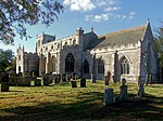
Church of St Peter and St Paul
Algarkirk Church
1799
26 January 1967
TF2912435289 52°53′58″N 0°04′54″W / 52.899541°N 0.081803°W / 52.899541; -0.081803 (Church of St Peter and St Paul)
1164857 Church of St Peter and St Paul More images
Church of All Saints
Benington Parish church
Early 13th century
26 January 1967
TF3971246511 52°59′52″N 0°04′49″E / 52.997707°N 0.080329°E / 52.997707; 0.080329 (Church of All Saints)
1062077 Church of All Saints More images
Church of St Swithin
Bicker Church
12th century
26 January 1967
TF2245737863 52°55′27″N 0°10′48″W / 52.924226°N 0.179893°W / 52.924226; -0.179893 (Church of St Swithin)
1062014 Church of St Swithin More images
Church of St Andrew
Butterwick Parish church
13th century
26 January 1967
TF3876544924 52°59′01″N 0°03′56″E / 52.983696°N 0.065548°E / 52.983696; 0.065548 (Church of St Andrew)
1308528 Church of St Andrew More images
Church of St Guthlac
Fishtoft Parish church
12th century
26 January 1967
TF3644842544 52°57′46″N 0°01′48″E / 52.96291°N 0.030056°E / 52.96291; 0.030056 (Church of St Guthlac)
1147452 Church of St Guthlac More images
Rochford Tower
Fishtoft House
1807
26 January 1967
TF3509644496 52°58′51″N 0°00′39″E / 52.980788°N 0.010755°E / 52.980788; 0.010755 (Rochford Tower)
1062088 Rochford Tower More images
Church of St Mary
Frampton Parish church
Late 12th century
26 January 1967
TF3257639169 52°56′01″N 0°01′44″W / 52.933559°N 0.028933°W / 52.933559; -0.028933 (Church of St Mary)
1360476 Church of St Mary More images
Church of St James
Freiston Parish church
16th century
26 January 1967
TF3772943770 52°58′25″N 0°02′59″E / 52.973596°N 0.049636°E / 52.973596; 0.049636 (Church of St James)
1308415 Church of St James More images
Church of St Peter and St Paul
Kirton Church
Mid-12th century
26 January 1967
TF3049338527 52°55′42″N 0°03′37″W / 52.928301°N 0.060163°W / 52.928301; -0.060163 (Church of St Peter and St Paul)
1062022 Church of St Peter and St Paul More images
Church of St Helen
Leverton Parish church
14th century
26 January 1967
TF3999547889 53°00′36″N 0°05′07″E / 53.010012°N 0.08514°E / 53.010012; 0.08514 (Church of St Helen)
1062072 Church of St Helen More images
Church of St Mary
Old Leake Church
12th century
26 January 1967
TF4074450281 53°01′53″N 0°05′50″E / 53.031303°N 0.097337°E / 53.031303; 0.097337 (Church of St Mary)
1147754 Church of St Mary More images
Church of St Mary
Sutterton Parish church
Late 12th century
26 January 1967
TF2849235558 52°54′08″N 0°05′28″W / 52.902109°N 0.091087°W / 52.902109; -0.091087 (Church of St Mary)
1360517 Church of St Mary More images
Church of St Mary
Swineshead Parish church
c .130026 January 1967
TF2375340193 52°56′42″N 0°09′35″W / 52.944863°N 0.159738°W / 52.944863; -0.159738 (Church of St Mary)
1232860 Church of St Mary More images
Church of St Peter and St Paul
Wigtoft Parish church
12th century
26 January 1967
TF2628336230 52°54′31″N 0°07′25″W / 52.908669°N 0.123649°W / 52.908669; -0.123649 (Church of St Peter and St Paul)
1237405 Church of St Peter and St Paul More images
Church of St Mary and St Nicholas
Wrangle Parish church
c .120026 January 1967
TF4248450854 53°02′10″N 0°07′25″E / 53.03599°N 0.123518°E / 53.03599; 0.123518 (Church of St Mary and St Nicholas)
1308367 Church of St Mary and St Nicholas More images
Church of St Leodegar
Wyberton Parish church
Late 12th century
26 January 1967
TF3286740831 52°56′54″N 0°01′26″W / 52.948418°N 0.023926°W / 52.948418; -0.023926 (Church of St Leodegar)
1147881 Church of St Leodegar More images
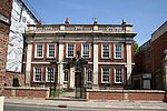
Fydell House and wall and railings and two urns
Boston House
1726
27 May 1949
TF3285543876 52°58′33″N 0°01′22″W / 52.975777°N 0.022857°W / 52.975777; -0.022857 (Fydell House and wall and railings and two urns)
1388995 Fydell House and wall and railings and two urnsMore images
Guildhall and attached gate
Boston Guildhall
Late 14th century
20 November 1975
TF3286543891 52°58′33″N 0°01′22″W / 52.975909°N 0.022702°W / 52.975909; -0.022702 (Guildhall and attached gate)
1389007 Guildhall and attached gate More images
Maud Foster Windmill and Granary
Boston Tower mill
1819
27 May 1949
TF3317244754 52°59′01″N 0°01′04″W / 52.983586°N 0.017778°W / 52.983586; -0.017778 (Maud Foster Windmill and Granary)
1389071 Maud Foster Windmill and Granary More images
Parish Church of St Botolph
Boston Church
c .140027 May 1949
TF3269244184 52°58′43″N 0°01′31″W / 52.978585°N 0.025157°W / 52.978585; -0.025157 (Parish Church of St Botolph)
1388844 Parish Church of St Botolph More images
