Name
Location
Type
Completed Date designated
Grid ref. Entry number Image
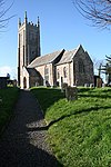
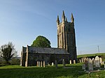
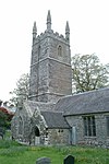
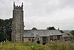
Church of St Andrew
Bere Ferrers , West DevonParish Church
no later than early 14th century
21 March 1967
SX4593563413 50°27′01″N 4°10′17″W / 50.450274°N 4.171457°W / 50.450274; -4.171457 (Church of St Andrew)
1163103 Church of St Andrew More images
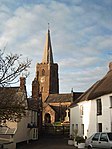
Church of St James
Bondleigh , West DevonChurch
Dated 1706
22 February 1967
SS6511504840 50°49′38″N 3°55′00″W / 50.827339°N 3.916556°W / 50.827339; -3.916556 (Church of St James)
1326420 Church of St James More images
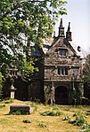
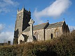
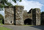
Bradstone Manor Gatehouse and Flanking Walls
Bradstone , West DevonWall
circa late 16th century
21 March 1967
SX3816980885 50°36′19″N 4°17′18″W / 50.605183°N 4.288341°W / 50.605183; -4.288341 (Bradstone Manor Gatehouse and Flanking Walls)
1104827 Bradstone Manor Gatehouse and Flanking Walls More images
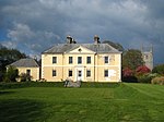
Church of St Nonna
Bradstone , West DevonParish Church
circa 12th century origins
21 March 1967
SX3812380899 50°36′19″N 4°17′20″W / 50.605296°N 4.288997°W / 50.605296; -4.288997 (Church of St Nonna)
1326684 Church of St Nonna More images
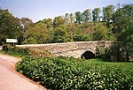
Greystone Bridge
Bradstone , West DevonRoad Bridge
1439
21 March 1967
SX3684680344 50°36′00″N 4°18′24″W / 50.599953°N 4.306784°W / 50.599953; -4.306784 (Greystone Bridge)
1104822 Greystone Bridge More images
Church of St Mary
Bratton Clovelly , West DevonParish Church
Early 14th century
22 February 1967
SX4636091821 50°42′20″N 4°10′38″W / 50.705672°N 4.177219°W / 50.705672; -4.177219 (Church of St Mary)
1326312 Church of St Mary More images
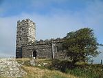
Church of St Michael De Rupe
Brent Tor , West DevonSundial
dated 1642
21 March 1967
SX4707780403 50°36′12″N 4°09′44″W / 50.603255°N 4.162354°W / 50.603255; -4.162354 (Church of St Michael De Rupe)
1104836 Church of St Michael De Rupe More images
Church of All Hallows
Broadwoodkelly , West DevonChurch
18th century
22 February 1967
SS6174805860 50°50′09″N 3°57′53″W / 50.835711°N 3.964718°W / 50.835711; -3.964718 (Church of All Hallows)
1146659 Church of All Hallows More images
Buckland Abbey
Buckland Monachorum, West Devon
Abbey
founded 1278
14 June 1952
SX4872566783 50°28′53″N 4°08′01″W / 50.481287°N 4.13355°W / 50.481287; -4.13355 (Buckland Abbey)
1163369 Buckland Abbey More images
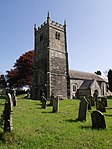
Church of St Andrew
Buckland Monachorum , West DevonParish Church
later 15th century
21 March 1967
SX4902268334 50°29′43″N 4°07′48″W / 50.495302°N 4.129994°W / 50.495302; -4.129994 (Church of St Andrew)
1326380 Church of St Andrew More images
Tithe Barn Directly to East of Buckland Abbey
Buckland Monachorum , West DevonTithe Barn
15th century
14 June 1952
SX4876766778 50°28′53″N 4°07′59″W / 50.481252°N 4.132957°W / 50.481252; -4.132957 (Tithe Barn Directly to East of Buckland Abbey)
1105493 Tithe Barn Directly to East of Buckland Abbey More images
Church of St Michael
Chagford , West DevonChurch
15th century
22 February 1967
SX7014687508 50°40′22″N 3°50′21″W / 50.672711°N 3.839046°W / 50.672711; -3.839046 (Church of St Michael)
1308610 Church of St Michael More images
Hole Farmhouse Including Garden Walls and Mounting Block Adjoining to North
Chagford , West DevonFarmhouse
C20
20 February 1952
SX6850786098 50°39′35″N 3°51′42″W / 50.659669°N 3.861727°W / 50.659669; -3.861727 (Hole Farmhouse Including Garden Walls and Mounting Block Adjoining to North)
1106187 Hole Farmhouse Including Garden Walls and Mounting Block Adjoining to North More images
Castle Drogo
Drewsteignton, West Devon
Country House
1911-1930
20 February 1952
SX7218490038 50°41′45″N 3°48′40″W / 50.695902°N 3.811096°W / 50.695902; -3.811096 (Castle Drogo)
1106086 Castle Drogo More images
Church of the Holy Trinity
Drewsteignton , West DevonParish Church
15th century and early 16th century
22 February 1967
SX7363790849 50°42′13″N 3°47′27″W / 50.70351°N 3.790811°W / 50.70351; -3.790811 (Church of the Holy Trinity)
1106073 Church of the Holy Trinity More images
Church of All Saints
Dunterton , West DevonStocks
circa 1460s
21 March 1967
SX3758379293 50°35′27″N 4°17′45″W / 50.590715°N 4.295919°W / 50.590715; -4.295919 (Church of All Saints)
1163426 Church of All Saints More images
Church of the Holy Trinity
Gidleigh , West DevonParish Church
Saxon or Norman
22 February 1967
SX6706288383 50°40′48″N 3°52′59″W / 50.679878°N 3.882981°W / 50.679878; -3.882981 (Church of the Holy Trinity)
1106128 Church of the Holy Trinity More images
Gidleigh Castle
Gidleigh , West DevonTower Keep
13th century
22 February 1967
SX6703788426 50°40′49″N 3°53′00″W / 50.680259°N 3.88335°W / 50.680259; -3.88335 (Gidleigh Castle)
1308353 Gidleigh Castle More images
Morwell Barton
Gulworthy , West DevonHouse
Late 12th century
14 June 1952
SX4456570790 50°30′58″N 4°11′38″W / 50.516206°N 4.193808°W / 50.516206; -4.193808 (Morwell Barton)
1105738 Upload Photo
New Bridge
Gulworthy , West DevonBridge
c. 1520
21 March 1967
SX4332172209 50°31′43″N 4°12′43″W / 50.528626°N 4.211937°W / 50.528626; -4.211937 (New Bridge)
1172383 New Bridge More images
Church of St John the Baptist
Hatherleigh , West DevonParish Church
late 15th century and early 16th century
22 February 1967
SS5411004599 50°49′21″N 4°04′21″W / 50.822502°N 4.072611°W / 50.822502; -4.072611 (Church of St John the Baptist)
1105250 Church of St John the Baptist More images
Horrabridge Bridge
Horrabridge , West DevonBridge
c. 1400
14 June 1952
SX5132769926 50°30′37″N 4°05′53″W / 50.510199°N 4.098153°W / 50.510199; -4.098153 (Horrabridge Bridge)
1105769 Horrabridge Bridge More images
Church of St James
Iddesleigh , West DevonParish Church
13th century
22 February 1967
SS5690008226 50°51′21″N 4°02′04″W / 50.855794°N 4.034445°W / 50.855794; -4.034445 (Church of St James)
1309051 Church of St James More images
Kelly House
Kelly , West DevonHouse
16th century
14 June 1952
SX3944681394 50°36′36″N 4°16′14″W / 50.610109°N 4.27053°W / 50.610109; -4.27053 (Kelly House)
1318194 Kelly House More images
Parish Church of St Mary
Kelly , West DevonParish Church
14th century
21 March 1967
SX3951481400 50°36′37″N 4°16′10″W / 50.610182°N 4.269573°W / 50.610182; -4.269573 (Parish Church of St Mary)
1104815 Parish Church of St Mary More images
Collacombe Manor
Lamerton , West DevonCross Passage House
Pre Reformation
14 June 1952
SX4308676450 50°34′00″N 4°13′01″W / 50.566673°N 4.217038°W / 50.566673; -4.217038 (Collacombe Manor)
1326224 Upload Photo
Parish Church of St Peter
Lewtrenchard , West DevonParish Church
Late 15th century
7 November 1985
SX4571786111 50°39′15″N 4°11′02″W / 50.654191°N 4.183934°W / 50.654191; -4.183934 (Parish Church of St Peter)
1326326 Parish Church of St Peter More images
Church of St Mary
Lifton , West DevonParish Church
14th century
21 March 1967
SX3863485019 50°38′33″N 4°17′01″W / 50.642458°N 4.283575°W / 50.642458; -4.283575 (Church of St Mary)
1317823 Church of St Mary More images
Wortham
Lifton, West Devon
Cross Wing House
15th century
14 June 1952
SX3820186957 50°39′35″N 4°17′26″W / 50.659752°N 4.290541°W / 50.659752; -4.290541 (Wortham)
1164234 Wortham More images
Church of St Mary
Mary Tavy , West DevonChurch
14th century
21 March 1967
SX5092378749 50°35′22″N 4°06′27″W / 50.589387°N 4.107381°W / 50.589387; -4.107381 (Church of St Mary)
1326217 Church of St Mary More images
Church of St Mary
Marystow , West DevonParish Church
12th century
21 March 1967
SX4346582862 50°37′28″N 4°12′52″W / 50.624394°N 4.214394°W / 50.624394; -4.214394 (Church of St Mary)
1326319 Church of St Mary More images
Sydenham House
Sydenham, Marystow, West Devon
House
Earlier
14 June 1952
SX4281383855 50°37′59″N 4°13′26″W / 50.633142°N 4.224025°W / 50.633142; -4.224025 (Sydenham House)
1164731 Sydenham House More images
Church of St Peter
Meavy , West DevonParish Church
Norman
21 March 1967
SX5403767220 50°29′12″N 4°03′32″W / 50.486562°N 4.058902°W / 50.486562; -4.058902 (Church of St Peter)
1105442 Church of St Peter More images
Parish Church of St Constantine
Milton Abbot , West DevonChurch
18th century
21 March 1967
SX4072579281 50°35′29″N 4°15′06″W / 50.591473°N 4.251562°W / 50.591473; -4.251562 (Parish Church of St Constantine)
1326349 Parish Church of St Constantine More images
Endsleigh House , Including Terrace Wall to the South East and Wall to the North East
Endsleigh, Milton Abbot, West Devon
House
Designed 1810
21 March 1967
SX3910978596 50°35′06″N 4°16′27″W / 50.584874°N 4.274077°W / 50.584874; -4.274077 (Endsleigh House, Including Terrace Wall to the South East and Wall to the North East)
1317513 Endsleigh House , Including Terrace Wall to the South East and Wall to the North EastMore images
Retaining Wall to the Raised Garden to the South West of Endsleigh House
Endsleigh, Milton Abbot, West Devon
Garden Wall
c. 1810
7 November 1985
SX3907678597 50°35′06″N 4°16′28″W / 50.584874°N 4.274543°W / 50.584874; -4.274543 (Retaining Wall to the Raised Garden to the South West of Endsleigh House)
1326345 Upload Photo
Rockery and Grotto, Endsleigh Gardens
Endsleigh, Milton Abbot, West Devon
Grotto
c. 1810
7 November 1985
SX3904378669 50°35′08″N 4°16′30″W / 50.585512°N 4.27504°W / 50.585512; -4.27504 (Rockery and Grotto, Endsleigh Gardens)
1165212 Upload Photo
Stables to the North of Endsleigh House
Endsleigh, Milton Abbot, West Devon
House
designed circa 1810
6 October 1982
SX3910278633 50°35′07″N 4°16′27″W / 50.585205°N 4.274191°W / 50.585205; -4.274191 (Stables to the North of Endsleigh House)
1165172 Upload Photo
The Salmon Larder and Ice House, Endsleigh Gardens
Endsleigh, Milton Abbot, West Devon
Dairy
c. 1814
6 October 1982
SX3894978671 50°35′08″N 4°16′35″W / 50.585504°N 4.276367°W / 50.585504; -4.276367 (The Salmon Larder and Ice House, Endsleigh Gardens)
1105548 The Salmon Larder and Ice House, Endsleigh Gardens More images
The Shell House and Grotto, Endsleigh Gardens
Endsleigh, Milton Abbot, West Devon
Wall
c. 1810
6 October 1982
SX3924278453 50°35′01″N 4°16′20″W / 50.583626°N 4.272138°W / 50.583626; -4.272138 (The Shell House and Grotto, Endsleigh Gardens)
1326346 Upload Photo
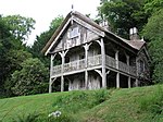
The Swiss Cottage, Endsleigh Gardens
Endsleigh, Milton Abbot, West Devon
House
late C20
19 October 1978
SX3952578018 50°34′47″N 4°16′05″W / 50.579795°N 4.267956°W / 50.579795; -4.267956 (The Swiss Cottage, Endsleigh Gardens)
1105549 The Swiss Cottage, Endsleigh Gardens More images
Church of St Peter
North Tawton , West DevonParish Church
13th century
22 February 1967
SS6644901722 50°47′59″N 3°53′47″W / 50.799625°N 3.89649°W / 50.799625; -3.89649 (Church of St Peter)
1146842 Church of St Peter More images
Church of St Thomas of Canterbury
Northlew , West DevonParish Church
Norman
22 February 1967
SX5050299173 50°46′22″N 4°07′18″W / 50.772821°N 4.121588°W / 50.772821; -4.121588 (Church of St Thomas of Canterbury)
1147443 Church of St Thomas of Canterbury More images
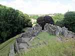
Okehampton Castle
Okehampton Hamlets , West DevonBailey
13th century
7 September 1987
SX5834294249 50°43′50″N 4°00′31″W / 50.730538°N 4.008578°W / 50.730538; -4.008578 (Okehampton Castle)
1165647 Okehampton Castle More images
Church of St Peter
Peter Tavy , West DevonParish Church
14th century
21 March 1967
SX5131377773 50°34′51″N 4°06′05″W / 50.580716°N 4.101484°W / 50.580716; -4.101484 (Church of St Peter)
1105400 Church of St Peter More images
Church of St Andrew
Sampford Courtenay , West DevonParish Church
15th century
22 February 1967
SS6324101267 50°47′41″N 3°56′31″W / 50.794787°N 3.941816°W / 50.794787; -3.941816 (Church of St Andrew)
1105290 Church of St Andrew More images
Church of St Mary
Honeychurch , Sampford Courtenay, West DevonGate
19th century
22 February 1967
SS6291302816 50°48′31″N 3°56′49″W / 50.808631°N 3.947045°W / 50.808631; -3.947045 (Church of St Mary)
1105288 Church of St Mary More images
Church of St Mary
Sampford Spiney , West DevonParish Church
Late C13/Early 14th century
21 March 1967
SX5342672471 50°32′01″N 4°04′10″W / 50.533601°N 4.069572°W / 50.533601; -4.069572 (Church of St Mary)
1326222 Church of St Mary More images
Church (dedication Unknown)
Sheepstor , West DevonParish Church
Late 15th century
21 March 1967
SX5601267653 50°29′27″N 4°01′52″W / 50.490943°N 4.031247°W / 50.490943; -4.031247 (Church (dedication Unknown))
1171232 Church (dedication Unknown) More images
Church of St Andrew
South Tawton , West DevonParish Church
15th century
22 February 1967
SX6530794482 50°44′03″N 3°54′36″W / 50.73429°N 3.910033°W / 50.73429; -3.910033 (Church of St Andrew)
1106035 Church of St Andrew More images
North Wyke
South Tawton , West DevonCountry House
15th century
20 February 1952
SX6602198379 50°46′10″N 3°54′05″W / 50.769481°N 3.901341°W / 50.769481; -3.901341 (North Wyke)
1170345 North Wyke More images
Church of St John the Baptist
Stowford , West DevonParish Church
14th century
21 March 1967
SX4326987021 50°39′42″N 4°13′08″W / 50.661714°N 4.218923°W / 50.661714; -4.218923 (Church of St John the Baptist)
1105532 Church of St John the Baptist More images
Horse Bridge
Horsebridge , Sydenham Damerel , West DevonRoad Bridge
Early 15th century
14 June 1952
SX4001274876 50°33′06″N 4°15′35″W / 50.551695°N 4.259731°W / 50.551695; -4.259731 (Horse Bridge)
1165822 Horse Bridge More images
Abbey Gatehouse
Tavistock , West DevonLibrary
1829
7 September 1951
SX4820174422 50°32′59″N 4°08′39″W / 50.5498°N 4.14404°W / 50.5498; -4.14404 (Abbey Gatehouse)
1105833 Abbey Gatehouse More images
Betsy Grimbal's Tower, the Vicarage
Tavistock , West DevonTower
15th century
7 September 1951
SX4811574330 50°32′56″N 4°08′43″W / 50.548951°N 4.145215°W / 50.548951; -4.145215 (Betsy Grimbal's Tower, the Vicarage)
1326209 Betsy Grimbal's Tower, the Vicarage More images
Church of St Andrew
Tavistock , West DevonChurch
Norman
7 September 1951
SX4929672697 50°32′04″N 4°07′40″W / 50.534582°N 4.127897°W / 50.534582; -4.127897 (Church of St Andrew)
1326196 Church of St Andrew More images
Porch to Abbot's Hall in Grounds of Bedford Hotel
Tavistock , West DevonTower
late 15th century or early 16th century
7 September 1951
SX4816374351 50°32′57″N 4°08′40″W / 50.549152°N 4.144547°W / 50.549152; -4.144547 (Porch to Abbot's Hall in Grounds of Bedford Hotel)
1105820 Porch to Abbot's Hall in Grounds of Bedford Hotel More images
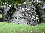
Remains of North-west Corner of Abbey Cloister and Church Wall in St Eustachius' Churchyard
Tavistock , West DevonWall
13th century
7 September 1951
SX4812974386 50°32′58″N 4°08′42″W / 50.549458°N 4.14504°W / 50.549458; -4.14504 (Remains of North-west Corner of Abbey Cloister and Church Wall in St Eustachius' Churchyard)
1162792 Remains of North-west Corner of Abbey Cloister and Church Wall in St Eustachius' Churchyard More images
Church of St Mary the Virgin
Throwleigh , West DevonParish Church
late 13th century - early 14th century
22 February 1967
SX6677190775 50°42′05″N 3°53′17″W / 50.701311°N 3.88796°W / 50.701311; -3.88796 (Church of St Mary the Virgin)
1168195 Church of St Mary the Virgin More images
Higher Shilstone Farmhouse Including Stables and Garden Walls Adjoining to South
Throwleigh, West Devon
Dairy
Late 17th century
20 February 1952
SX6602590085 50°41′42″N 3°53′54″W / 50.694938°N 3.898267°W / 50.694938; -3.898267 (Higher Shilstone Farmhouse Including Stables and Garden Walls Adjoining to South)
1307205 Upload Photo
Church of St George
Thrushelton , West DevonParish Church
13th century
21 March 1967
SX4473787609 50°40′03″N 4°11′54″W / 50.667392°N 4.198416°W / 50.667392; -4.198416 (Church of St George)
1105510 Church of St George More images
Church of St Mary
Walkhampton , West DevonParish Church
Pre 15th century
21 March 1967
SX5366270150 50°30′46″N 4°03′55″W / 50.512801°N 4.065333°W / 50.512801; -4.065333 (Church of St Mary)
1105371 Church of St Mary More images
Walreddon Manor
Whitchurch , West DevonHouse
Early/Mid 17th century
21 March 1967
SX4775871315 50°31′18″N 4°08′56″W / 50.521764°N 4.149018°W / 50.521764; -4.149018 (Walreddon Manor)
1105714 Upload Photo

