| Grapevine Canyon | |
|---|---|
 Grapevine Canyon Grapevine Canyon | |
 | |
| Geography | |
| Country | United States |
| State | Nevada |
| District | Clark County |
| Coordinates | 35°13′37″N 114°41′10″W / 35.227066°N 114.68621°W / 35.227066; -114.68621 |
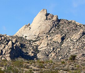
Grapevine Canyon is located in the Bridge Canyon Wilderness Area and the Spirit Mountain Wilderness within Lake Mead National Recreation Area. The canyon contains the Grapevine Canyon Petroglyphs and is accessible from Nevada State Route 163 which leads to Lower Grapevine Canyon Road. During non-drought years, the canyon contains a fresh water spring. The spring provides water for shrubbery along its path.
While it was used by the Mohave people, the canyon may have served as a ritual location and for summer solstice observations. Various petroglyphs serve as evidence of use by the Mohave people
Notes
- Wall, Deborah (6 November 2007). "Rocks steal spotlight along hike". Summerlin South View (Las Vegas Review Journal). Retrieved 26 August 2011.
- "Spirit Mountain Wilderness" (PDF). Archived from the original (PDF) on 2012-01-30. Retrieved 2010-03-15.
- ^ "Laughlin Area Attractions". Las Vegas Convention and Visitors Authority. Retrieved 25 August 2011.
- Jim Boone (2009-06-09). "Lower Grapevine Canyon Road". birdandhike.com. Retrieved 2010-08-15.
- ^ "Grapevine Canyon; Bridge Canyon Wilderness" (PDF). National Park Service. Retrieved 2018-04-06.
- Gary A. David. "Grapevine Canyon (Nevada)". The Orion Zone. Retrieved 2010-08-15.
- "Bridge Canyon Wilderness". Friends of Nevada Wilderness. Retrieved 2010-03-15.
This article is a stub. You can help Misplaced Pages by expanding it. |
This article is a stub. You can help Misplaced Pages by expanding it. |