Unincorporated town in Indiana, United States
| Hazelrigg, Indiana | |
|---|---|
| Unincorporated town | |
 Grain elevators in Hazelrigg, Indiana Grain elevators in Hazelrigg, Indiana | |
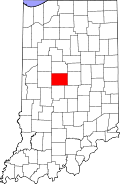
 Boone County's location in Indiana Boone County's location in Indiana | |
 | |
| Coordinates: 40°04′56″N 86°33′47″W / 40.08222°N 86.56306°W / 40.08222; -86.56306 | |
| Country | United States |
| State | Indiana |
| County | Boone |
| Township | Jefferson |
| Elevation | 912 ft (278 m) |
| Time zone | UTC-5 (Eastern (EST)) |
| • Summer (DST) | UTC-4 (EDT) |
| ZIP code | 46052 |
| Area code | 765 |
| FIPS code | 18-32656 |
| GNIS feature ID | 435938 |
Hazelrigg is an unincorporated town in Jefferson Township, Boone County, in the U.S. state of Indiana.
History
Upon the founding of the Lafayette and Indianapolis (L&I) Railroad Company in the 1860s, prominent local businessman Harvey G. Hazelrigg (1807–1877) became a director of the company and a railway station was built on land he owned in rural Jefferson Township, a stop that was identified as Hazelrigg Station. The L&I railroad that ran through town soon became the Indianapolis, Cincinnati and Lafayette Railroad, then in 1880 became the Cincinnati, Indianapolis, St. Louis and Chicago Railway, and finally in 1889 was merged into the Cleveland, Cincinnati, Chicago and St. Louis Railway, commonly known as the Big Four.
The stop attracted a small settlement; an 1887 history notes that Hazelrigg Station had been "a stopping and shipping point of some note for the last twenty years" and possessed a store, public hall, blacksmith, and residences. It also had a post office, established 10 September 1873, with James Driskill serving as its first post master.
Later identified simply as Hazelrigg, the town in the early 20th century had a church, school, and roughly 20 lots.; a 1914 history notes that it was "a stopping and shipping point of some note since its inception." The town had at some point a small grocery.
As of 1918, C. S. Byers, a poultry breeder specializing in buff, white and black Orpington chickens, was based in Hazelrigg.
The post office closed in 1935. On 11 April 1965 during the Palm Sunday tornado outbreak a tornado caused considerable damage to Hazelrigg and nearby areas of Boone County, with Indiana Governor Roger Branigin arriving to survey the destruction.
The town has a grain elevator but otherwise is entirely residential.
Geography

Hazelrigg is located at 40°04′56″N 86°33′47″W / 40.08222°N 86.56306°W / 40.08222; -86.56306 near the intersection of Boone County roads 300 North (Hazelrigg Road) and 500 West. Surrounded mostly by open farmland, the location is about three miles west of U.S. Route 52 and Interstate 65, about four miles southeast of Thorntown, and about five miles northwest of the city of Lebanon.
The Big 4 Trail (previously the Farm Heritage Trail) which passes along with southwest side of Hazelrigg stretches south to Lebanon and north to Colfax in Tippecanoe County along the path of the defunct railroad.
References
- "US Board on Geographic Names". United States Geological Survey. October 25, 2007. Retrieved January 31, 2008.
- "U.S. Census website". United States Census Bureau. Retrieved January 31, 2008.
- "Hazelrigg, Indiana". Geographic Names Information System. United States Geological Survey. Retrieved March 1, 2020.
- "Obituary for Harvey G. Hazelrigg". The Chicago Daily Tribune. December 17, 1877. Retrieved April 14, 2024 – via Newspapers.com.
- ^ Crist, Leander Mead (1914). History of Boone County, Indiana. Vol. I. Indianapolis: A. W. Bowen. p. 402.
Upon the organization of the LaFayette & Indianapolis Railroad Company, Major Hazelrigg became a stockholder and was immediately chosen as one of the directors... has been a stopping and shipping point of some note since its inception.
- Harden, Samuel (May 1887). Early Life and Times in Boone County, Indiana. Indianapolis: Carlon & Hollenbeck. pp. 34-35, 63-64.
This town is located on the Indianapolis, Cincinnati & Lafayette Railroad, six miles northwest of Lebanon, in the southeast corner of Washington Township. It was laid out on the land originally owned by the late H. G. Hazlerigg, and names in honor of him. It has been a stopping and shipping point of some note for the last twenty years.
- Stark, Ralph W. (May 1974). "Early Hamlets, Villages, Towns, and Post Offices of Boone County". Boone, Your County Magazine. Lebanon, Indiana: John R. Parsons. pp. 23–24. ISSN 0161-7958.
Hazelrigg, five miles northwest of Lebanon and on the Big Four railroad, was commissioned a post office, September 10, 1873... Its first postmaster was James Driskill.
- Plat Book of Boone County, Indiana. Rockford, Illinois: W. W. Hixson & Company. c. 1925.
- Ogle, George A. (1904). Standard Atlas of Boone County, Indiana. Chicago: George A. Ogle & Company.
- Mavity, Mary Louise Byers (October 1976). "Journey to Hazelrigg". Boone, Your County Magazine. Whitestown, Indiana: Bob and Pat Heidemeich. pp. 8–9. ISSN 0161-7958.
- "Mr. Byers' Guarantee on Best Quality Eggs". Reliable Poultry Journal. April 1918. p. 257. Retrieved April 13, 2024.
- "Boone County". Jim Forte Postal History. Retrieved August 26, 2014.
- "2,000 Aiding Cleanup of Storm-Swept Boone Farms". Indianapolis News. Indianapolis. April 17, 1965. Retrieved April 13, 2024.
The governor walked among the rubble from Hazlerigg, north of Lebanon, to Dover in western Boone County...
- "Making Connections: Towns collaborate to extend Big-4 Rail Trail to Lafayette". Current. Retrieved April 13, 2024.
Construction workers put down pavement for the Big 4 Trail in Hazelrigg, a town between Thorntown and Lebanon.
- "Big 4 Trail (Lebanon to Colfax)". TrailLink. Retrieved April 13, 2024.
Gallery

| Municipalities and communities of Boone County, Indiana, United States | ||
|---|---|---|
| County seat: Lebanon | ||
| City | ||
| Towns | ||
| Townships | ||
| CDP | ||
| Other communities | ||
| Footnotes | ‡This populated place also has portions in an adjacent county or counties | |
