Unincorporated community and Census-designated place in Indiana, United States
| Homer, Indiana | |
|---|---|
| Unincorporated community and Census-designated place | |
  | |
| Coordinates: 39°34′42″N 85°34′39″W / 39.57833°N 85.57750°W / 39.57833; -85.57750 | |
| Country | United States |
| State | Indiana |
| County | Rush |
| Township | Walker |
| Elevation | 906 ft (276 m) |
| Time zone | UTC-5 (Eastern (EST)) |
| • Summer (DST) | UTC-4 (EDT) |
| ZIP code | 46146 |
| Area code | 765 |
| GNIS feature ID | 2830518 |
Homer (also Goddard or Slabtown) is an unincorporated community in central Walker Township, Rush County, in the U.S. state of Indiana. Although Homer is unincorporated, it has a post office, with the ZIP code of 46146.
History
Homer was originally called Slabtown, and under the latter name had its start around 1850 when a sawmill was established at that point.
A post office was established under the name Goddard in 1840 and was discontinued in 1852. Another post office with the name Homer ran from 1854 to 2000.

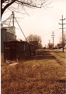
Beginning in 1967, the village became the site for many workshops for Rush County youth. Elementary children through high schoolers attended summer weekend camps in drama, speech, history, woodworking, photography, fitness, and creative writing. Hundreds of children in the 1960s and into the 1980s spent part of their summers here. The boys slept in shuttered trains cars while the girls camped in a nearby barn and later in the basement of the Homer Federated Church.
Geography
It lies along State Road 44, west-southwest of the city of Rushville, the county seat of Rush County.
Demographics
The United States Census Bureau delineated Homer as a census designated place in the 2022 American Community Survey.
Notable people
- Marjorie Pebworth, Illinois legislator, was born in Homer.
References
- ^ U.S. Geological Survey Geographic Names Information System: Homer, Indiana
- Zip Code Lookup
- History of Rush County, Indiana: From the Earliest Time to the Present, with Biographical Sketches, Notes, Etc. Eastern Indiana Publishing Company. 1888. p. 669.
- "Rush County". Jim Forte Postal History. Retrieved February 25, 2017.
- "Rushville Republican 30 Apr 1984, page 1". Newspapers.com. Retrieved January 31, 2024.
- DeLorme. Indiana Atlas & Gazetteer, 3rd ed. Yarmouth: DeLorme, 2004, p. 46. ISBN 0-89933-319-2.
- "2022 Geography Changes". United States Census Bureau.
- 'Illinois Blue Book 1967-1968,' Biographical Sketch of Marjorie Pebworth, pg. 203
| Municipalities and communities of Rush County, Indiana, United States | ||
|---|---|---|
| County seat: Rushville | ||
| City | ||
| Towns | ||
| Townships | ||
| CDPs | ||
| Other communities | ||
| Footnotes | ‡This populated place also has portions in an adjacent county or counties | |
This Rush County, Indiana location article is a stub. You can help Misplaced Pages by expanding it. |
