| Ituzaingó | |
|---|---|
| Barrio | |
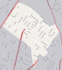
 Street map of Ituzaingó Street map of Ituzaingó | |
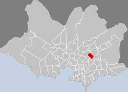
 Location of Ituzaingó in Montevideo Location of Ituzaingó in Montevideo | |
| Coordinates: 34°50′49″S 56°8′39″W / 34.84694°S 56.14417°W / -34.84694; -56.14417 | |
| Country | |
| Department | Montevideo Department |
| City | Montevideo |
Ituzaingó is a barrio (neighbourhood or district) of Montevideo, Uruguay.
Location
It borders Castro Castellanos to the southwest, Las Acacias to the northwest, Jardines del Hipódromo to the northeast, Flor de Maroñas to the southeast and Villa Española to the south.
Places of worship
- Parish Church of Our Lady of the Sacred Heart and St. Rita (Maroñas), which is also a Roman Catholic pilgrimage sanctuary
See also
References
- Saint Rita Diocesan Sanctuary (in Spanish)
- Patron saint of the impossible (in Spanish)
External links
This Montevideo-related article is a stub. You can help Misplaced Pages by expanding it. |
