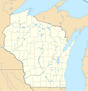
| John Muir Memorial County Park | |
|---|---|
| French Creek State Wildlife Area | |
| IUCN category V (protected landscape/seascape) | |
  | |
| Location | Marquette County, Wisconsin |
| Coordinates | 43°41′24″N 89°23′52″W / 43.69000°N 89.39778°W / 43.69000; -89.39778 |
| Area | 239 acres (97 ha) |
| Governing body | Wisconsin Department of Natural Resources |
John Muir Memorial County Park is a 239-acre (97 ha) tract of protected land, located in Marquette County, Wisconsin, United States, at an altitude of 239 m (784 ft). It is located next to Ennis Lake.
The terrain around John Muir Memorial County Park is flat and is sparsely populated, with the nearest large town being Portage, located 17.5 km to the south. The area around John Muir Memorial County Park is surrounded by farmland.
The climate is hemiboreal, with an average temperature of 7 °C (45 °F). The warmest month is July, at 21 °C (70 °F), and the coldest is January, at −10 °C (14 °F). The average annual rainfall is 1,212 millimetres (47.7 in). The wettest month is June, with 187 millimetres (7.4 in), and the driest is November, with 62 millimetres (2.4 in).
Images
-
 Plaque of the Memorial County; dedicated to John Muir
References
- Protected Planet Website- Retrieved April 13, 2023
- John Muir Memorial County Park at Geonames.org (cc-by ); post updated 2006-01-15; database download on 2017-02-28
- "NASA Earth Observations: Population Density". NASA/SEDAC. Retrieved 30 January 2016.
- "NASA Earth Observations: Land Cover Classification". NASA/MODIS. Retrieved 30 January 2016.
- B.L. Fanlayson (2007). "Updated world map of the Köppen-Geiger climate classification". Hydrology and Earth System Sciences. 11 (5): 1633–1644. Bibcode:2007HESS...11.1633P. doi:10.5194/hess-11-1633-2007. Retrieved 30 January 2016.
- "NASA Earth Observations Data Set Index". NASA. Retrieved 30 January 2016.
- "NASA Earth Observations: Rainfall (1 month - TRMM)". NASA/Tropical Rainfall Monitoring Mission. Retrieved 30 January 2016.