| José Leonardo Chirino International Airport | |||||||||||
|---|---|---|---|---|---|---|---|---|---|---|---|
 | |||||||||||
| Summary | |||||||||||
| Airport type | Public | ||||||||||
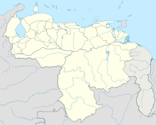
| Location | Santa Ana de Coro, Venezuela | ||||||||||
| Elevation AMSL | 52 ft / 16 m | ||||||||||
| Coordinates | 11°24′55″N 069°40′50″W / 11.41528°N 69.68056°W / 11.41528; -69.68056 | ||||||||||
| Map | |||||||||||
 | |||||||||||
| Runways | |||||||||||
| |||||||||||
| Sources: GCM Google Maps | |||||||||||
José Leonardo Chirino Airport (IATA: CZE, ICAO: SVCR), is an airport serving Coro, the capital of Falcón state in Venezuela. It is named to honor José Leonardo Chirino, leader of a 1795 rebellion in Coro that called for the abolition of slavery and the establishment of a democratic republic.
The runway length includes a 100 metres (330 ft) displaced threshold on Runway 27.
The Coro VOR-DME (Ident: CRO) is located on the field.
See also
References
- Airport information for CZE at Great Circle Mapper.
- Google Maps - Coro
- CRO VOR
External links
[REDACTED] Media related to José Leonardo Chirino Airport at Wikimedia Commons
Portals:
This Venezuela-related article is a stub. You can help Misplaced Pages by expanding it. |
This article about an airport in Venezuela is a stub. You can help Misplaced Pages by expanding it. |