| Křelov-Břuchotín | |
|---|---|
| Municipality | |
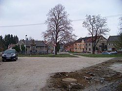
 Lipové Square in Křelov Lipové Square in Křelov | |
 Flag Flag Coat of arms Coat of arms | |
 | |
| Coordinates: 49°36′53″N 17°11′58″E / 49.61472°N 17.19944°E / 49.61472; 17.19944 | |
| Country | |
| Region | Olomouc |
| District | Olomouc |
| First mentioned | 1275 |
| Area | |
| • Total | 7.91 km (3.05 sq mi) |
| Elevation | 255 m (837 ft) |
| Population | |
| • Total | 1,954 |
| • Density | 250/km (640/sq mi) |
| Time zone | UTC+1 (CET) |
| • Summer (DST) | UTC+2 (CEST) |
| Postal code | 783 36 |
| Website | www |
Křelov-Břuchotín is a municipality in Olomouc District in the Olomouc Region of the Czech Republic. It has about 2,000 inhabitants.
Administrative division
Křelov-Břuchotín consists of two municipal parts (in brackets population according to the 2021 census):
- Křelov (1,516)
- Břuchotín (240)
Geography
Křelov-Břuchotín is located about 3 kilometres (2 mi) northwest of Olomouc. It lies in a flat landscape in the Upper Morava Valley. The highest point is the flat hill Dílový vrch at 283 m (928 ft) above sea level. The eastern tip of the municipal territory extends into the Litovelské Pomoraví Protected Landscape Area.
History
The first written mention of Křelov is from 1275 and the first mention of Břuchotín is from 1278. The two municipalities were merged in 1960 under the name Křelov. In 1975, Křelov and Břuchotín were joined to Olomouc. In 1995, it became a separate municipality under its current name.
Demographics
|
|
| ||||||||||||||||||||||||||||||||||||||||||||||||||||||
| Source: Censuses | ||||||||||||||||||||||||||||||||||||||||||||||||||||||||
Transport
The D35 motorway from Olomouc to the Hradec Králové Region passes through the municipality.
Sights

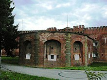
Historical monuments are Fort XVII Křelov (built in 1850–1854) and Fort XX Křelov (built in 1854–1858). They were built as part of the advanced fortification around the city walls of Olomouc. Fort XVII Křelov house a small museum, a restaurant and spaces for organizing cultural events.
Notable people
- Ivo Viktor (born 1942), footballer
References
- "Population of Municipalities – 1 January 2024". Czech Statistical Office. 2024-05-17.
- "Public Census 2021 – basic data". Public Database (in Czech). Czech Statistical Office. 2022.
- "Historie a památky" (in Czech). Obec Křelov-Břuchotín. Retrieved 2020-10-24.
- "Historický lexikon obcí České republiky 1869–2011" (in Czech). Czech Statistical Office. 2015-12-21.
- "Population Census 2021: Population by sex". Public Database. Czech Statistical Office. 2021-03-27.
- "Fort XVII Křelov" (in Czech). National Heritage Institute. Retrieved 2024-02-19.
- "Fort XX Křelov" (in Czech). National Heritage Institute. Retrieved 2024-02-19.
- "Fort Křelov XVII" (in Czech). Fort Křelov. Retrieved 2024-02-19.