The Kazakhstan–Russia border is the 7,644-kilometre (4,750 mi) international border between the Republic of Kazakhstan and the Russian Federation. It is the longest continuous international border in the world and the second longest by total length, after the Canada–United States border. It is in the same location as the former administrative-territorial border between the Kazakh Soviet Socialist Republic and the Russian Soviet Federative Socialist Republic.
Geography
The border starts in the west at the Caspian Sea and runs in a broadly west–east direction to the tripoint with China, though in places it is extremely convoluted. The border consists almost entirely of a series of overland lines traversing the Eurasian Steppe, though in sections rivers are utilised, such as the Maly Uzen, Ural and Uy. The border runs across lakes Botkul and Bura. In the far eastern section the border runs through the Altai Mountains.
Settlements

The following towns and cities of Kazakhstan lie adjacent to the border:
The following towns and cities of Russia lie adjacent to the border:
- Marfino
- Astrakhan
- Kaysatskoye
- Pallasovka
- Alexandrov Gay
- Ozinki
- Orsk
- Novotroitsk
- Dombarovsky
- Troitsk
- Isilkul
- Gornyak
Subnational entities
The following Regions of Kazakhstan (oblystar) lie on the border:
 Atyrau Region
 West Kazakhstan Region
 Aktobe Region
 Kostanay Region
 North Kazakhstan Region
 Pavlodar Region
 East Kazakhstan Region
The following Federal subjects of Russia lie on the border:
 Astrakhan Oblast
 Volgograd Oblast
 Saratov Oblast
 Samara Oblast
 Orenburg Oblast
 Chelyabinsk Oblast
 Kurgan Oblast
 Tyumen Oblast
 Omsk Oblast
 Novosibirsk Oblast
 Altai Krai
 Altai Republic
History
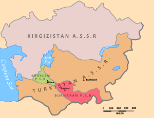
Russia had conquered Central Asia in the 19th century, by annexing the formerly independent Khanates of Kokand and Khiva and the Emirate of Bukhara. After the Communists took power in 1917 and created the Soviet Union it was decided to divide Central Asia into ethnically-based republics in a process known as National Territorial Delimitation (or NTD). This was in line with Communist theory that nationalism was a necessary step on the path towards an eventually communist society, and Joseph Stalin's definition of a nation as being “a historically constituted, stable community of people, formed on the basis of a common language, territory, economic life, and psychological make-up manifested in a common culture”.

The NTD is commonly portrayed as being nothing more than a cynical exercise in divide and rule, a deliberately Machiavellian attempt by Stalin to maintain Soviet hegemony over the region by artificially dividing its inhabitants into separate nations and with borders deliberately drawn so as to leave minorities within each state. Though indeed the Soviets were concerned at the possible threat of pan-Turkic nationalism, as expressed for example with the Basmachi movement of the 1920s, closer analysis informed by the primary sources paints a much more nuanced picture than is commonly presented.
NTD of the area along ethnic lines had been proposed as early as 1920. During Tsarist times the general area of modern Kazakhstan was composed of four regions (oblasts); west-to-east these were Ural (plus part of Transcaspian Oblast, Turgai, Akmolinsk and Semipalatinsk. All four oblasts had been created by a Decree of Tsar Alexander II of 21 October (2 November) 1868. On 26 August 1920 the Kirghiz Autonomous Socialist Soviet Republic (KASSR, located within the Russian Soviet Federative Socialist Republic, RSFSR) was created from these four provinces (briefly joined together in this period in the short-lived Alash Autonomy), with the northern border of the ASSR essentially following that of the former four oblasts, though adjusted in places to reflect local demographics; however, disputes over specific areas of the boundary continued into the following year. At this time Kazakhs were referred to as "Kyrgyz" and what are now the Kyrgyz were deemed a sub-group of the Kazakhs and referred to as "Kara-Kyrgyz" (i.e. mountain-dwelling black-Kyrgyz). The areas west of the Ural river associated with the Kazakh Bukey Horde were claimed by both the KASSR and Astrakhan Oblast, with most of the area going to the KASSR in 1921, including Kurmangazy and Sinemorsk. Elsewhere, some Russian-inhabited areas of the four oblasts, such as Omsk, were transferred to Russia.

On 22 September 1920 Orenburg was transferred to the KASSR and became its capital, along with surrounding parts of Orenburg Oblast such as Sol-Iletsk, Akbulak and Sharlyk. It is thought that the decision to shift the capital to Orenburg was because at that time it was the only large industrial city in the Kazakh-inhabited region and it was hoped that it would assist in the KASSR's economic development, as well as act as a bridge between the Russian lands to the north and the Turkic lands to the south. However in early 1925 the capital of the KASSR was moved from Orenburg to the southern city of Ak-Mechet, with Orenburg and the surrounding lands being transferred back to Russia.
The boundary became an international frontier in 1991 following the dissolution of the Soviet Union and the independence of its constituent republics. Thousands of ethnic Russians who had migrated to Kazakhstan in Soviet times left, fearing marginalisation in the new Kazakh-dominated state. In 1989 the Russian population stood at about 6,227,549 (37.82% of the population), though by 1999 this figure had fallen to 4,479,618 (29.95%) and in 2009 it stood at 3,793,764 (23.69%). As of 2019 Russians are estimated to make up 19.3% of the population and are heavily concentrated in the country's north along the Russian border.
Negotiations on border delimitation took place from 1999 to 2005, with a final treaty being approved in Moscow by Presidents Vladimir Putin and Nursultan Nazarbayev on 18 January 2005. The treaty entered into force on 12 January 2006. On-the-ground demarcation started in July 2007, with a series of pillars marking the frontier beginning to be erected from May 2009. When the border became international in 1991, one branch of the Trans-Siberian Railway was interrupted by two border crossings at Petropavl. In 2017, Russia and Kazakhstan agreed to create a transit (corridor) without border controls.
Border crossings

There are numerous border crossings along the lengthy frontier:
- Kurmangazy (KAZ) - Karaozek (RUS)
- Taskala (KAZ) - Ozinki (RUS)
- Aksay (KAZ) - Ilek (RUS)
- Bidaik (KAZ) - Odesskoye (RUS)
- Alimbetovka (KAZ) - Orsk (RUS)
- Zhaisan (KAZ) - Sagarchin (RUS)
- Kayerak (KAZ) - Bugristoye (RUS)
- Akbalshyk (KAZ) - Voskresenskoye (RUS)
- Zhanazhol (KAZ) - Petukhovo (RUS)
- Karakoga (KAZ) - Isilkul (RUS)
- Urlitobe (KAZ) - Cherlak (RUS)
- Sulu-Agash (KAZ) - Karasuk (RUS)
- Sharbakty (KAZ) - Kulunda (RUS)
- Auyl (KAZ) - Vesyoloyarsk (RUS)
- Ube (KAZ) - Mikhaylovka (RUS)
- Zhezkent (KAZ) - Gornyak (RUS)
Historical maps
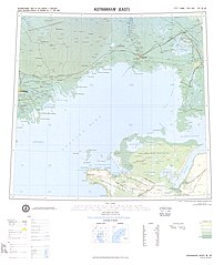
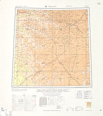
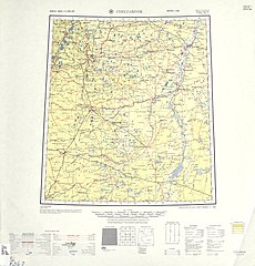
Historical English-language maps of the Kazakh SSR-Russian SSR border from the Caspian Sea to the border with China, mid to late 20th century:
Demographics

Notes
- Kazakh: Қазақстан-Ресей шекарасы, romanized: Qazaqstan-Resei şekarasy, IPA: [qɑzɑqstɑ́n‿rʲesʲéj ʃʲekʰɑrɑsə́]; Russian: Казахстанско-российская граница, romanized: Kazahstansko-rossijskaja granica, IPA: [kəzɐxˌstanskə‿rɐˈsʲijskəjə ɡrɐˈnʲitsə]
References
- ^ "Profile - Kazakhstan". CIA World Factbook. Archived from the original on 9 January 2021. Retrieved 4 September 2020.
- "Global land border length between countries". Statista. Archived from the original on 2 November 2020. Retrieved 4 September 2020.
- The charge is so common as to have become almost the conventional wisdom within mainstream journalistic coverage of Central Asia, with Stalin himself often the one drawing the borders, see for example Stourton, E. in The Guardian, 2010 Kyrgyzstan: Stalin's deadly legacy https://www.theguardian.com/commentisfree/2010/jun/20/kyrgyzstan-stalins-deadly-legacy Archived 2020-08-04 at the Wayback Machine; Zeihan, P. for Stratfor, 2010 The Kyrgyzstan Crisis and the Russian Dilemma https://worldview.stratfor.com/article/kyrgyzstan-crisis-and-russian-dilemma Archived 2020-08-04 at the Wayback Machine; The Economist, 2010 Kyrgyzstan - Stalin's Harvest https://www.economist.com/briefing/2010/06/17/stalins-harvest?story_id=16377083 Archived 2020-06-22 at the Wayback Machine; Pillalamarri, A in the Diplomat, 2016, The Tajik Tragedy of Uzbekistan https://thediplomat.com/2016/09/the-tajik-tragedy-of-uzbekistan/ Archived 2020-06-19 at the Wayback Machine; Rashid, A in the New York Review of Books, 2010, Tajikistan - the Next Jihadi Stronghold? https://www.nybooks.com/daily/2010/11/29/tajikistan-next-jihadi-stronghold Archived 2019-04-26 at the Wayback Machine; Schreck, C. in The National, 2010, Stalin at core of Kyrgyzstan carnage, https://www.thenational.ae/world/asia/stalin-at-core-of-kyrgyzstan-carnage-1.548241 Archived 2020-08-30 at the Wayback Machine
- Bergne, Paul (2007) The Birth of Tajikistan: National Identity and the Origins of the Republic, IB Taurus & Co Ltd, pg. 39-40
- Haugen, Arne (2003) The Establishment of National Republics in Central Asia, Palgrave Macmillan, pgs. 24-5, 182-3
- Khalid, Adeeb (2015) Making Uzbekistan: Nation, Empire, and Revolution in the Early USSR, Cornell University Press, pg. 13
- Edgar, Adrienne Lynn (2004) Tribal Nation: The Making Of Soviet Turkmenistan, Princeton University Press, pg. 46
- Bergne, Paul (2007) The Birth of Tajikistan: National Identity and the Origins of the Republic, IB Taurus & Co Ltd, pg. 40-1
- Starr, S. Frederick (ed.) (2011) Ferghana Valley – the Heart of Central Asia Routledge, pg. 105
- Suleimenov, Arman (15 July 2017). "History of Colonial Reform". Qazaqstan Tarihy. Archived from the original on 4 February 2021. Retrieved 5 September 2020.
- Kassymova, Didar; Kundakbayeva, Zhanat; Markus, Ustina (2012). Historical Dictionary of Kazakhstan. Scarecrow Press. p. xxv.
- "The Alash Movement and the Soviet Government: A Difference of Positions" (PDF). Archived (PDF) from the original on 2018-04-17. Retrieved 2021-02-04.
- Kesici, Özgecan (19 July 2017). "The Alash movement and the question of Kazakh ethnicity". Nationalities Papers. 45 (6). The Journal of Nationalism and Ethnicity: 1135–1149. doi:10.1080/00905992.2017.1320541. S2CID 135009204. Archived from the original on 4 February 2021. Retrieved 28 July 2020.
- ^ Thomas, Alun (July 2015). "Kazakh Nomads and the New Soviet State, 1919-1934" (PDF). University of Sheffield. Archived (PDF) from the original on 8 August 2017. Retrieved 5 September 2020.
- ^ Akanov, KG (2017). "Orenburg as the capital of autonomous Kazakhstan (1920-1925): the reasons of choice and attempts of search for alternatives". Samara Journal of Science. 6 (4): 160–165. doi:10.17816/snv201764209. Archived from the original on 10 December 2020. Retrieved 4 September 2020.
- Smith, Jeremy (2009). The Bolsheviks and the National Question, 1917–23. Palgrave MacMillan. p. 82.
- Sébastien Peyrouse, Nationhood and the Minority Question in Central Asia: The Russians in Kazakhstan, Europe-Asia Studies 59 (2007): 484-85
- David D. Laitin, Identity in Formation: The Russian-speaking Populations in the Near Abroad (Ithaca: Cornell University Press, 1998), 105.
- Ethnodemographic situation in Kazakhstan Archived 2003-04-16 at the Wayback Machine on ide.go.jp (unidentified source)
- "Ethnic composition: 1970 census (data for regions)". pop-stat.mashke.org. Archived from the original on 22 May 2018. Retrieved 3 July 2018.
- "Ethnic composition: 1979 census (data for regions)". pop-stat.mashke.org. Archived from the original on 22 May 2018. Retrieved 3 July 2018.
- "Ethnic composition: 1989 census (data for regions)". pop-stat.mashke.org. Archived from the original on 7 August 2018. Retrieved 3 July 2018.
- "Ethnic composition: 1999 census (data for regions)". pop-stat.mashke.org. Archived from the original on 7 August 2018. Retrieved 3 July 2018.
- "Ethnic composition: 2009 census (data for regions)". pop-stat.mashke.org. Archived from the original on 7 August 2018. Retrieved 3 July 2018.
- Lillis, Joanna (20 March 2019). "Dark Shadows: Inside the Secret World of Kazakhstan". Archived from the original on 22 March 2019. Retrieved 25 November 2019.
- ^ Kazakhstan MFA - Delimitation and Demarcation of State Border, archived from the original on 2020-01-22, retrieved 12 September 2018
- "Press Statement Following Russian-Kazakh Talks". Kremlin. 18 January 2005. Archived from the original on 6 January 2020. Retrieved 4 September 2020.
- "Demarcation of Russian-Kazakh border begun - Durham University". Dur.ac.uk. 2009-05-26. Archived from the original on 2013-08-01. Retrieved 2016-10-22.
- "Russia and Kazakhstan abolish border controls for transit trains". 26 September 2017. Archived from the original on 2018-09-04. Retrieved 2018-09-04.
- "Kazakhstan Border Crossings". Advantour. Archived from the original on 20 September 2020. Retrieved 5 September 2020.
External links
| Borders of Kazakhstan | |
|---|---|
| Borders of Russia | |
|---|---|
| Land: |
|
| Maritime: | |
- Kazakhstan–Russia border
- 1930 establishments in the Kazakh Autonomous Socialist Soviet Republic
- 1930 establishments in Russia
- 1930 in international relations
- Internal borders of the Soviet Union
- Kazakhstan–Russia relations
- Borders of Russia
- Borders of Kazakhstan
- International borders
- 1991 establishments in Kazakhstan
- 1991 establishments in Russia


