| Kentriko Κεντρικό | |
|---|---|
| Community | |
    | |
 | |
| Coordinates: 37°16′32″N 21°58′9″E / 37.27556°N 21.96917°E / 37.27556; 21.96917 | |
| Country | Greece |
| Administrative region | Peloponnese |
| Regional unit | Messenia |
| Municipality | Oichalia |
| Municipal unit | Andania |
| Elevation | 80 m (260 ft) |
| Population | |
| • Community | 78 |
| Time zone | UTC+2 (EET) |
| • Summer (DST) | UTC+3 (EEST) |
| Postal code | 240 08 |
| Area code(s) | 27240 |
| Vehicle registration | KM |
Kentriko (Greek: Κεντρικό [kentrikoˈ]) is a village in the municipal unit of Andania in the municipality of Oichalia of the Regional Unit of Messenia located in the Region of Peloponnese, according to the administrative division of Greece as formed by the Kallikratis Plan 2011 local government reform program. The official village name is "Kentrikon" (Greek: Κεντρικόν [kentrikoˈn]). The seat of the municipality is Meligalas and it belongs to the geographical division of Peloponnese. Until 2010, Kentriko belonged to the Local District of Kentriko, of the former Andania Municipality of Messenia Prefecture.
Kentriko has an altitude of 80 meters above sea level, at latitude 37.2756 and longitude 21.9693.
Kentriko today is surrounded by arable land and its 78 inhabitants (2021) are engaged exclusively in agricultural work. It is located 38 kilometers from the Messenia capital Kalamata, 35 kilometers from Kyparissia and only 6 kilometers from Meligalas.
History
Kentriko is a small village built in the center of a plain, hence its name, near Polichni and Diavolitsi. Its oldest name until 1927 was Kato Kurtaga or simply Kurtaga. The name change is due to a decision of the then government to rename all the settlements that had Turkish-speaking names. According to the prevailing version, the name Kurtaga was taken from a Turkish official, namely Aga, with the name Kurt, who probably owned the area during the Turkish occupation. The village existed before the revolution of 1821. Kentriko at the beginning of the 20th century was a hub because initially the Meligalas - Kentriko railway section had not been built. So passengers from Kalamata had to stop at Meligala and board horse-drawn wagons to go to Kentriko and pick up another train that started from there to Tripoli.
Climate
Kentriko has a mediterranean climate (Köppen Csa) with mild, wet winters and dry, hot summers. It receives plenty of precipitation days in winter. Summers are very hot and dry.
Cuisine

Local specialities:
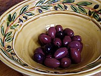
- Kalamata olives
- Lalagides local donuts
- Pasto salted pork
- Lokaniko with orange
- Petimezi
- Diples (dessert)
- Sfela goat cheese
Notable people
- Michail A Karageorgis, 1899-1995, Shipowner
- George Anastasopoulos 1965-, Engineer
References
- ^ "Αποτελέσματα Απογραφής Πληθυσμού - Κατοικιών 2021, Μόνιμος Πληθυσμός κατά οικισμό" [Results of the 2021 Population - Housing Census, Permanent population by settlement] (in Greek). Hellenic Statistical Authority. 29 March 2024.
- "ΦΕΚ A 87/2010, Kallikratis reform law text" (in Greek). Government Gazette.
- "Kentriko geographical data".
- "Population & housing census 2001 (incl. area and average elevation)" (PDF) (in Greek). National Statistical Service of Greece. Archived from the original (PDF) on 21 September 2015.
| Subdivisions of the municipality of Oichalia | |
|---|---|
| Municipal unit of Andania |
|
| Municipal unit of Dorio | |
| Municipal unit of Eira |
|
| Municipal unit of Meligalas |
|
| Municipal unit of Oichalia | |