| This article needs additional citations for verification. Please help improve this article by adding citations to reliable sources. Unsourced material may be challenged and removed. Find sources: "Kinhai" – news · newspapers · books · scholar · JSTOR (July 2022) (Learn how and when to remove this message) |
| Kinhai | |
|---|---|
| Village | |
 | |
 | |
| Coordinates: 17°47′17″N 74°10′18″E / 17.788127°N 74.171672°E / 17.788127; 74.171672 | |
| Country | |
| State | Maharashtra |
| Region | West India |
| District | Satara |
| Taluka | Koregaon |
| Government | |
| • Body | Gram Panchayat |
| Demonym | Kinhaikar |
| Languages | |
| • Official | Marathi |
| Time zone | UTC+5:30 (IST) |
| Telephone code | (+91)2371 |
| Vehicle registration | MH 11 |
| Nearest city | Satara |
| Website | www.maharashtra.gov.in |
Kinhai is a village located in Koregaon Taluka, Satara District in Maharashtra, India. The village is divided into Pantanchi Kinhai on the western side and Peth Kinhai to the east. It is located 7 miles (11 km) north of Koregaon, at 2,320 ft (710 m) above sea level. As of the 2011 Indian census, Kinhai had a population of 3,360.
History
In 965 CE, the village, then known as Kinhika, was donated to a Brahmin named Navashiv. It fell under the administrative unit of Ramtirthika.
Kinhai was a village of the former princely state of Aundh and was included in Koregaon Taluka after the merger of the princely states.
The Pratinidhi families were hereditary Kulkarnis or accountants of Kinhai and several of the neighbouring villages and it was from that position that Parashuram Trimbak raised himself till he was appointed the third Pratinidhi in 1700.
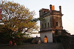
In 1749, Sakhargadnivasini Temple (meaning "she who resides on top of the hill called sugar-fort") was completed. In 2014, the temple underwent a restoration effort which received a UNESCO Asia-Pacific Heritage Award.
Geography
| This section does not cite any sources. Please help improve this section by adding citations to reliable sources. Unsourced material may be challenged and removed. (July 2022) (Learn how and when to remove this message) |
The village lies on the banks of a feeder of the Vasna River. To the north and north-west is a spur of steep hills at the end of which rises the ancient fort of Kalyangad (nowadays Nandgiri) (3,537 ft).
References
- "Koregaon new hotspot in Satara district". The Times of India. 24 October 2020. Retrieved 1 July 2022.
- Kalamdani, Kiran. "Before and After Photographs of Kinhai Project".
{{cite journal}}: Cite journal requires|journal=(help) - "Basic Population Figures of India, States, Districts, Sub-District and Village". Government of India. 2011.
- "Sutradhara's tales: Pune gets its first names... royal patronages recognise sacred headquarters". Hindustan Times. 3 March 2021. Retrieved 1 July 2022.
- Pant, Apa (1990). An Extended Family Or Fellow Pilgrims. Sangam Books. p. 10. ISBN 9780863111099.
- "Tata house, temple win UNESCO award". The Hindu. 3 September 2014. ISSN 0971-751X. Retrieved 1 July 2022.
| Satara district topics | ||
|---|---|---|
| History |  | |
| Battles | ||
| Rivers | ||
| Dams | ||
| Lakes | ||
| Ghats | ||
| Caves | ||
| Cities and towns | ||
| Villages | ||
| Places to see | ||
| Monuments | ||
| Transport | ||
| Education | ||
| Lok Sabha constituencies | ||
| Vidhan Sabha constituencies | ||
| Culture | ||