| La Tène | |
|---|---|
| Former municipality | |
 Flag Flag Coat of arms Coat of arms | |
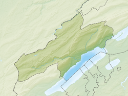
| Location of La Tène | |
  | |
| Coordinates: 47°01′N 7°01′E / 47.017°N 7.017°E / 47.017; 7.017 | |
| Country | Switzerland |
| Canton | Neuchâtel |
| Area | |
| • Total | 5.35 km (2.07 sq mi) |
| Elevation | 450 m (1,480 ft) |
| Population | |
| • Total | 5,000 |
| • Density | 930/km (2,400/sq mi) |
| Time zone | UTC+01:00 (Central European Time) |
| • Summer (DST) | UTC+02:00 (Central European Summer Time) |
| Postal code(s) | 2074 |
| SFOS number | 6461 |
| ISO 3166 code | CH-NE |
| Surrounded by | Cudrefin (VD), Gampelen (BE), Ins (BE), Saint-Blaise, Thielle-Wavre |
| Website | www SFSO statistics |
La Tène (French: [la tɛn]; Arpitan: La Tena) is a former municipality in the Swiss canton of Neuchâtel. On 1 January 2009, the former municipalities of Marin-Epagnier and Thielle-Wavre merged to form the new municipality of La Tène. On 1 January 2025 the former municipalities of Enges, Hauterive, Saint-Blaise and La Tène merged into the new municipality of Laténa.
The La Tène toponym was originally applied to the lakeside area near Epagnier, notable as the eponymous site of the Iron Age archaeological of the La Tène culture.
Geography

La Tène has an area, as of 2009, of 5.4 square kilometers (2.1 sq mi). Of this area, 2.65 km (1.02 sq mi) or 48.7% is used for agricultural purposes, while 0.45 km (0.17 sq mi) or 8.3% is forested. Of the rest of the land, 2 km (1 sq mi) or 36.8% is settled (buildings or roads), 0.21 km (0.08 sq mi) or 3.9% is either rivers or lakes and 0.13 km (32.12 acres) or 2.4% is unproductive land.
Of the built up area, industrial buildings made up 6.1% of the total area while housing and buildings made up 14.2% and transportation infrastructure made up 11.9%. while parks, green belts and sports fields made up 3.9%. Out of the forested land, all of the forested land area is covered with heavy forests. Of the agricultural land, 41.9% is used for growing crops and 3.3% is pastures, while 3.5% is used for orchards or vine crops. Of the water in the municipality, 0.2% is in lakes and 3.7% is in rivers and streams.
It is located at the northeastern tip of Lake Neuchâtel at an elevation of 455 meters. It lies close to Biel/Bienne, at the boundary between French- and German-speaking regions, and at a knot of highways.
It was part of the district of Neuchâtel, until the district level was eliminated on 1 January 2018.
Demographics
La Tène has a population (as of December 2020) of 5,176. As of 2008, 26.0% of the population are resident foreign nationals. Over the last 10 years (2000–2010) the population has changed at a rate of 16.7%. It has changed at a rate of 12.1% due to migration and at a rate of 3.2% due to births and deaths.
Most of the population (as of 2000) speaks French (81.6%) as their first language, German is the second most common (7.2%) and Italian is the third (3.8%).
As of 2008, the population was 49.2% male and 50.8% female. The population was made up of 1,740 Swiss men (36.1% of the population) and 634 (13.1%) non-Swiss men. There were 1,871 Swiss women (38.8%) and 578 (12.0%) non-Swiss women.
As of 2000, children and teenagers (0–19 years old) make up 24.4% of the population, while adults (20–64 years old) make up 64.2% and seniors (over 64 years old) make up 11.4%.
The vacancy rate for the municipality, in 2010, was 0.1%.
Heritage sites of national significance

The Clinique De Préfargier, Maison De Santé and Les Bourguignonnes-les-Perveuils in Marin-Epagnier, the La Tène culture settlement and the Les marais d‘Epagnier prehistoric and medieval sites are listed as Swiss heritage site of national significance. The Préfargier, Montmirail and Cité Martini areas are part of the Inventory of Swiss Heritage Sites.
Economy
As of 2010, La Tène had an unemployment rate of 5.6%. As of 2008, there were 47 people employed in the primary economic sector and about 14 businesses involved in this sector. 1,167 people were employed in the secondary sector and there were 60 businesses in this sector. 2,867 people were employed in the tertiary sector, with 198 businesses in this sector.
Of the working population, 15.8% used public transportation to get to work, and 55.2% used a private car.
References
- ^ "Arealstatistik Standard - Gemeinden nach 4 Hauptbereichen". Federal Statistical Office. Retrieved 13 January 2019.
- "Ständige Wohnbevölkerung nach Staatsangehörigkeitskategorie Geschlecht und Gemeinde; Provisorische Jahresergebnisse; 2018". Federal Statistical Office. 9 April 2019. Retrieved 11 April 2019.
- Amtliches Gemeindeverzeichnis der Schweiz published by the Swiss Federal Statistical Office (in German) accessed 14 January 2010
- Swisstopo map (1931) geo.admin.ch
- ^ Swiss Federal Statistical Office-Land Use Statistics 2009 data (in German) accessed 25 March 2010
- Amtliches Gemeindeverzeichnis der Schweiz (in German) accessed 15 February 2018
- "Ständige und nichtständige Wohnbevölkerung nach institutionellen Gliederungen, Geburtsort und Staatsangehörigkeit". bfs.admin.ch (in German). Swiss Federal Statistical Office - STAT-TAB. 31 December 2020. Retrieved 21 September 2021.
- Swiss Federal Statistical Office - Superweb database - Gemeinde Statistics 1981-2008 Archived 2010-06-28 at the Wayback Machine (in German) accessed 19 June 2010
- ^ Swiss Federal Statistical Office Archived 2016-01-05 at the Wayback Machine accessed 24-October-2011
- Canton of Neuchâtel Statistics Archived 2012-12-05 at archive.today, République et canton de Neuchâtel - Recensement annuel de la population (in German) accessed 13 October 2011
- "Kantonsliste A-Objekte". KGS Inventar (in German). Federal Office of Civil Protection. 2009. Archived from the original on 28 June 2010. Retrieved 25 April 2011.