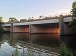
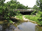
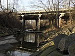
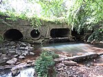
This is a complete list of current bridges and other crossings of Four Mile Run from its mouth at the Potomac River to its source.
Crossings
All locations arefalls in Virginia. Pedestrian-only bridges are marked in italics.
| Image | Crossing | Opened | Coordinates | Notes |
|---|---|---|---|---|
| Arlington–Alexandria | ||||

|
George Washington Memorial Parkway / Mount Vernon Trail | 1980 | 38°50′28″N 77°02′52″W / 38.8410°N 77.0479°W / 38.8410; -77.0479 | |

|
WMATA Yellow and Blue Lines | 1983 | 38°50′27″N 77°02′55″W / 38.8409°N 77.0485°W / 38.8409; -77.0485 | |

|
CSX Transportation RF&P Subdivision | 1980 | 38°50′27″N 77°02′56″W / 38.8409°N 77.0488°W / 38.8409; -77.0488 | Originally Potomac Yard rail bridge |

|
Potomac Avenue | 1980 | 38°50′27″N 77°02′57″W / 38.8408°N 77.0493°W / 38.8408; -77.0493 | Originally Potomac Yard rail bridge |

|
Short Bridge Park (disused) | 1980 | 38°50′27″N 77°03′01″W / 38.8408°N 77.0504°W / 38.8408; -77.0504 | Originally Potomac Yard rail bridge |

|
demolished rail bridge | 1980 | 38°50′27″N 77°03′06″W / 38.8407°N 77.0516°W / 38.8407; -77.0516 | Originally Potomac Yard rail bridge; demolished in 2013 |

|
Short Bridge Park footbridge | 1980 | 38°50′27″N 77°03′08″W / 38.8407°N 77.0521°W / 38.8407; -77.0521 | Originally Potomac Yard rail bridge |

|
1980 | 38°50′27″N 77°03′09″W / 38.8407°N 77.0524°W / 38.8407; -77.0524 | ||
| Washington, Alexandria, and Mount Vernon Electric Railway Bridge | 1896 | 38°50′27″N 77°03′20″W / 38.8409°N 77.0555°W / 38.8409; -77.0555 | Removed sometime between 1932 and 1943. | |

|
Mt. Vernon Avenue | 1958 | 38°50′41″N 77°03′53″W / 38.8446°N 77.0647°W / 38.8446; -77.0647 | Reconstructed 1981 |

|
W. Glebe Road | 1957 | 38°50′37″N 77°04′38″W / 38.8436°N 77.0772°W / 38.8436; -77.0772 | Reconstruction of the superstructure of the bridge began in May 2022 and was completed in August of 2023. The new bridge will reuse the existing piers and create more space for cyclists and pedestrians. |

|
1973 | 38°50′35″N 77°04′57″W / 38.8431°N 77.0825°W / 38.8431; -77.0825 | Reconstructed 2018 | |

|
Shirlington Road | 1973 | 38°50′36″N 77°05′09″W / 38.8432°N 77.0857°W / 38.8432; -77.0857 | |
| Arlington | ||||

|
Jennie Dean Park footbridge (aka "The S. Nelson Street bridge") | 1986 | Rehabilitated in 2023-2024 | |

|
S. Walter Reed Drive | 1974 | Former bridge destroyed by Hurricane Agnes in 1972 | |

|
Barcroft Park footbridge | |||

|
Barcroft Park footbridge | 2009 | ||

|
S. George Mason Drive | 1966 | ||

|
Four Mile Run Trail | ~1974-76 | ||

|
1940 | Widened in 1958. Reconstructed in 2001 | ||

|
Four Mile Run Trail | |||

|
Four Mile Run Trail | |||

|
Four Mile Run Trail | 1967 | ||

|
Glencarlyn Park footbridge | 2022 | Previous bridge destroyed in a flood in July 2019, new bridge opened in 2022 | |

|
Glencarlyn Park Playground footbridge | Destroyed in flood in July 2019 | ||

|
Four Mile Run Trail | 1967 | ||

|
Washington & Old Dominion Trail | 1984 | Span was built atop the extant abutments dating back to the 1850's | |

|
Washington & Old Dominion Trail | 1984 | Span was built atop the extant abutments dating back to the 1850's | |
| Abandoned Four Mile Run Trail | 1967 | Visible in bottom of the photo. Unsure when it was abandoned. | ||

|
Washington & Old Dominion Trail | 1984 | Span was built atop the extant abutments dating back to the 1850's | |

|
1987 | |||

|
footbridge to N. Greenbrier Street | |||

|
Washington & Old Dominion Trail | 2001 | Ribbon Cutting for section of trail on May 11, 2002. | |

|
N. Carlin Springs Road | 1987 | ||

|
Bluemont Park footbridge | |||

|
Bluemont Park footbridge | |||

|
Bluemont Junction Trail | 1990 | ||

|
Washington & Old Dominion Trail | 1991 | ||

|
Wilson Boulevard | 1994 | ||

|
Bon Air Park footbridge | Destroyed in flood in July 2019 | ||

|
Washington & Old Dominion Trail | 1984 | ||

|
Patrick Henry Drive | 1982 | This is the first bridge at this location. It was built in coordination with I-66 and with space for the bike trail beneath. Originally this was going to be a cloverleaf intersection, but Arlington County opposed it due to the park space and homes it would need to take. | |

|
McKinley Road Bridge | ~1950 | Originally, McKinley connected across Four Mile Run and the railroad. Part of the road was removed and the bridge became a bicycle/pedestrian trail when I-66 was built. | |

|
N. Ohio Street | 1981 | Constructed as part of the I-66 project to replace the removal of Mckinley. | |

|
Four Mile Run Trail | 1967 | ||

|
Washington & Old Dominion Trail |
1982 | Culvert crosses W&OD Trail, but enters and exits on same side of Interstate 66 | |

|
East Falls Church Park footbridge | 2012 | Replaced older bridge slightly downstream | |

|
N. Sycamore Street | 1971 | ||

|
Washington & Old Dominion Trail/Banneker Park | Prior to 1981 | In 2020 the railings on the bridge were replaced. | |
| Falls Church | ||||

|
N. Van Buren Street | 2018 | Replaced older bridge | |

|
||||
| Arlington–Falls Church | ||||

|
Driveway to Arlington Fire Station 6 | 1990 | ||
| Arlington | ||||

|
Washington & Old Dominion Trail | 1982 | ||

|
Little Falls Road / 26th Street N / Fairfax Drive | 1970 | Culvert under residential neighborhood | |

|
WMATA Orange, Blue, and Silver Lines Williamsburg Boulevard |
1982 | Culvert under freeway | |
| Fairfax County | ||||

|
Gordon Avenue | Gordon Avenue originally had a gap where Four Mile Run was but by 1977 it was closed, with a culvert for the run, to replace connections lost by the construction of I-66. | ||
References
- ^ Hodge, Paul (January 24, 1980). "Seven Bridges Span Four Mile Run Flood-Control Project and Bicycle Trail". The Washington Post. ISSN 0190-8286. Retrieved June 16, 2020.
- "Demolition to Begin on Four Mile Run Bridge". ARLnow.com - Arlington, Va. Local News. July 22, 2013. Retrieved June 16, 2020.
- "Washington, Alexandria and Mount Vernon Line". The Evening Star. June 5, 1896.
- "Arlington County Map 1943".
- "Four Mile Run Bridge Dedication". Northern Virginia Sun. June 19, 1958. Retrieved February 27, 2023.
- ^ "County, City Will Share Bridge Cost". The Washington Post. February 8, 1957.
- ^ "County Board Agenda Item Meeting of September 12, 2020". Retrieved February 14, 2023.
- ^ "Arlington County, Virginia". National Bridge Inventory. Retrieved December 31, 2020 – via BridgeReports.com.
- Jarvis, James. "County to cut ribbon on West Glebe Road bridge upgrades after full reopening last month". Retrieved September 11, 2023.
- "West Glebe Road Bridge Reconstruction Project". Retrieved February 9, 2023.
- ^ "Alexandria, Virginia". National Bridge Inventory. Retrieved December 31, 2020 – via BridgeReports.com.
- "SHIRLINGTON RD. over FOUR MILE RUN Arlington County, Virginia Bridge Inspection Report". Pensacola News Journal. Retrieved August 7, 2020.
- Forgey, Benjamin (November 1, 1986). "In Shirlington, Main Street Revisited". The Washington Post.
- "Shirlington area pedestrian bridge back open after repairs". May 3, 2024. Retrieved May 3, 2024.
- Date on marker on bridge's SW abutment
- "Stormwater Management Overview" (PDF). Arlington County. August 18, 2019. p. 6. Retrieved June 20, 2020.
- Date on marker on bridge's abutment
- "EBL S. G. MASON DR over FOUR MILE RUN Arlington County, Virginia Bridge Inspection Report". Pensacola News Journal. Retrieved August 7, 2020.
- "Bridge Construction". Northern Virginia Sun. January 27, 1967. Retrieved March 23, 2023.
- According to marker on the bridge's northeast corner
- ^ Davidson, Gary (November 20, 1974). "Where the Bikeways Are". Northern Virginia Sun. Retrieved April 11, 2023.
- ^ "July 8 Storm Update". Parks & Recreation. August 5, 2019. Retrieved June 20, 2020.
- ^ "Arlington Estimates $3.5 Million in Flood Damage to County Property". ARLnow. July 9, 2019. Retrieved June 20, 2020.
- DeVoe, Jo (February 16, 2022). "Glencarlyn Park gets new pedestrian bridge after 2019 flood, but trail still closed". Retrieved March 20, 2023.
- ^ "Bikers and Hikers: All Aboard the W&OD". September 2, 1984. Retrieved April 12, 2023.
- ^ Hodge, Paul (December 1, 1983). "Arlington Bike Trail To Be Reconstructed". Retrieved May 16, 2023.
- According to plaque on bridge "FEB 2001"
- "ARLINGTON TO CELEBRATE SIXTH ANNUAL NEIGHBORHOOD DAY MAY 11". Archived from the original on October 31, 2004. Retrieved May 26, 2023.
- According to plate on bridge "8-4-90"
- According to plaque on bridge "June 1991"
- "WILSON BLVD. over FOUR MILE RUN Arlington County, Virginia Bridge Inspection Report". Pensacola News Journal. Retrieved August 7, 2020.
- "Bike Trail to Open in Arlington". Northern Virginia Sun. September 2, 1967. Retrieved August 23, 2023.
- ^ Offutt, Steve (January 17, 2012). "Four Mile Run getting new pedestrian and bike bridge". Greater Greater Washington. Retrieved June 16, 2020.
- "SBL N. SYCAMORE ST over FOUR MILE RUN Arlington County, Virginia Bridge Inspection Report". Pensacola News Journal. Retrieved August 7, 2020.
- DeVoe, Joe (December 7, 2020). "Upgraded Banneker Park Set to Reopen Before Christmas, Delayed by COVID-19". Arlington Now. Retrieved August 24, 2023.
- "Van Buren Bridge Replacement". Fort Myer Construction. Retrieved August 7, 2020.
- "Falls Church, Virginia". National Bridge Inventory. Retrieved December 31, 2020 – via BridgeReports.com.