| Name
|
Address
|
Coordinates
|
Government recognition (CRHP №)
|
[REDACTED]
|
Image
|
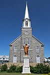
| Chapelle de Tadoussac
|
Rue du Bord-de-l'Eau
Tadoussac QC
|
48°08′30″N 69°42′55″W / 48.1418°N 69.7152°W / 48.1418; -69.7152 (Chapelle de Tadoussac)
|
Quebec (12432)
|
|

More images
|
| Wreck of the Elizabeth and Mary National Historic Site of Canada
|
L'Anse-aux-Bouleaux
Baie-Trinité QC
|
49°23′00″N 67°18′57″W / 49.3834°N 67.3158°W / 49.3834; -67.3158 (Wreck of the Elizabeth and Mary National Historic Site of Canada)
|
Federal (15926)
|
|

Upload Photo
|
| Église de Sainte-Amélie
|
37, Avenue Marquette
Baie-Comeau QC
|
49°13′09″N 68°08′51″W / 49.2192°N 68.1475°W / 49.2192; -68.1475 (Église de Sainte-Amélie)
|
Quebec (13799)
|
|

More images
|
| La Petite Anglicane de Forestville
|
2e Rue
Forestville QC
|
48°44′14″N 69°04′13″W / 48.7372°N 69.0703°W / 48.7372; -69.0703 (La Petite Anglicane de Forestville)
|
Forestville municipality (8493)
|
|

Upload Photo
|
| Site du patrimoine de Sacré-Coeur
|
Sacre-Coeur QC
|
48°13′58″N 69°48′06″W / 48.2328°N 69.8017°W / 48.2328; -69.8017 (Site du patrimoine de Sacré-Coeur)
|
Sacre-Coeur municipality (10334)
|
|

More images
|
| Site archéologique des Basques-de-l'Anse-à-la-Cave
|
Les Bergeronnes QC
|
48°17′07″N 69°26′00″W / 48.2852°N 69.4333°W / 48.2852; -69.4333 (Site archéologique des Basques-de-l'Anse-à-la-Cave)
|
Quebec (12464)
|
|

Upload Photo
|
| Sites archéologiques de la Pointe-à-John
|
Rue de la Mer
Les Bergeronnes QC
|
48°13′46″N 69°33′02″W / 48.2295°N 69.5506°W / 48.2295; -69.5506 (Sites archéologiques de la Pointe-à-John)
|
Quebec (12932)
|
|

|
| Église de Sainte-Anne
|
Rue de Monseigneur-Bouchard
Portneuf-sur-Mer QC
|
48°37′04″N 69°06′01″W / 48.6177°N 69.1002°W / 48.6177; -69.1002 (Église de Sainte-Anne)
|
Portneuf-sur-Mer municipality (13255)
|
|

|
| Arboriduc
|
Forestville QC
|
48°44′21″N 69°03′37″W / 48.7393°N 69.0603°W / 48.7393; -69.0603 (Arboriduc)
|
Forestville municipality (14411)
|
|

|
| Maison Johan-Beetz
|
Route 138
Baie-Johan-Beetz QC
|
50°17′20″N 62°48′21″W / 50.289°N 62.8058°W / 50.289; -62.8058 (Maison Johan-Beetz)
|
Quebec (9371)
|
|

More images
|
| Arrondissement naturel de l'Archipel-de-Mingan
|
Havre-Saint-Pierre QC
|
50°12′10″N 63°28′47″W / 50.2028°N 63.4797°W / 50.2028; -63.4797 (Arrondissement naturel de l'Archipel-de-Mingan)
|
Quebec (10225)
|
|

|
| Église Sainte-Anne de l'île Providence
|
Cote-Nord-du-Golfe-du-Saint-Laurent QC
|
50°37′01″N 59°13′41″W / 50.617°N 59.2281°W / 50.617; -59.2281 (Église Sainte-Anne de l'île Providence)
|
Cote-Nord-du-Golfe-du-Saint-Laurent municipality (11976)
|
|

Upload Photo
|
| Site historique des Galets
|
Natashquan QC
|
50°10′54″N 61°49′24″W / 50.1817°N 61.8234°W / 50.1817; -61.8234 (Site historique des Galets)
|
Quebec (12391)
|
|

|
| Site historique de Room's Point
|
Blanc-Sablon QC
|
51°25′29″N 57°08′17″W / 51.4247°N 57.1381°W / 51.4247; -57.1381 (Site historique de Room's Point)
|
Quebec (12442)
|
|

|
| Four à chaux de Baie-Sainte-Claire
|
L'Ile-d'Anticosti QC
|
49°53′53″N 64°29′32″W / 49.8981°N 64.4922°W / 49.8981; -64.4922 (Four à chaux de Baie-Sainte-Claire)
|
Quebec (13057)
|
|

Upload Photo
|
| Site archéologique de l'Île-au-Bois
|
Blanc-Sablon QC
|
51°23′57″N 57°09′16″W / 51.3992°N 57.1544°W / 51.3992; -57.1544 (Site archéologique de l'Île-au-Bois)
|
Quebec (13396)
|
|

|
| Blanc-Sablon National Historic Site of Canada
|
Blanc-Sablon QC
|
51°25′39″N 57°08′00″W / 51.4275°N 57.1333°W / 51.4275; -57.1333 (Blanc-Sablon National Historic Site of Canada)
|
Federal (15814),
Quebec (13434)
|
|

More images
|
| Site archéologique du Poste-de-Nétagamiou
|
Cote-Nord-du-Golfe-du-Saint-Laurent QC
|
50°28′47″N 59°35′13″W / 50.4797°N 59.5869°W / 50.4797; -59.5869 (Site archéologique du Poste-de-Nétagamiou)
|
Quebec (13805)
|
|

Upload Photo
|
| Phare de Pointe-des-Monts
|
Baie-Trinite QC
|
49°19′32″N 67°22′00″W / 49.3256°N 67.3667°W / 49.3256; -67.3667 (Phare de Pointe-des-Monts)
|
Quebec (9366)
|
|

More images
|
| Corossol
|
Sept-Îles QC
|
50°05′37″N 66°23′29″W / 50.0937°N 66.3914°W / 50.0937; -66.3914 (Corossol)
|
Federal (15957)
|
|

Upload Photo
|
| Light Tower
|
Central south coast of Anticosti Isle
Bagot Bluff QC
|
49°23′29″N 63°35′42″W / 49.3913°N 63.5949°W / 49.3913; -63.5949 (Light Tower (Bagot Bluff Light))
|
Federal (10890)
|
|

Upload Photo
|
| Light Tower
|
Northeast coast of Anticosti Isle
Cap de la Table QC
|
49°21′03″N 61°53′47″W / 49.3509°N 61.8963°W / 49.3509; -61.8963 (Light Tower (Cap de la Table Light))
|
Federal (10949)
|
|

Upload Photo
|
| Light Tower
|
Northwest coast of Anticosti Isle
Cap de Rabast QC
|
49°57′05″N 64°09′00″W / 49.9515°N 64.1499°W / 49.9515; -64.1499 (Light Tower (Cap de Rabast Light))
|
Federal (10948)
|
|

Upload Photo
|
| Light Tower
|
North central coast of Anticosti Isle
Cap de Rabast QC
|
49°43′52″N 62°56′33″W / 49.7310°N 62.9424°W / 49.7310; -62.9424 (Light Tower (Pointe-Carleton Light))
|
Federal (10893)
|
|

Upload Photo
|
| Île aux Perroquets Lighthouse
|
Western end of the Mingan Islands Archipelago
Longue-Pointe-de-Mingan QC
|
50°13′14″N 64°12′23″W / 50.2205°N 64.2065°W / 50.2205; -64.2065 (Île aux Perroquets Lighthouse)
|
Federal (20714)
|
|

|
| Haut-Fond-Prince Lighttower
|
On a caisson in the Saint Lawrence River
Tadoussac QC
|
48°07′26″N 69°40′16″W / 48.1239°N 69.6710°W / 48.1239; -69.6710 (Haut-Fond-Prince Lighttower)
|
Federal (21069)
|
|

|


