Map all coordinates using OpenStreetMap
Download coordinates as:
There are 42 listed buildings (Swedish: byggnadsminne) in Västmanland County.
Multiple municipalities
| Image | Name | Premise | Number of buildings |
Year built | Architect | Coordinates | ID |
|---|---|---|---|---|---|---|---|

|
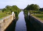
Strömsholms kanal | Semla 11:14 etc. Finntorpet 1:3 etc. Virsbo 2:316 etc. Horn 6:2 etc. |
85 | 1777–1795 | 59°41′13″N 16°09′35″E / 59.68684°N 16.15961°E / 59.68684; 16.15961 | 21300000015243 |
Arboga Municipality
| Image | Name | Premise | Number of buildings |
Year built | Architect | Coordinates | ID |
|---|---|---|---|---|---|---|---|

|
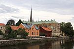
Kungsgården 3, 5 | Kungsgården 3, 5 | 11 | 59°23′36″N 15°50′24″E / 59.39342°N 15.83998°E / 59.39342; 15.83998 | 21300000001968 | ||

|
Crugska gården | Fältskären 2, 3 | 5 | 59°23′35″N 15°50′34″E / 59.39294°N 15.84273°E / 59.39294; 15.84273 | 21300000001939 | ||
| Götlunda previously kyrkoherdebostad | Holmsätter 1:77 | 1 | 17th century | 59°21′17″N 15°40′04″E / 59.35485°N 15.66768°E / 59.35485; 15.66768 | 21300000013026 |
Fagersta Municipality
placeholder
Hallstahammar Municipality
placeholder
Kungsör Municipality
There are no listed buildings in Kungsör Municipality.
Köping Municipality
placeholder
Norberg Municipality
placeholder
Sala Municipality
placeholder
Skinnskatteberg Municipality
placeholder
Surahammar Municipality
There are no listed buildings in Surahammar Municipality.
Västerås Municipality
placeholder
External links
- (in Swedish) Bebyggelseregistret