| Litzelsdorf | |
|---|---|
| Municipality | |
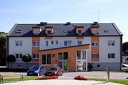
 Municipal office Municipal office | |
 Coat of arms Coat of arms | |
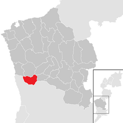
 Location within Oberwart district Location within Oberwart district | |
 | |
| Coordinates: 47°13′N 16°10′E / 47.217°N 16.167°E / 47.217; 16.167 | |
| Country | Austria |
| State | Burgenland |
| District | Oberwart |
| Government | |
| • Mayor | Peter Fassl (ÖVP) |
| Area | |
| • Total | 13.88 km (5.36 sq mi) |
| Elevation | 292 m (958 ft) |
| Population | |
| • Total | 1,181 |
| • Density | 85/km (220/sq mi) |
| Time zone | UTC+1 (CET) |
| • Summer (DST) | UTC+2 (CEST) |
| Postal code | 7532 |
| Website | www.litzelsdorf.at |
Litzelsdorf (Hungarian: Lődös, Croatian: Licištrof) is a town in the district of Oberwart in the Austrian state of Burgenland.
Geography
The small town is located in the south of Burgenland.
History
The town of Litzelsdorf along with the whole Burgenland belonged to the Western part of the Kingdom of Hungary until 1920/21, and its official name was Lődös. After World War I Burgenland was awarded to the newly formed Republic of Austria as a result of the Treaties of St. Germain and Trianon. Since 1921 Litzelsdorf belongs to the newly formed state of Burgenland.
Population
| Year | Pop. | ±% |
|---|---|---|
| 1869 | 1,333 | — |
| 1880 | 1,528 | +14.6% |
| 1890 | 1,729 | +13.2% |
| 1900 | 1,956 | +13.1% |
| 1910 | 1,888 | −3.5% |
| 1923 | 1,709 | −9.5% |
| 1934 | 1,618 | −5.3% |
| 1939 | 1,313 | −18.9% |
| 1951 | 1,259 | −4.1% |
| 1961 | 1,092 | −13.3% |
| 1971 | 1,155 | +5.8% |
| 1981 | 1,151 | −0.3% |
| 1991 | 1,156 | +0.4% |
| 2001 | 1,151 | −0.4% |
| 2011 | 1,144 | −0.6% |
Politics
The current mayor of Litzelsdorf is Peter Fassl (Austrian People's Party = ÖVP) and the vice mayor is Martin Gerbafczits (Social Democratic Party of Austria = SPÖ).
Coat of arms
The coat of arms is coloured in blue and gold and divided into 3 parts. The first part is blue and shows a golden triangle with rays. This is a symbol for the trinity – and a column has been built a long time ago as a sign of adoring trinity. In the second part, which is colored in gold, a blue gear wheel can be seen and in the last part, coloured in blue ears (botany) can be seen. These are symbols for trade and agriculture. coats of arms
References
- "Dauersiedlungsraum der Gemeinden Politischen Bezirke und Bundesländer - Gebietsstand 1.1.2018". Statistics Austria. Retrieved 10 March 2019.
- "Einwohnerzahl 1.1.2018 nach Gemeinden mit Status, Gebietsstand 1.1.2018". Statistics Austria. Retrieved 9 March 2019.
External links
This Burgenland location article is a stub. You can help Misplaced Pages by expanding it. |